
Day 18 – It's All about the Weather
Wednesday, May 27 2020
Day 18
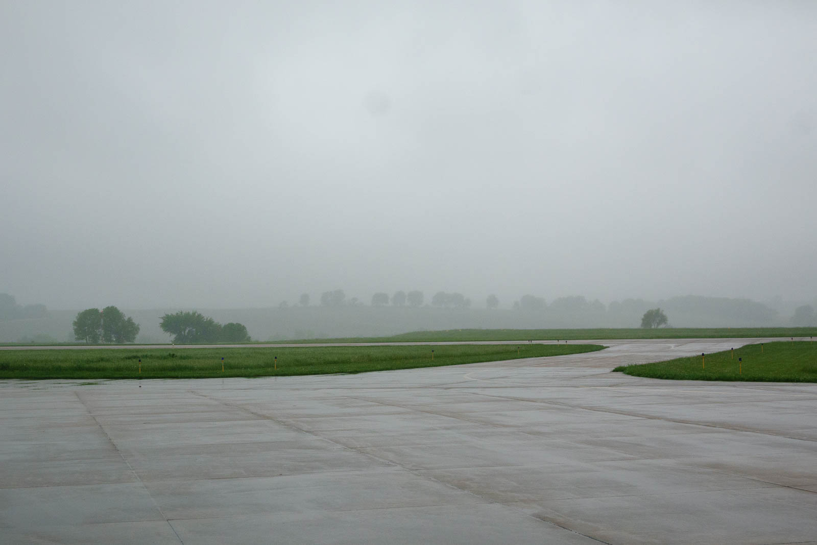
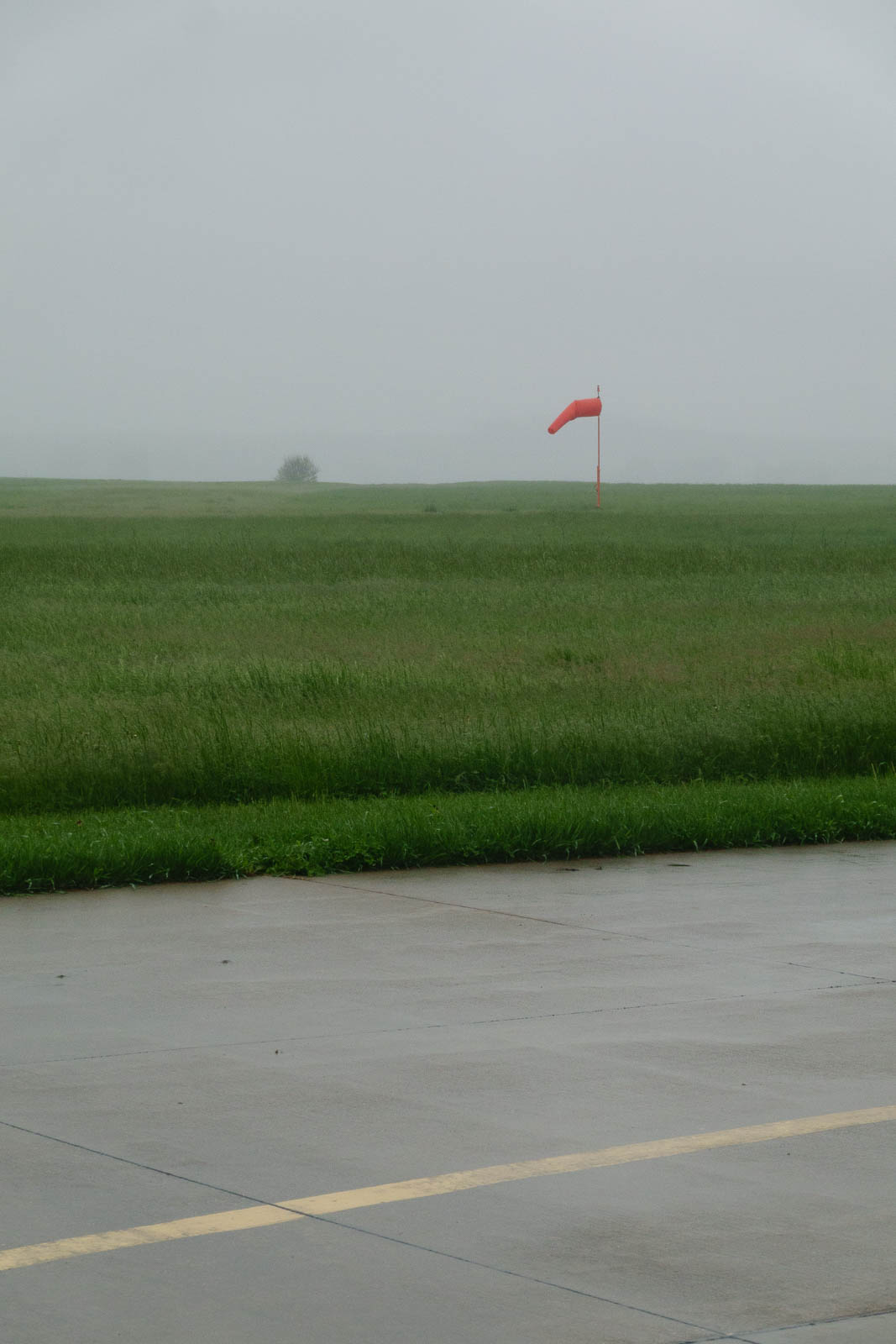
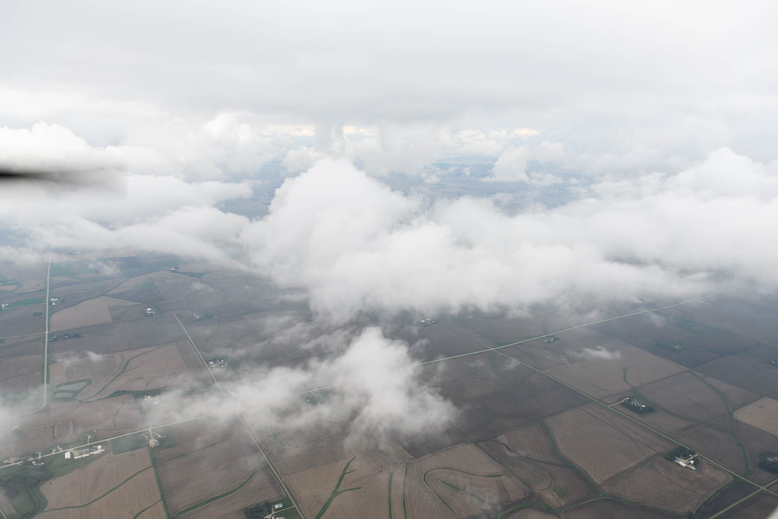
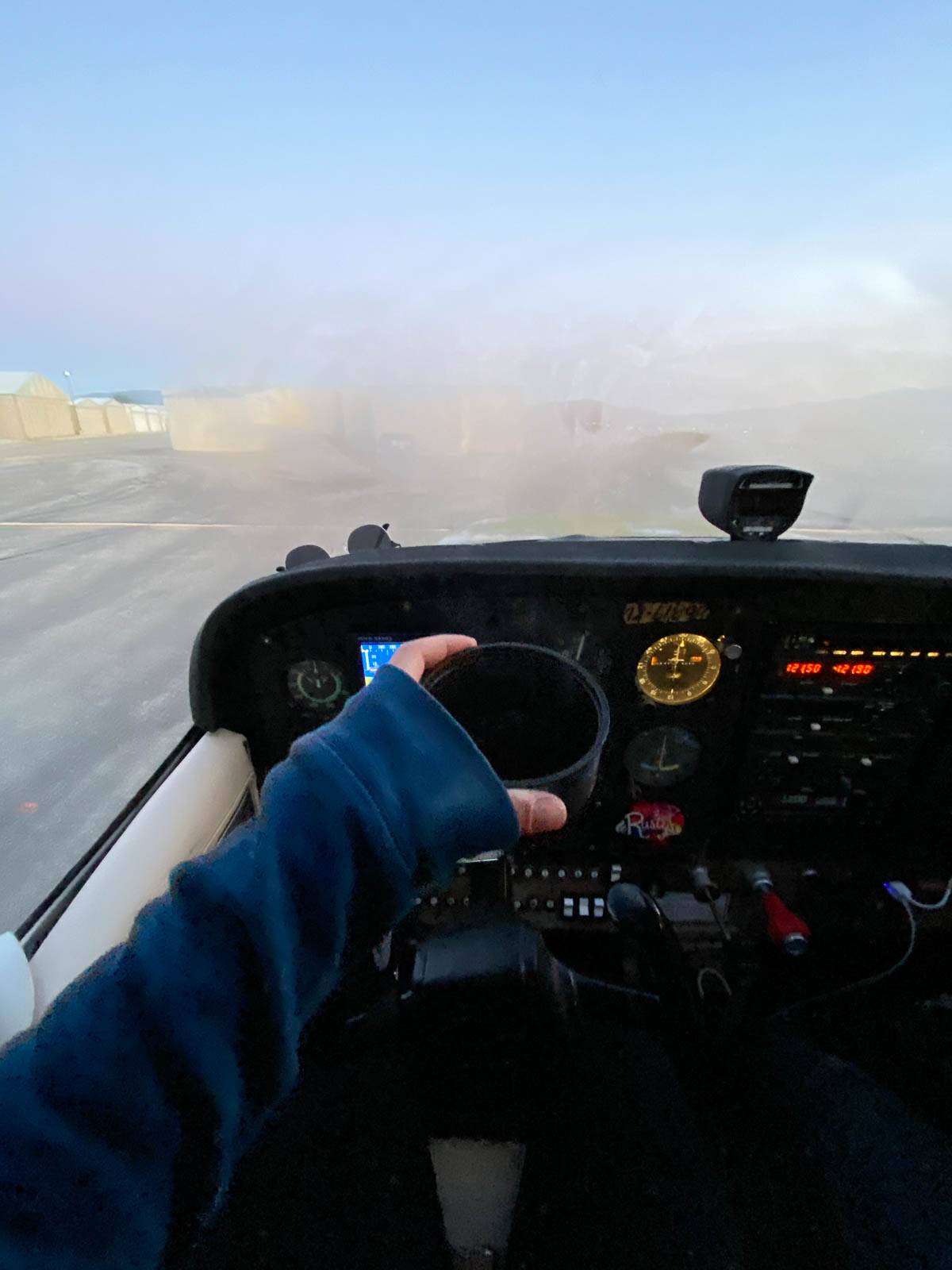
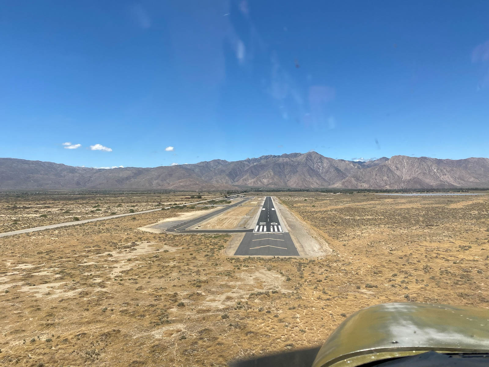
Denison, Iowa was a restful stop under dense grey skies that absolutely refused to clear up despite promising forecasts the night before. The entire day was spent in a frustrating state of “hurry up and wait,” we kept almost heading to the plane to fire up and then conditions would worsen and we’d sit back down, defeated. A surprisingly exhausting state to remain in, we took several drives around town in the airport truck with an eye to the sky and it’s low, unfriendly ceilings.
Finally at 5 pm, after a long day of ground things—the longest we’ve remained on the ground since the trip began—we were rewarded with a window of opportunity and dashed to the plane, taking off into a beautiful window of blue.
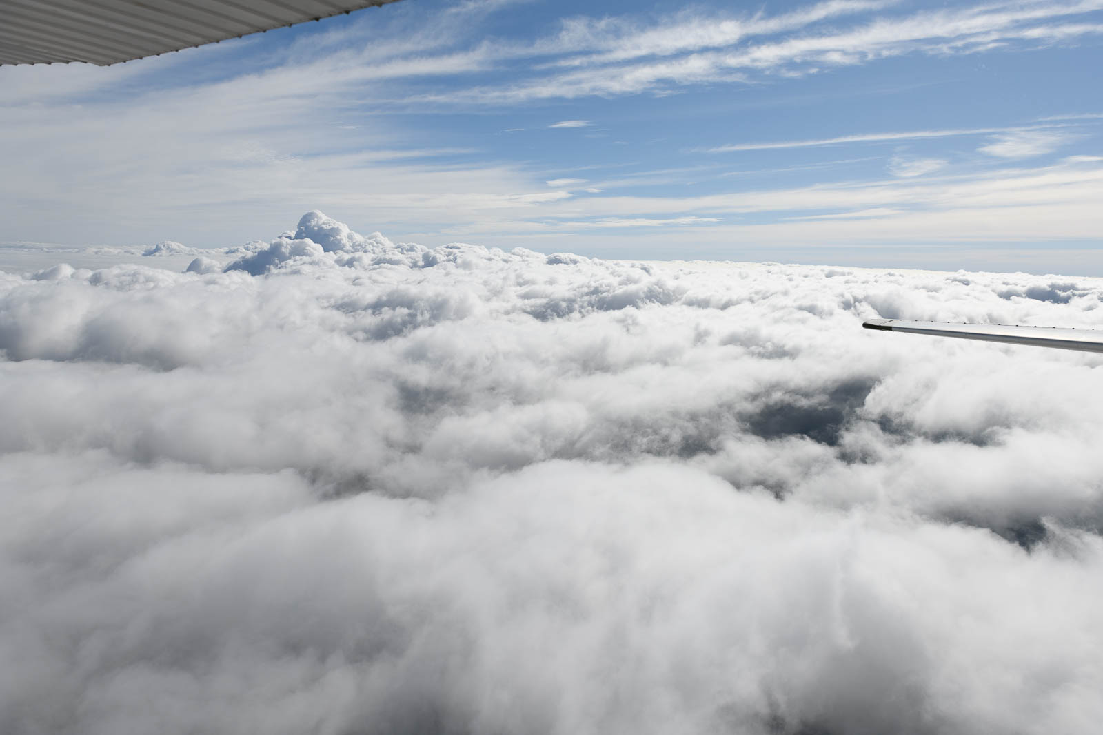
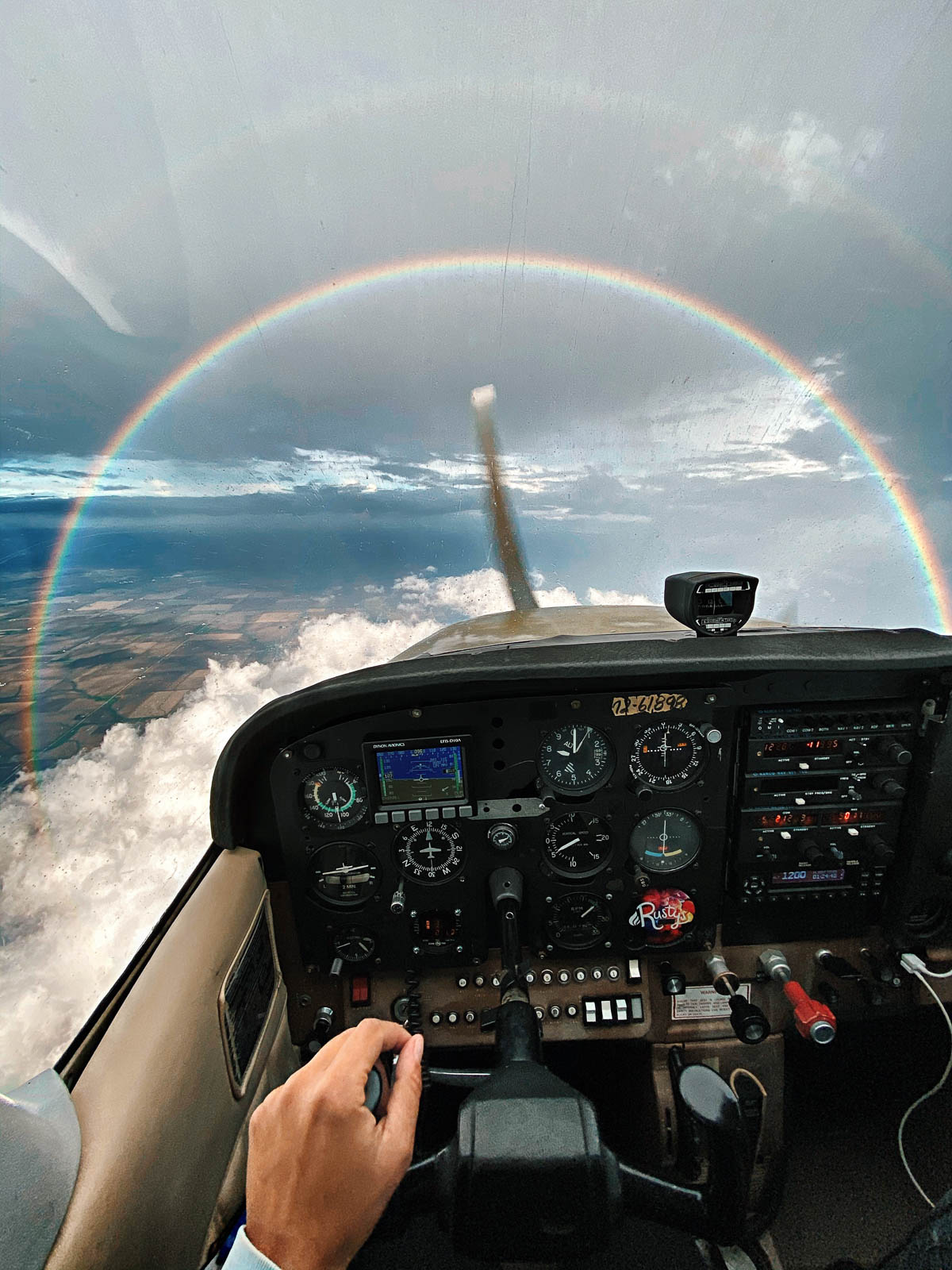
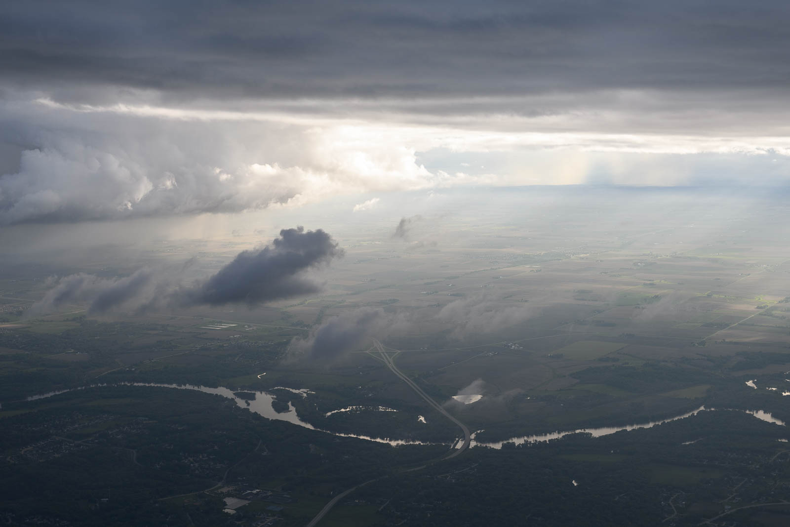
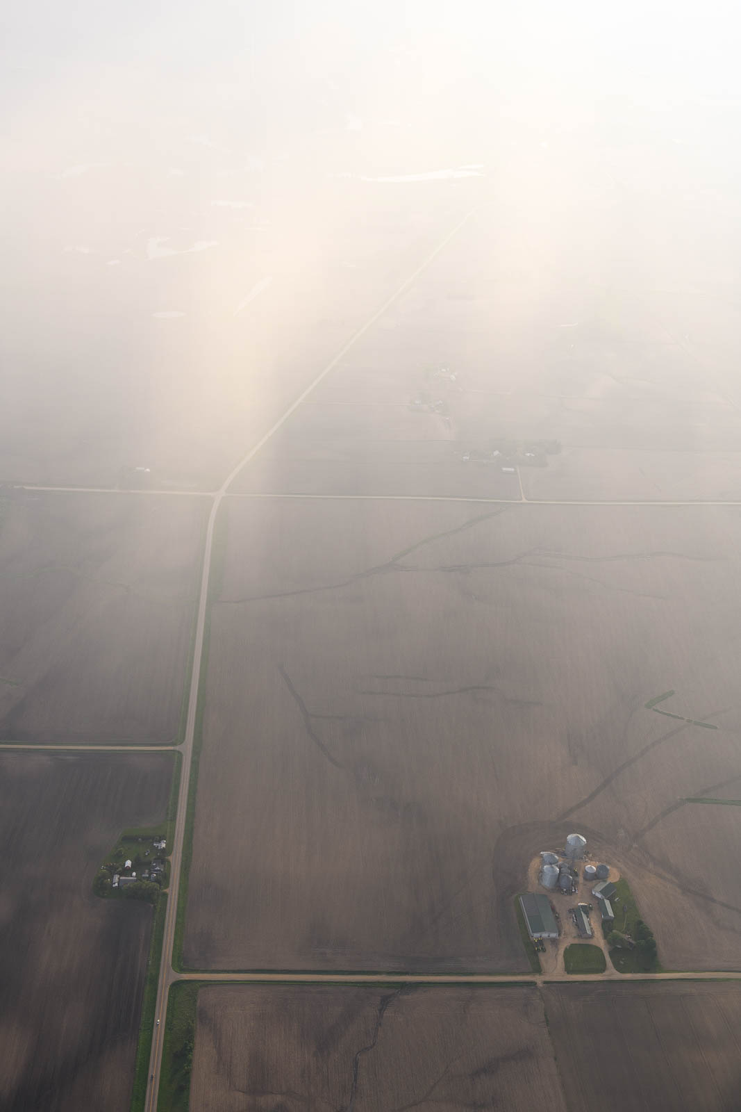
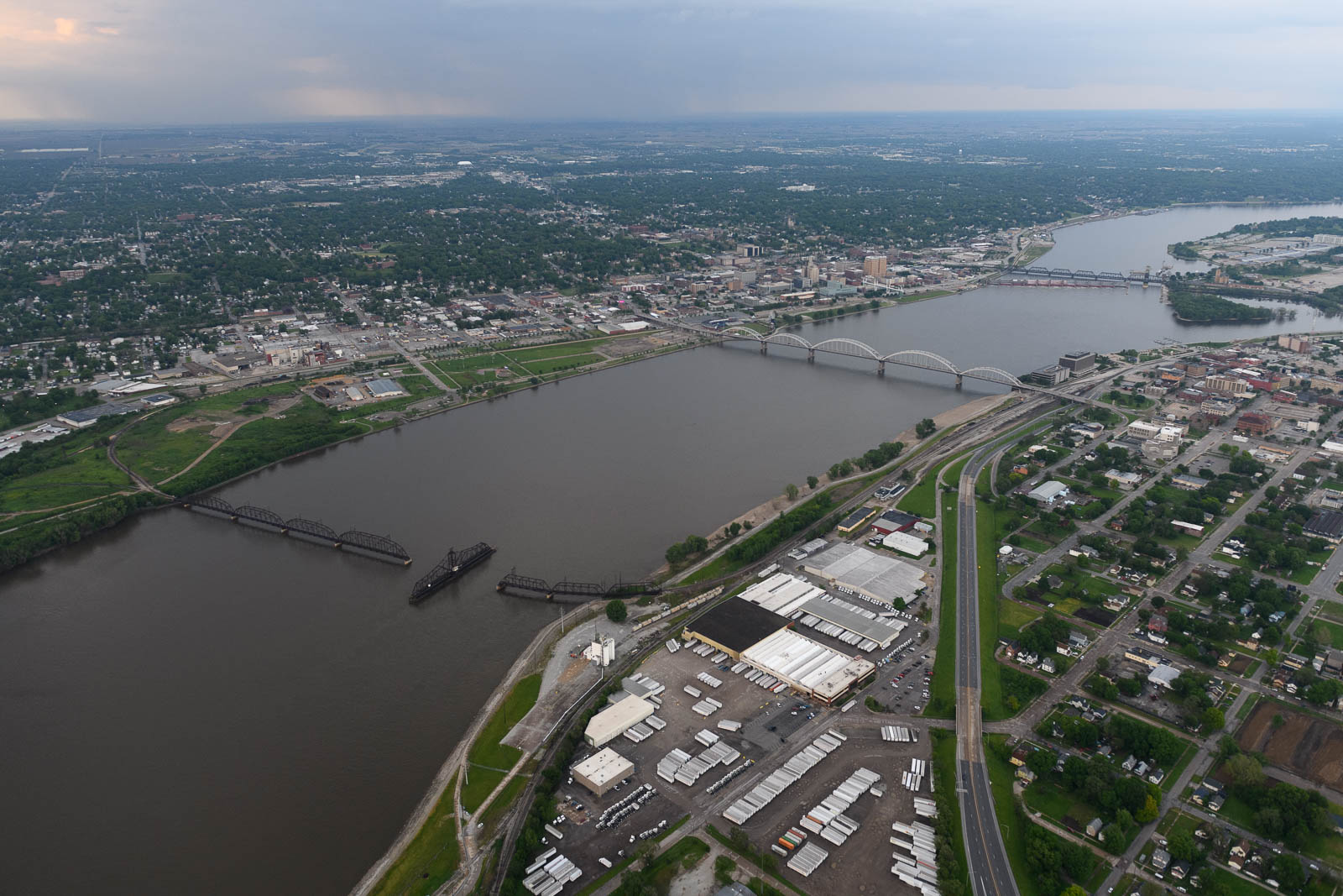
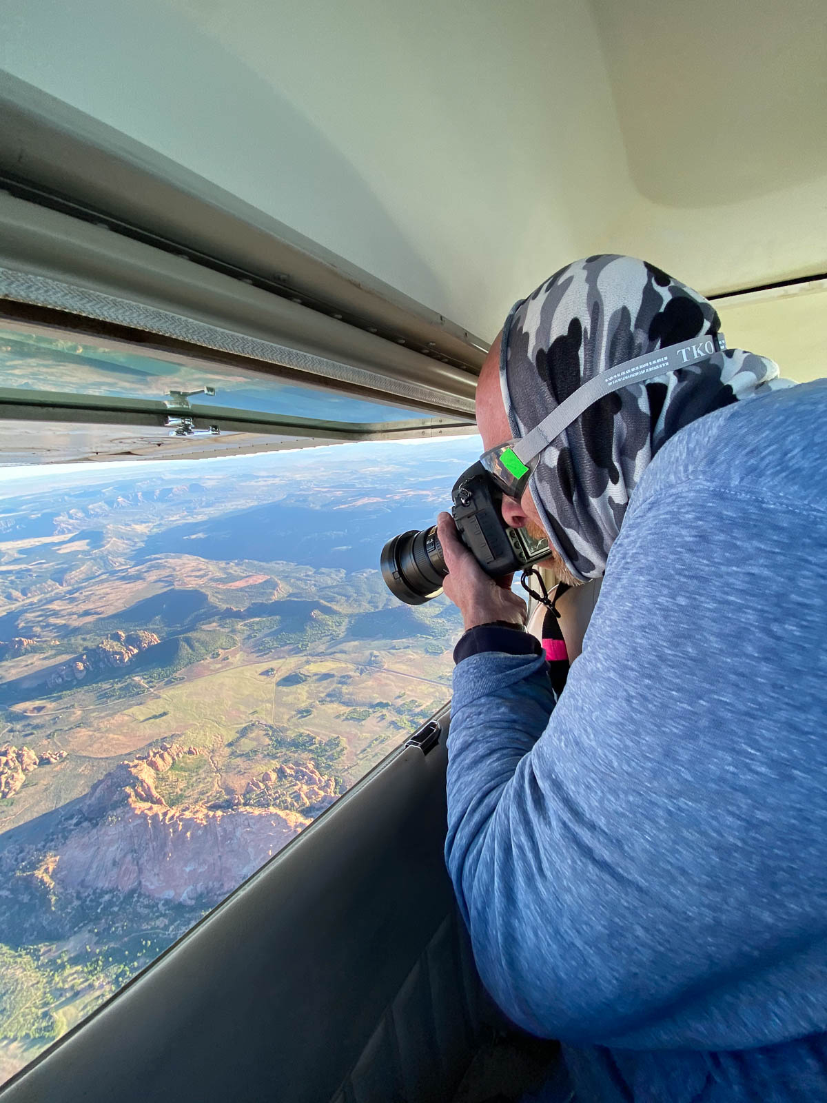
Off we flew! Circumnavigating around storm clouds and IMC, our patient waiting gifted us beautiful views of rainbows and sunbeams the entire leg. After a couple hours, we landed and fueled in Moline, IL. Incredibly, I’d been to KMLI, Quad City Airport, twice in the past year to drop off and pick up our company seaplane for a new paint job. Never thought I would return so soon, but there is was, right on our route with the best fuel prices in the state.
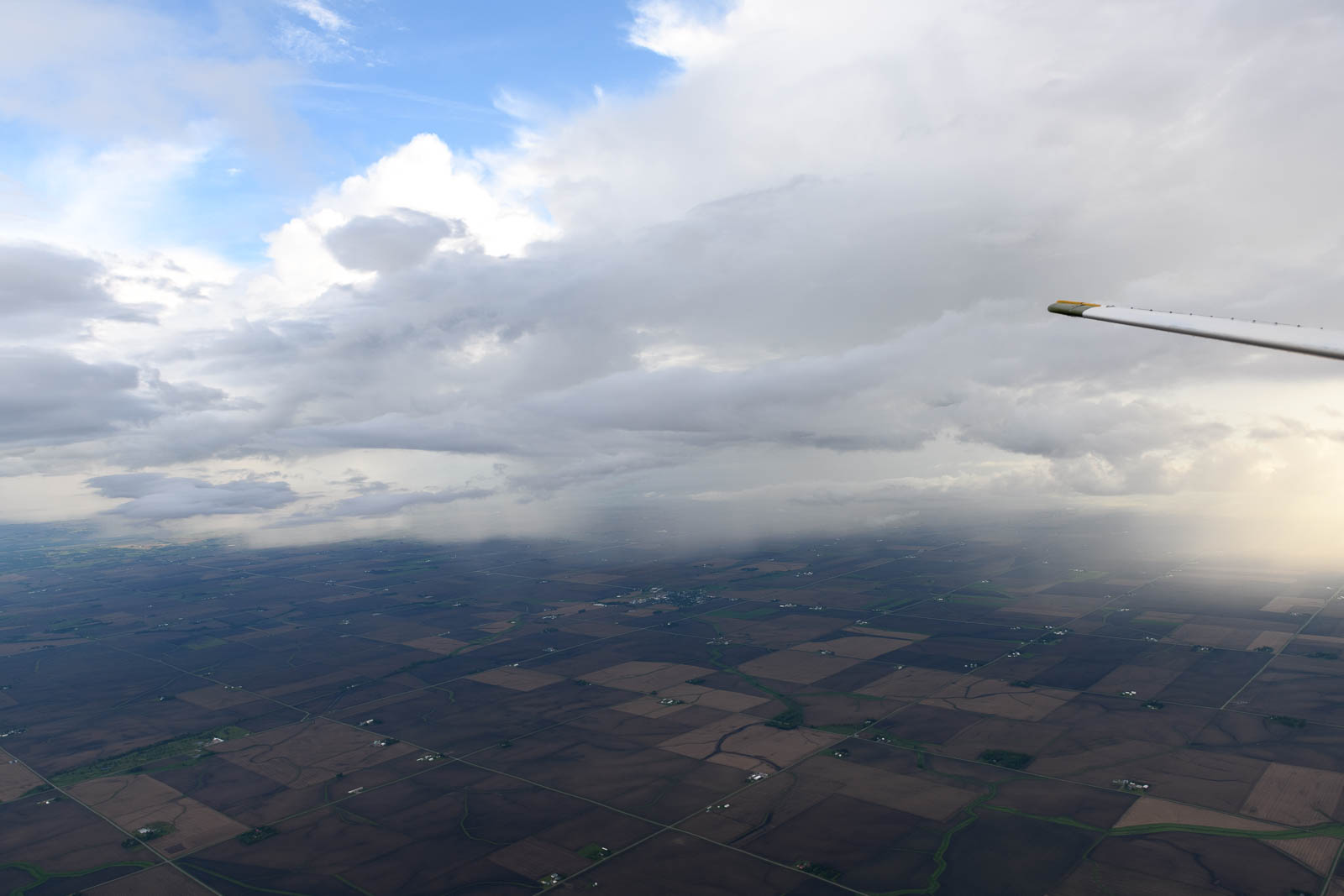
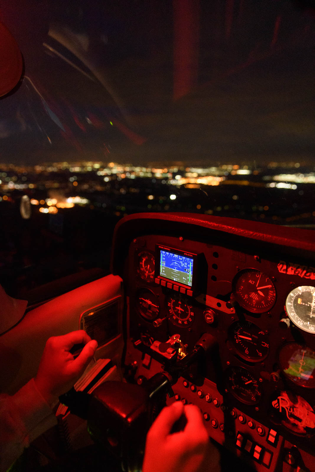
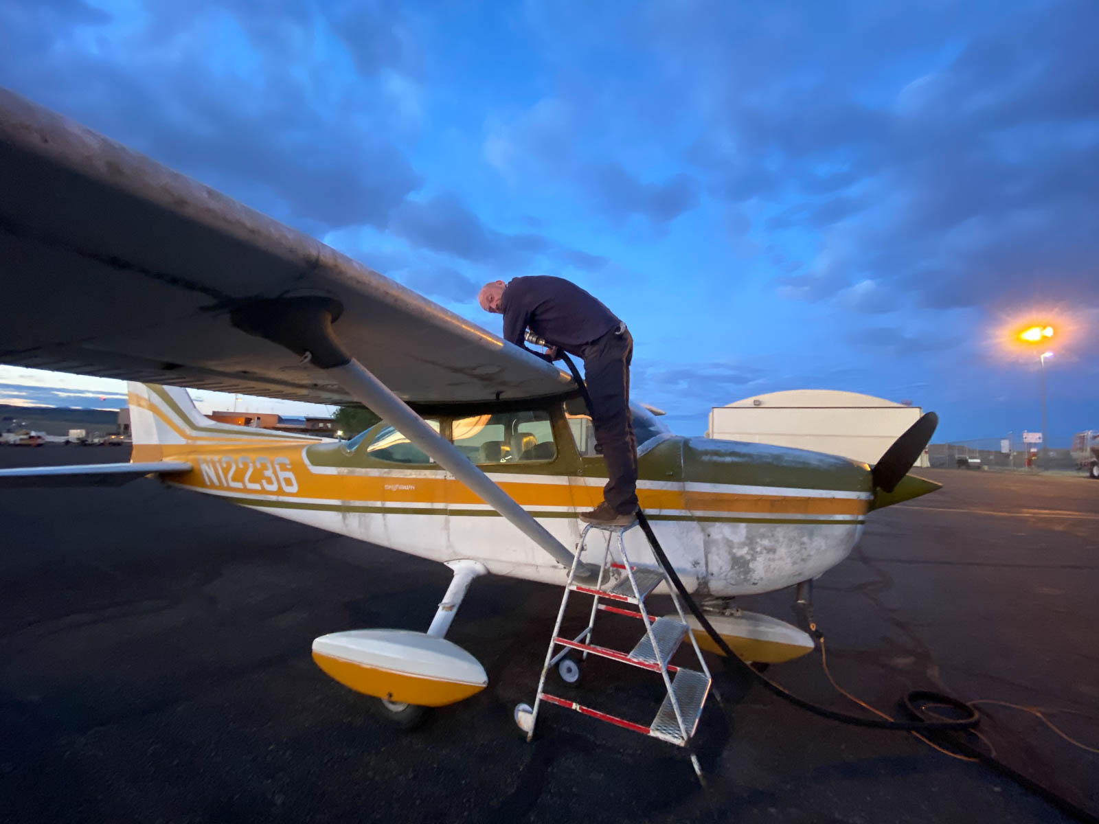
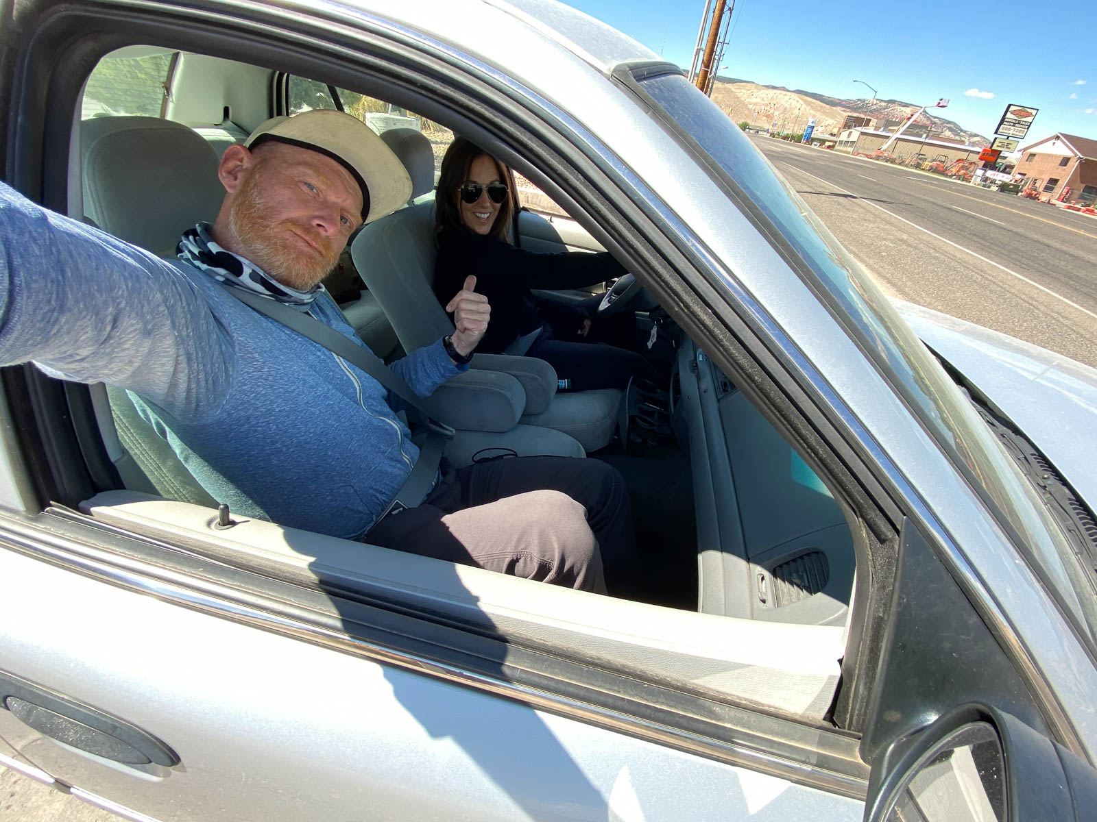
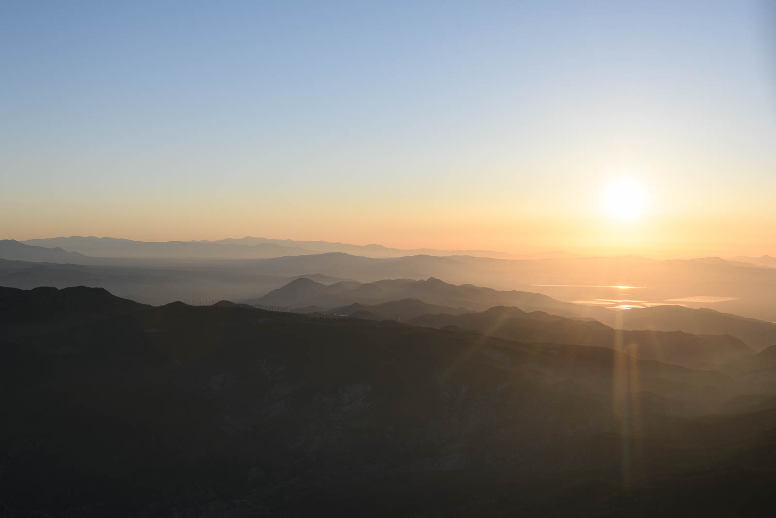
We took off again and as night descended around us, we passed by Chicago and some menacing storm clouds, the air smooth, dark, and peaceful. We determined our stop for the night would be KANQ, chosen for good fuel prices, good accommodations, and most importantly, because it was surrounded by at least 10 seaplane bases, which is always a great thing. We touched down around 11:30 EST (we’d lost an hour crossing over from central time), had dinner, and fell into a restful Indiana slumber.


Flight Path (incomplete)
[sgpx gpx=/tracks/stratux/gslog_2020-05-27.gpx summary=1 uom=5 gheight=200]

Day 17 – Onto the Farmlands of Nebraska and Iowa
Tuesday, May 26 2020
Day 17
I awoke on the airport to the sound of a turbine engine, that familiar roaring whine joyfully clawing it’s way into my unconscious brain and shaking me awake—I opened my eyes and sat up quickly, fueled by sleepy curiosity. Outside the massive window to the ramp in the pilot lounge we crashed in was a glorious biplane Ag Cat taxiing by. What a gorgeous airplane to awaken to! While they were first manufactured with a radial engine, this bad boy had a PT-6A-34AG with 750 hp. So beautiful, it looked like it would be the most fun thing in the world to fly, all low altitude operations with all that power.
I must have been inspired by that beautiful machine and it’s low over the Earth operations, because later, as we pressed on East from Wyoming to Nebraska, I descended low and slow, side by side with an Eastbound train, as Filip filmed it chugging along over the ground. Fantastic to fly in unison with another Eastbound engine.
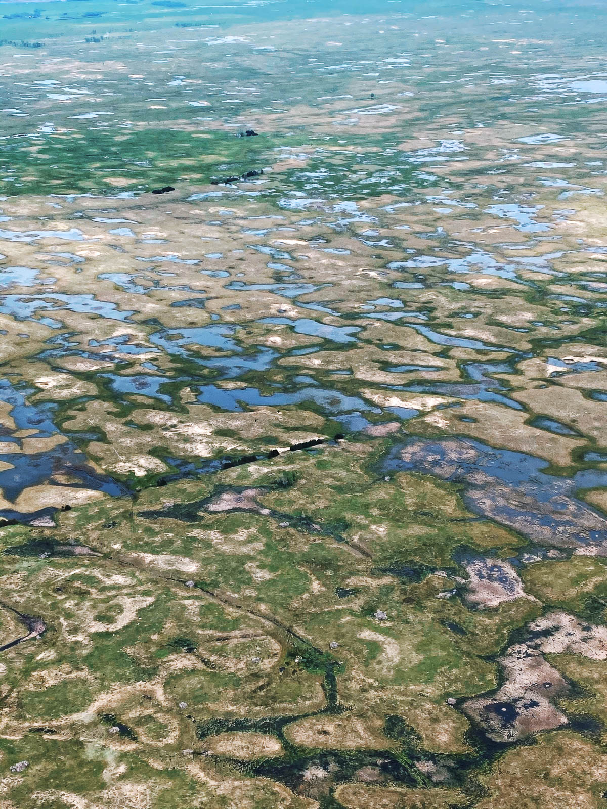
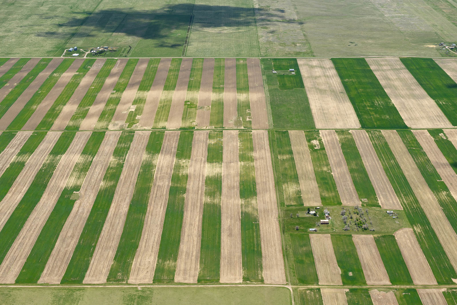
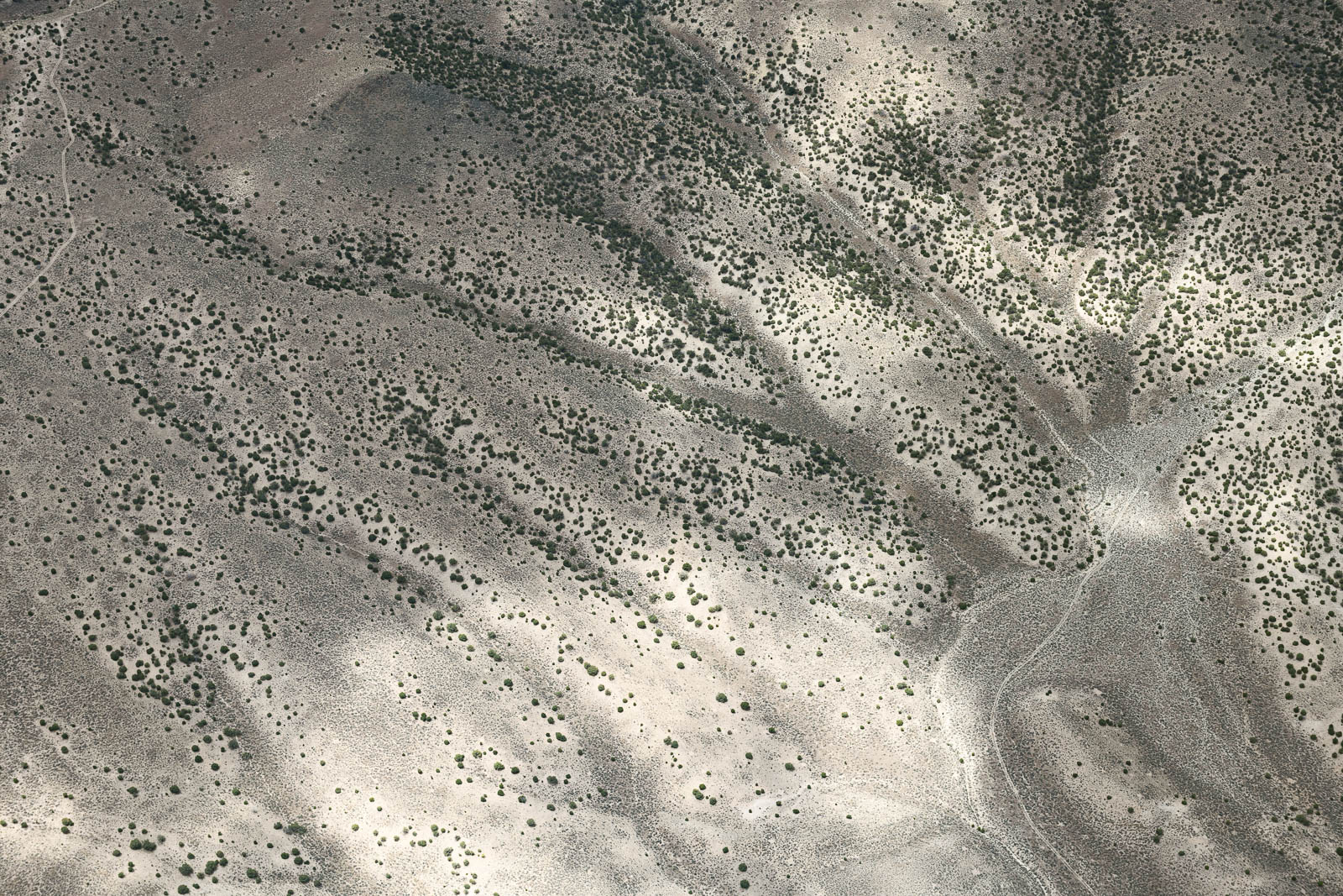
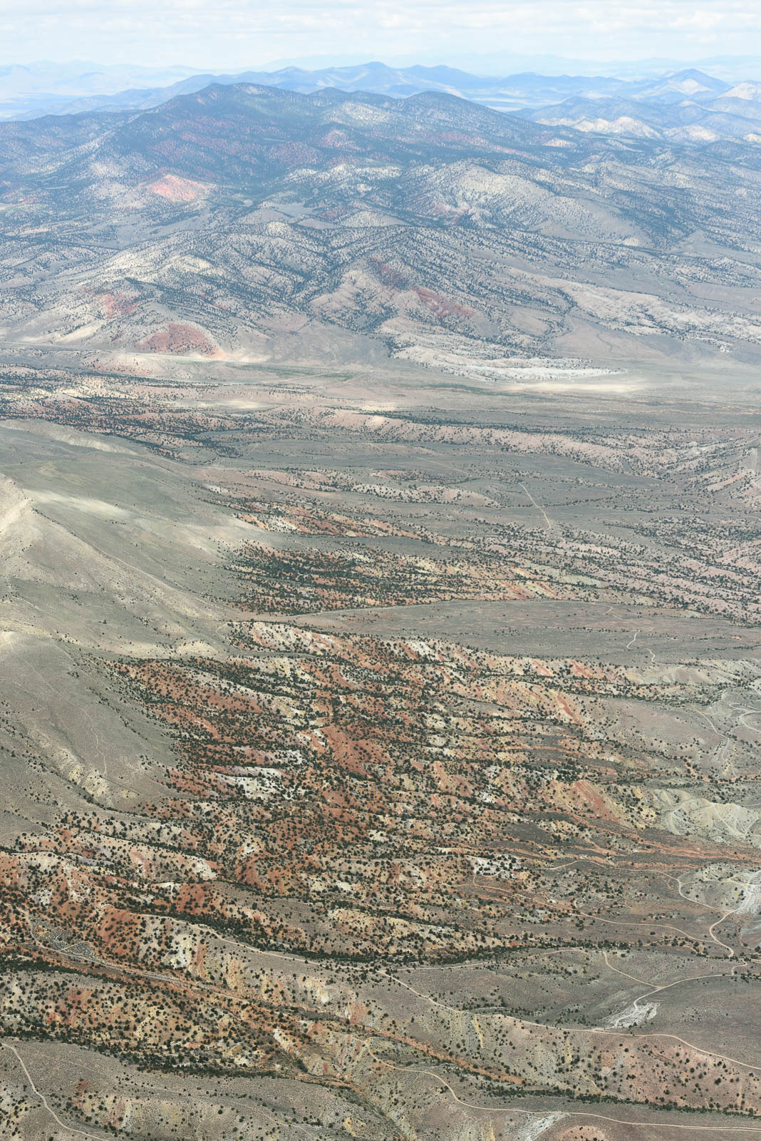
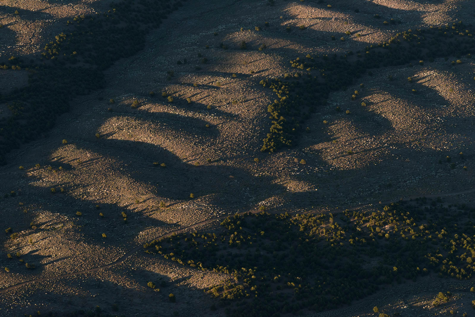
The lands we flew over this morning weren’t as notable as the explosive wonders we had grown used to flying over for the past week in the West, but the sky was massive and we were flying—life was good.
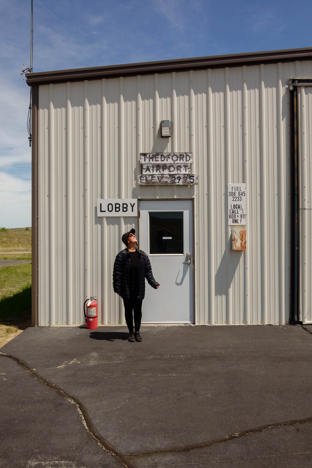
Our first fuel stop was KTIF, in Thedford, Nebraska, a sweet empty field untouched by time with a big old Ford camper van sitting next to the fuel pump with the keys on the dash for pilot use. We took it to town and grabbed breakfast at a local joint, the Arrow Cafe, that was running an all day Taco Tuesday special. The locals were hilarious and warm, especially the owner, who was busy making, running, and bussing all the food himself, cracking jokes the whole time. We flew overhead when we departed and rocked our wings adios.
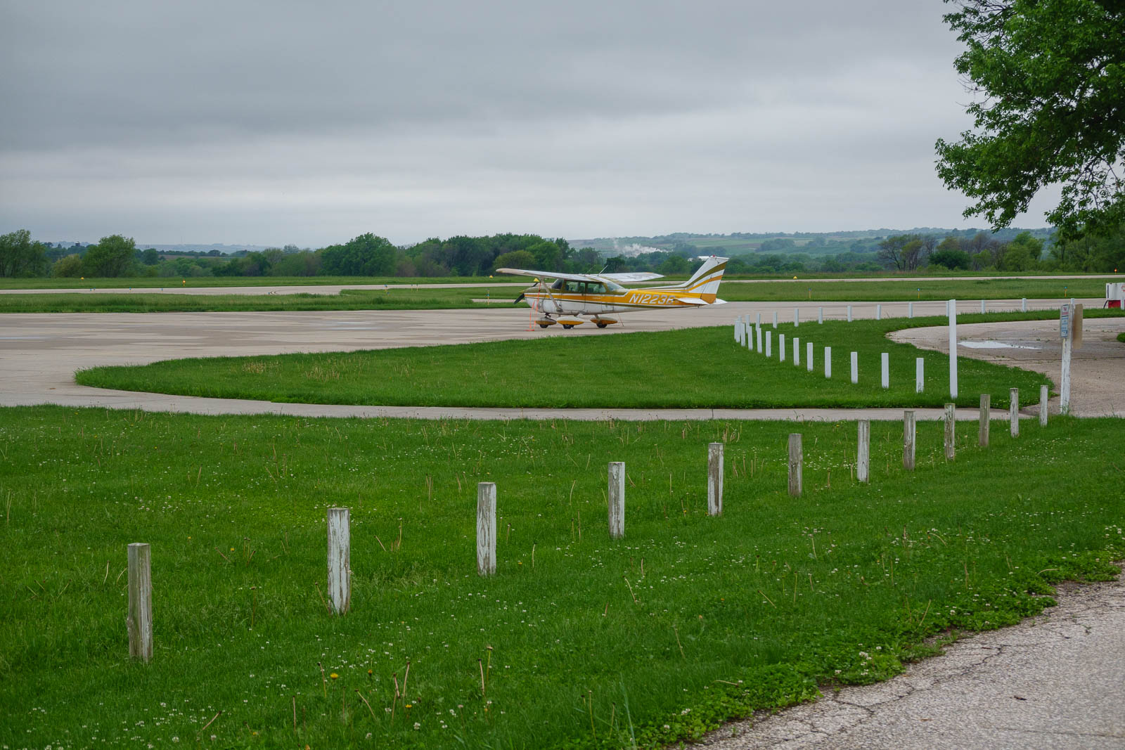
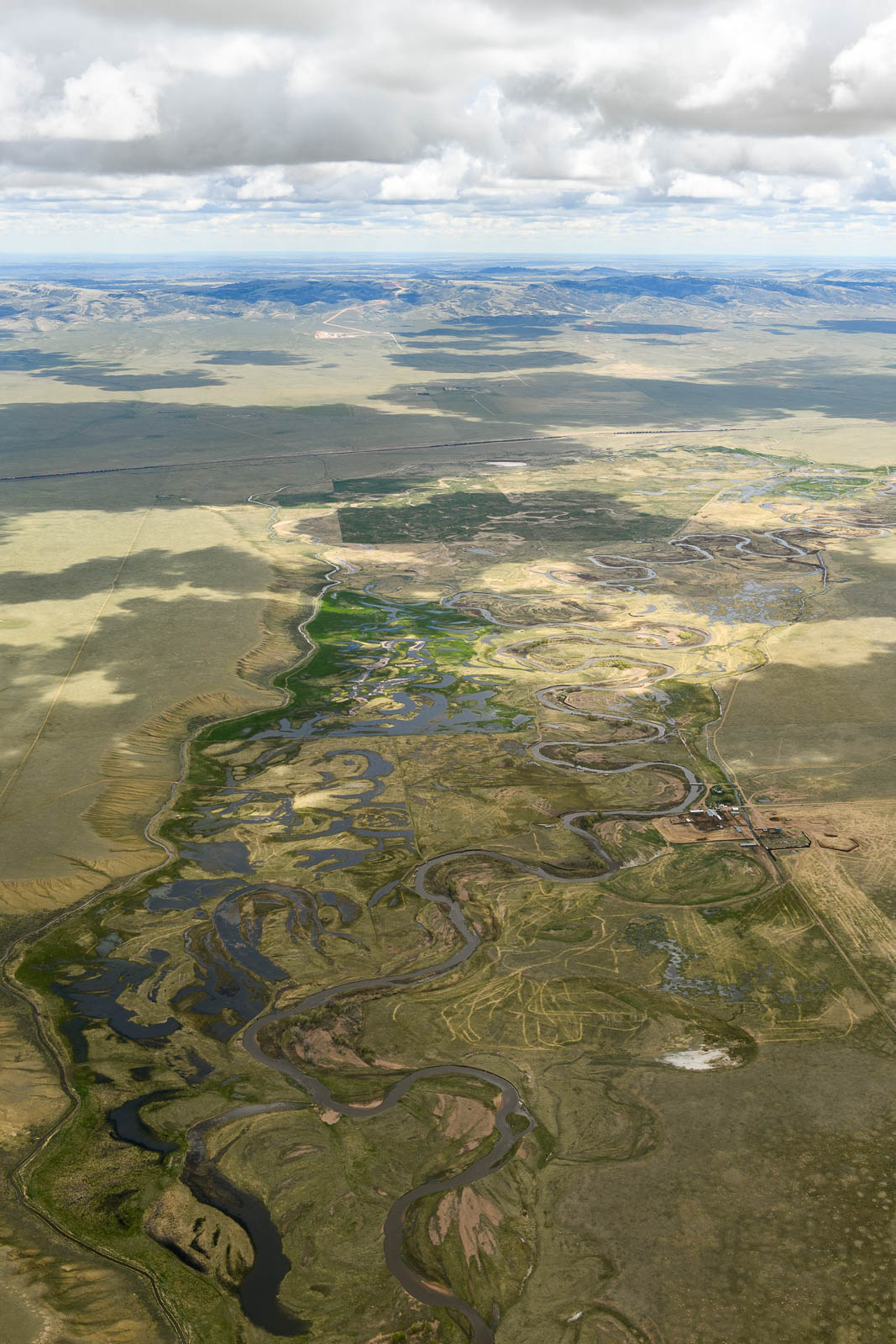
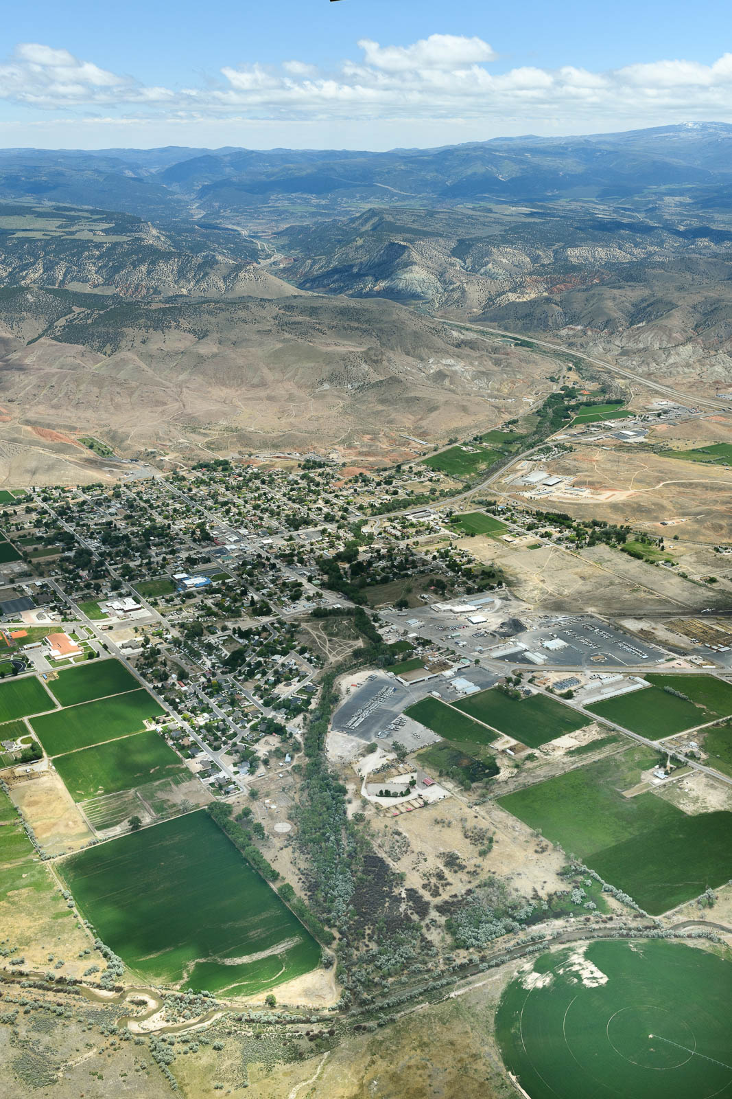
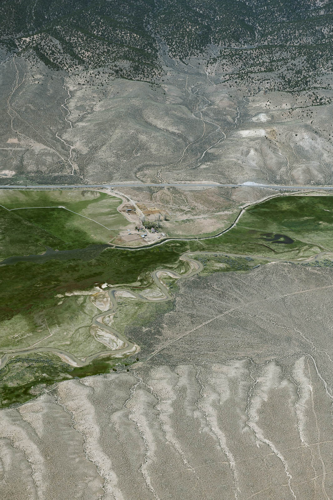
Onwards we went, and landed to fuel at Norfolk, Nebraska and check out the massive weather front blocking our smooth VFR passage back to the East. We took a cruise in their crew car and explored the town—apparently it’s Johnny Carson’s hometown, who knew!
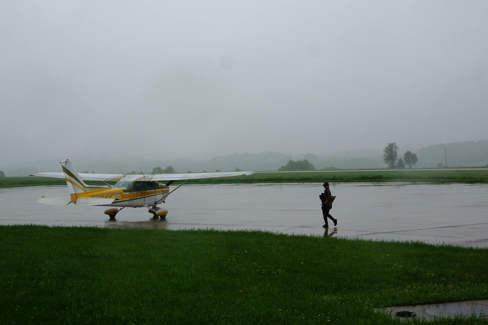
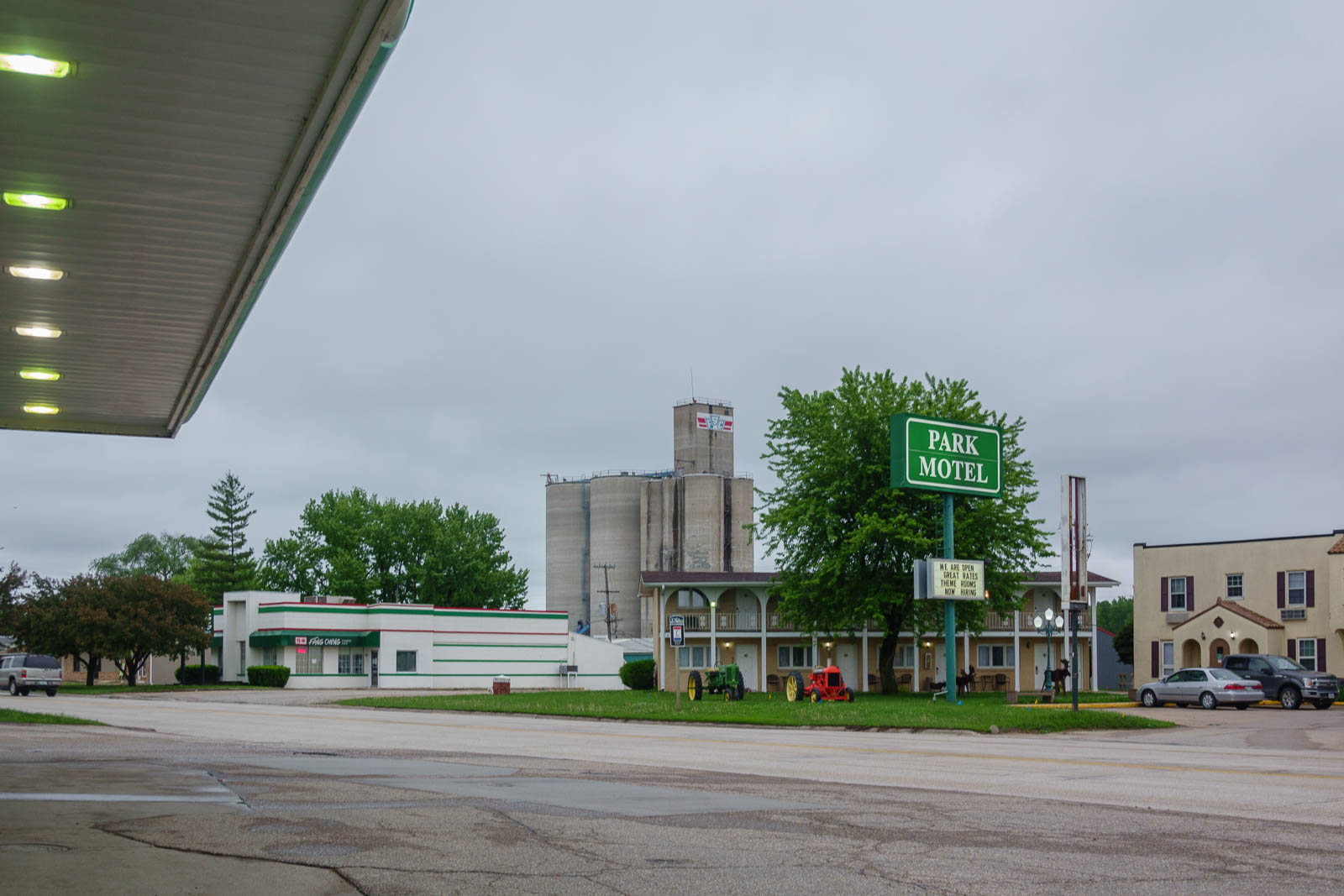
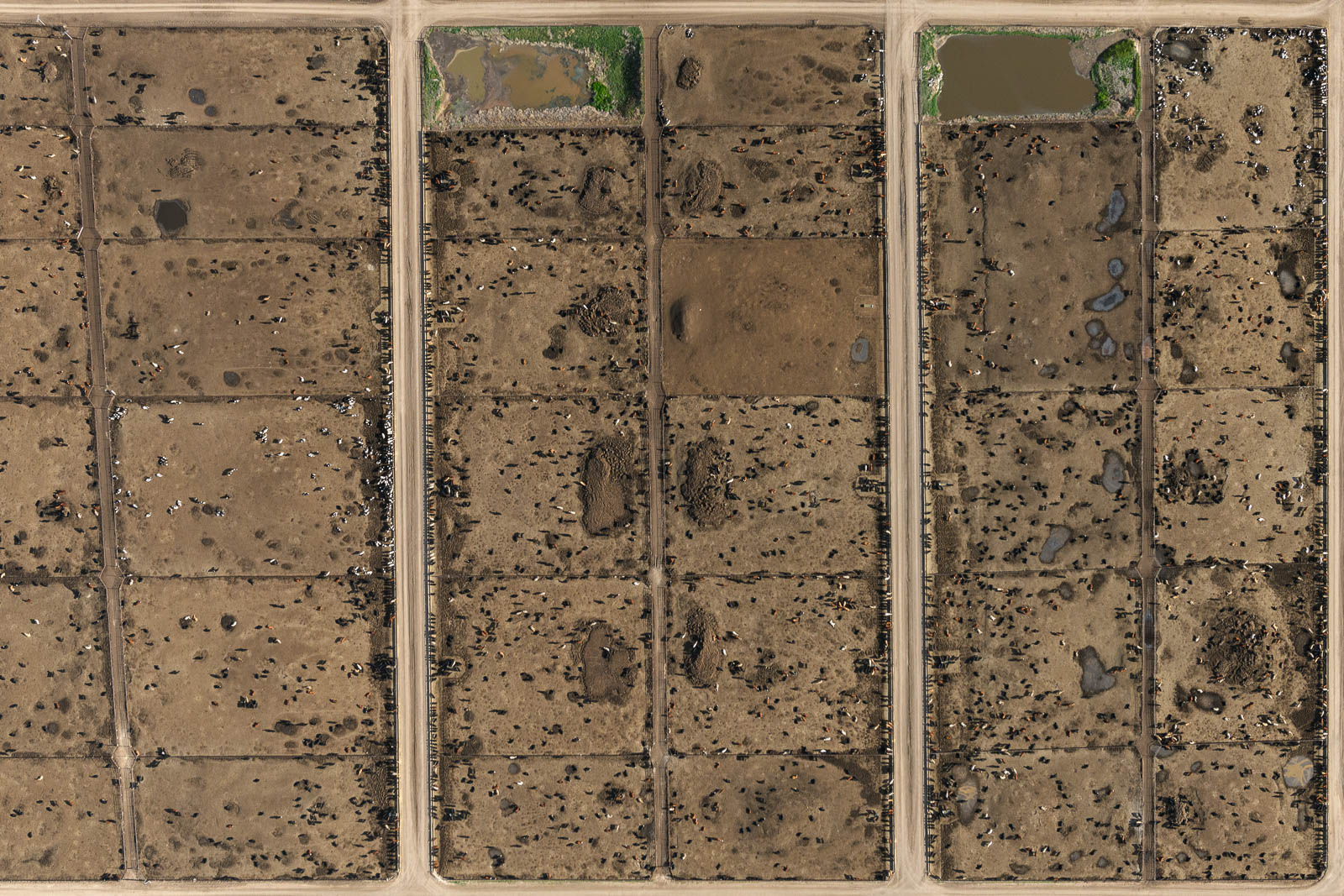
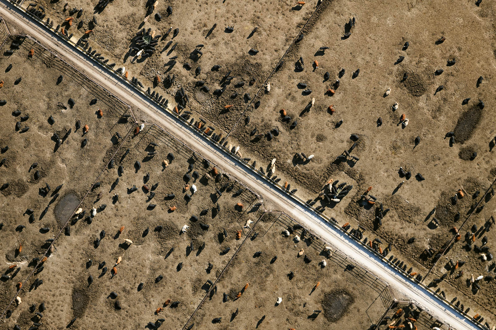
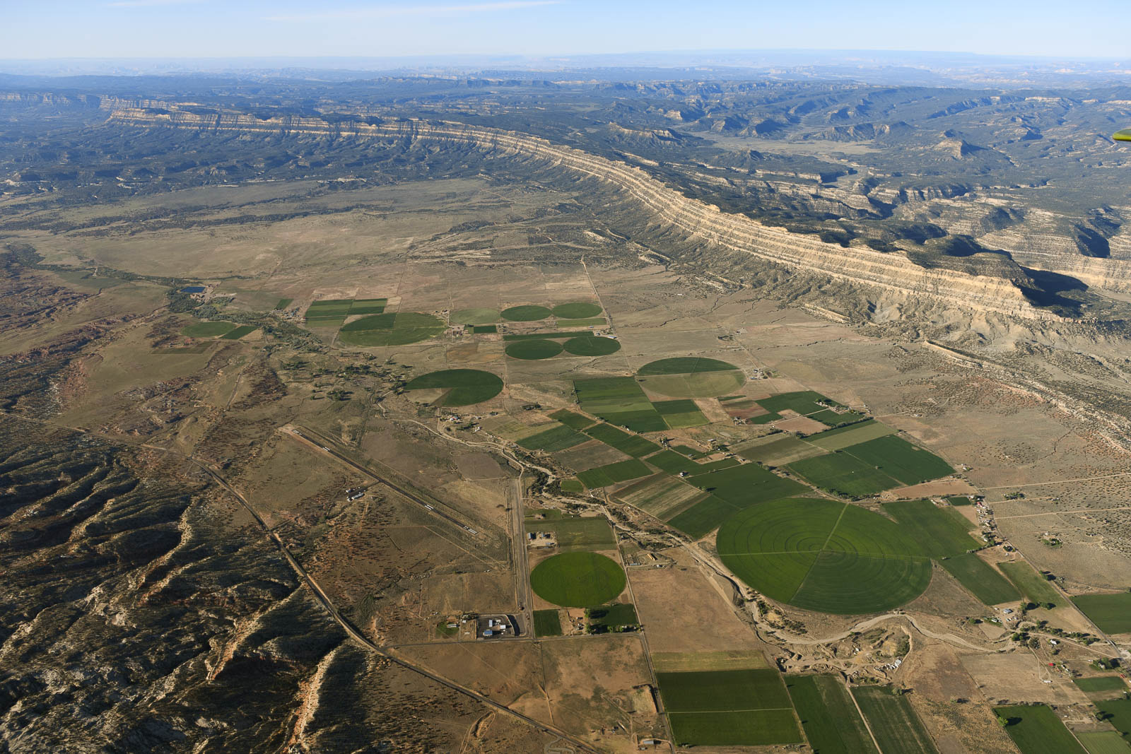
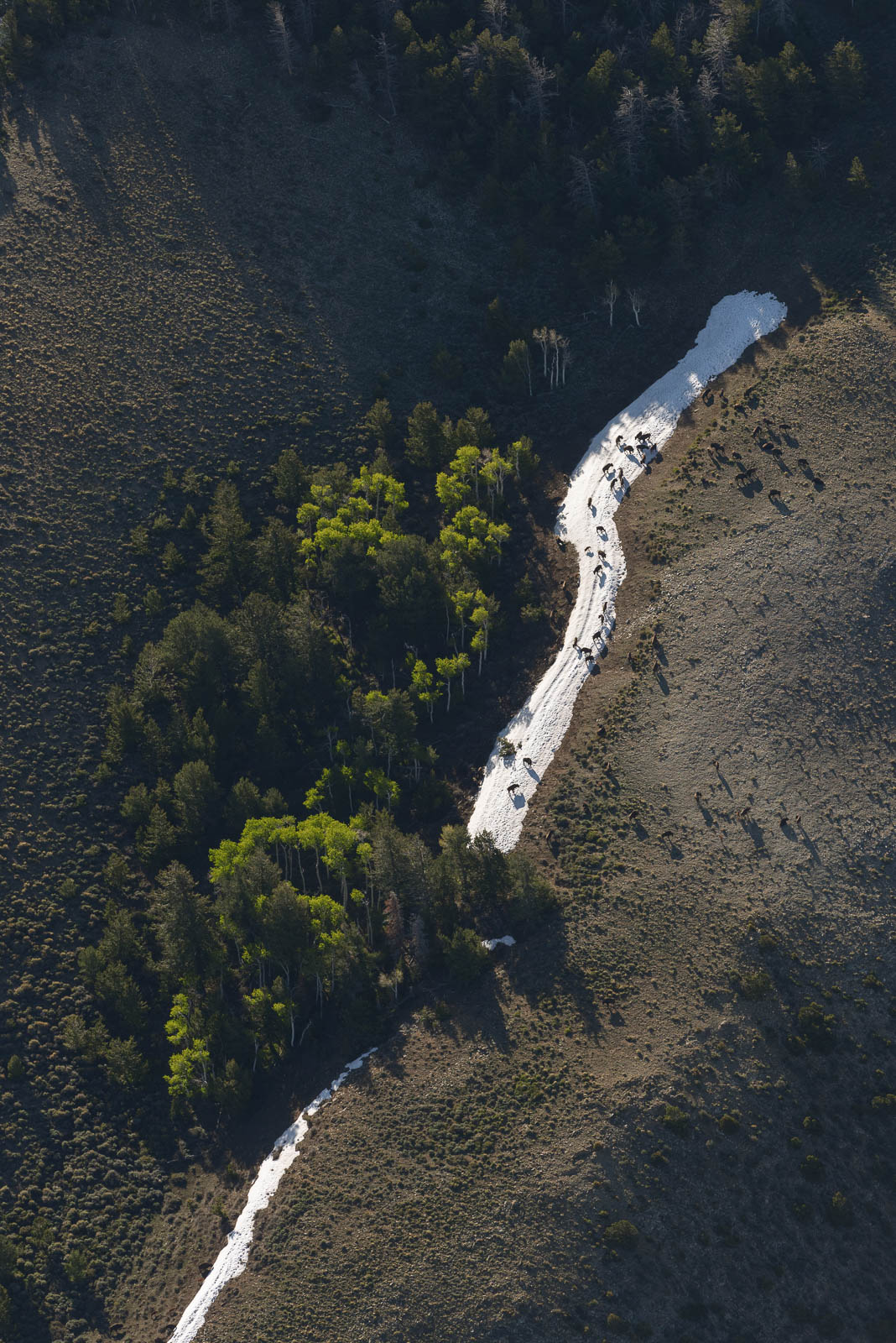
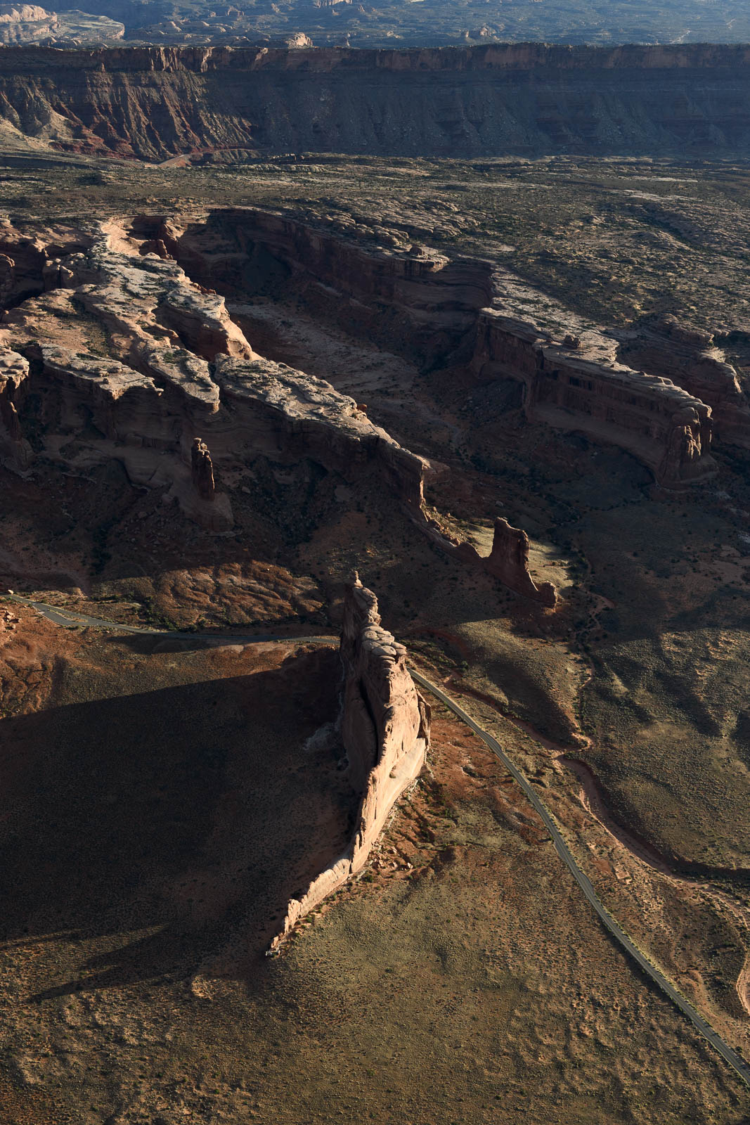
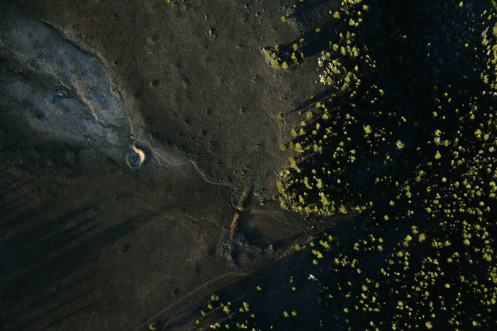
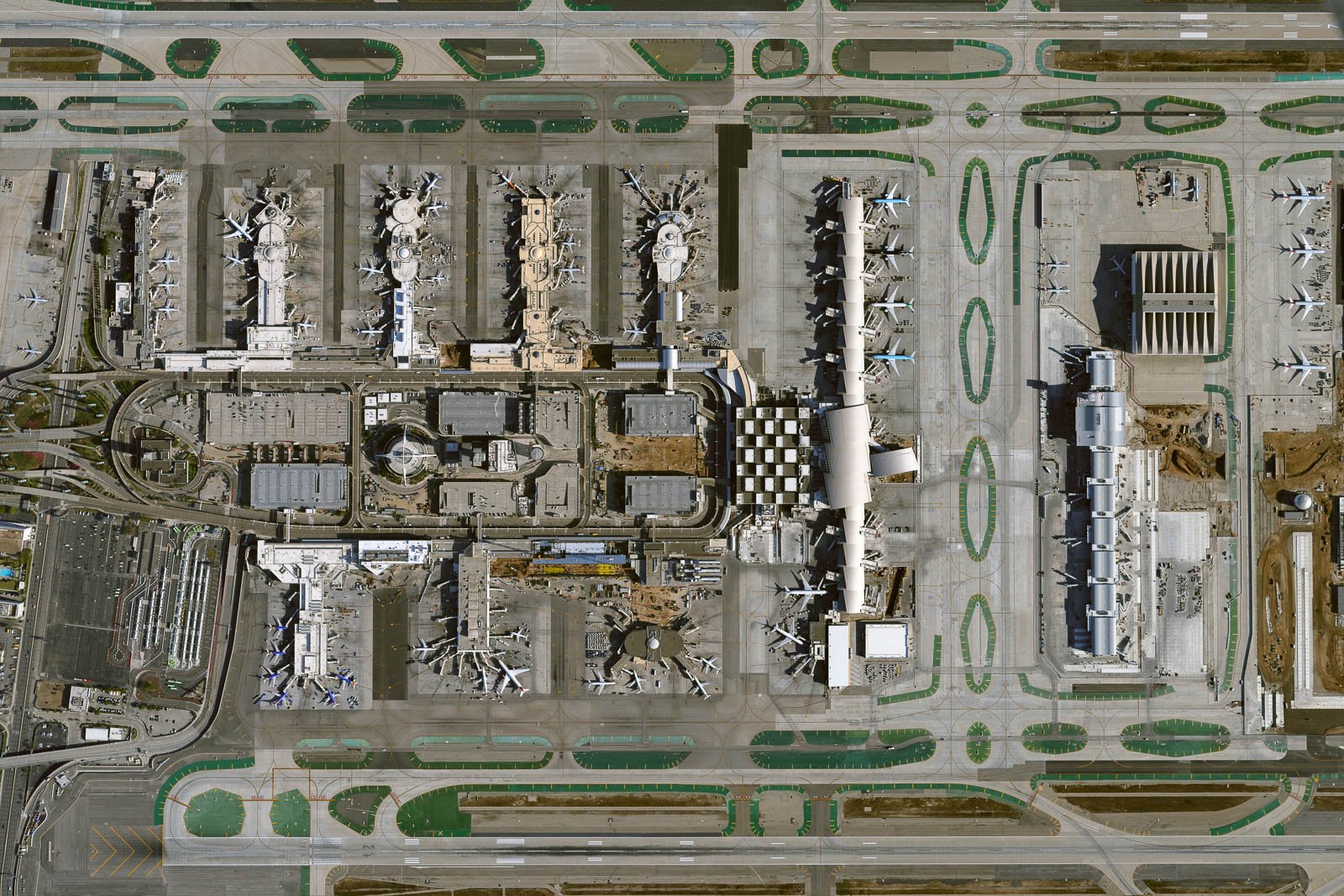
The forecast for the next week is questionable and is absolutely going to have an effect on our homeward mission. However, in Norfolk, we determined conditions were acceptable enough to make it to a field two hours East, putting us closer to Chicago, where we have aspirations of shooting the busiest airport in the country, O’Hare. So we fired up and took off into weather that was reporting perfect visibility and decent to perfect ceilings. However, as we flew, the ceiling began to drop without warning and conditions deteriorated rapidly. We were forced to land at KDNS, Denison, in Iowa. It was a happy accident however—the FBO there was gorgeous, empty, with a crew car awaiting us and a great place to sleep. We couldn’t be luckier to spend a night in such a perfect place. And hot damn, were we happy to be on the ground.
To the East!


Flight Path
[sgpx gpx=/tracks/stratux/gslog_2020-05-26.gpx summary=1 uom=5 gheight=200]
Day 16 – Departing the West
Monday, May 25 2020
Day 16
We knew it was going to be hard to say goodbye to the West, so waking up in the wild desert of Utah as the sun rose over the red sands of Moab was bittersweet. We stretched and packed our gear and looked at the white airport crew car with some amusement—the desert winds and dusty sands had done a number on the interior and exterior of it. We made sure we gave it a good wipe down when we got it back to the airport.
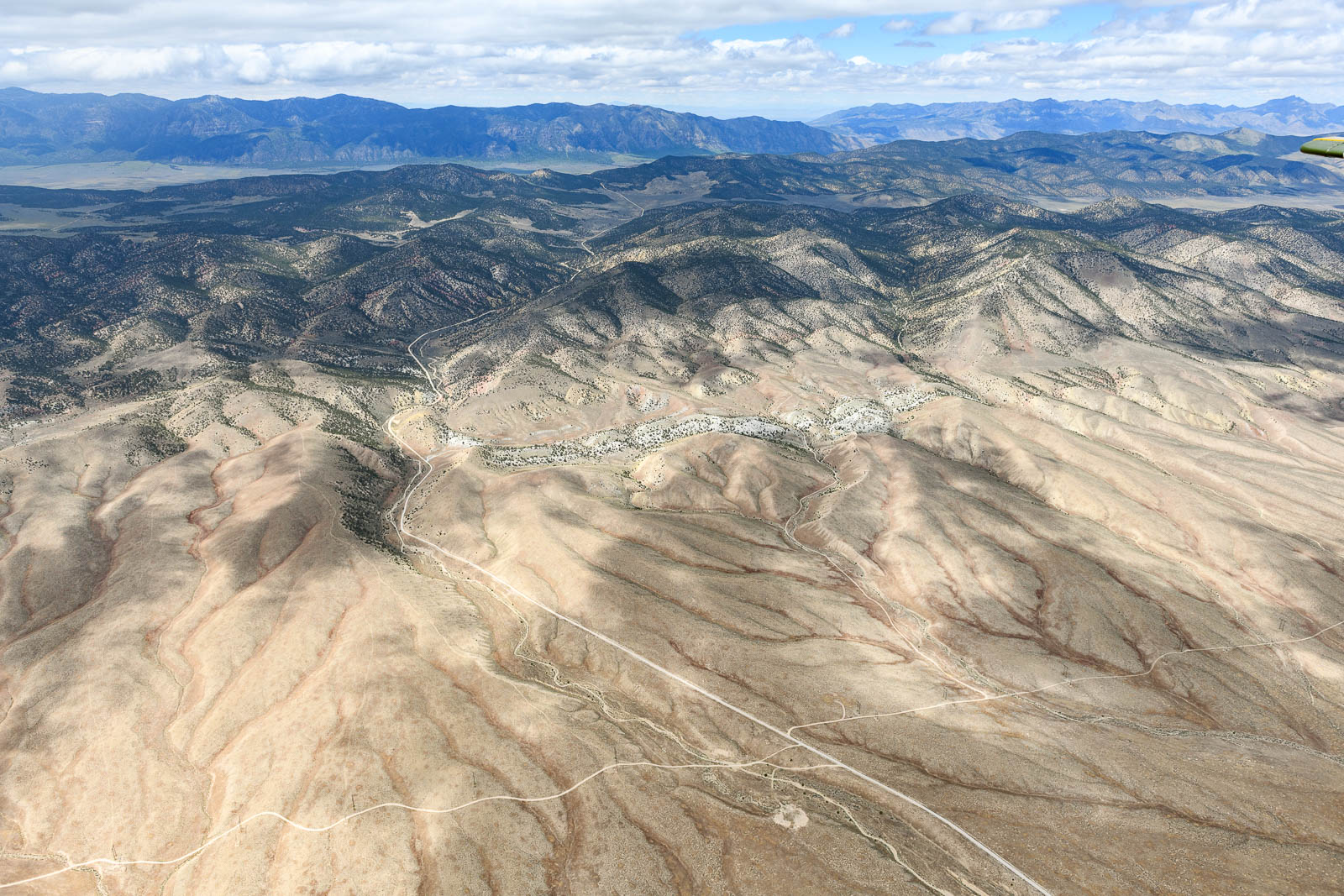
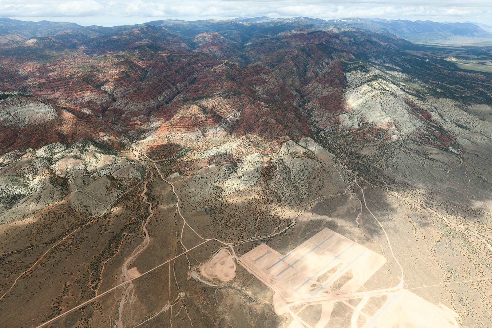
We’d gone back and forth about the route we were planning to take back East and had settled on crossing the final Western mountain ranges by flying North through some passes that would take us into Wyoming and back through the Midwest, rather than descending to the South again or attempting to cross peaks that reached over 10,000 ft MSL by flying directly East.
We made it back to Canyonlands and leisurely repacked the plane and took off into the morning sky. Today we’d be crossing the Rockies over northern Colorado and into Wyoming. Our route didn’t take us over any peaks that worried us, but if the winds picked up, we could be dealing with some serious up and down drafts, and with the predicted warm weather, there was the possibility of some unstable conditions. Our early departure was in service of avoiding this, and our planning and sleepiness paid off—the conditions we calm and stable and the plane’s performance was solid, even at our maxed out density altitude of 14k.
It was lovely flying over the snow capped peaks of Colorado. We marveled at how the terrain changed rapidly after departing Utah, and the temperatures at altitude over those snowy expanses, even with the heat going, chilled us to the bone. Some hot black coffee helped—doesn’t it always? We crossed the final expanse of mountains as we entered Wyoming, and the land grew flatter and green.
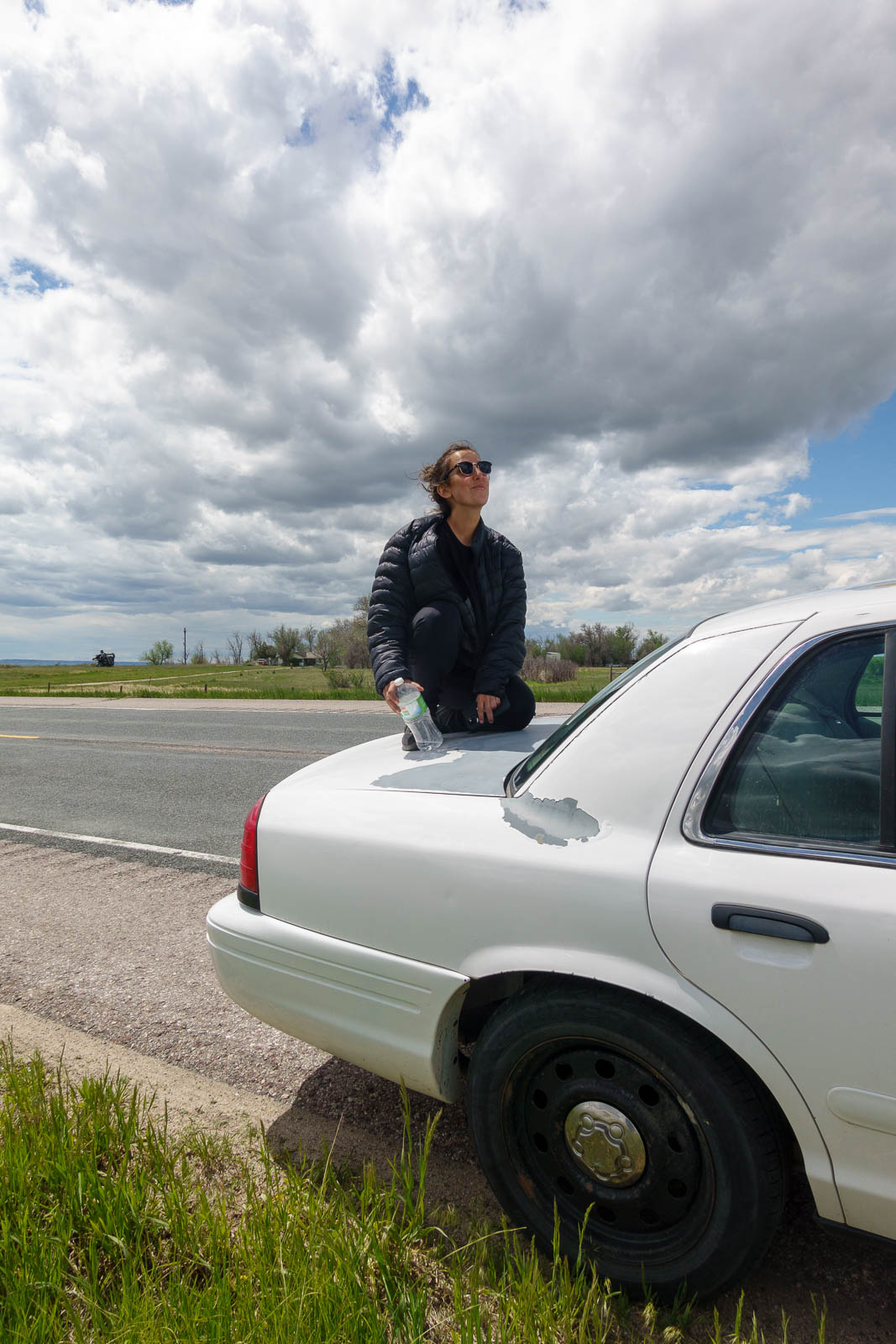
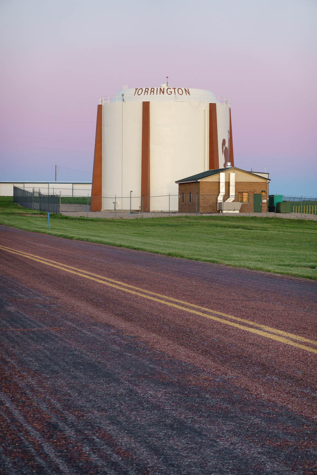
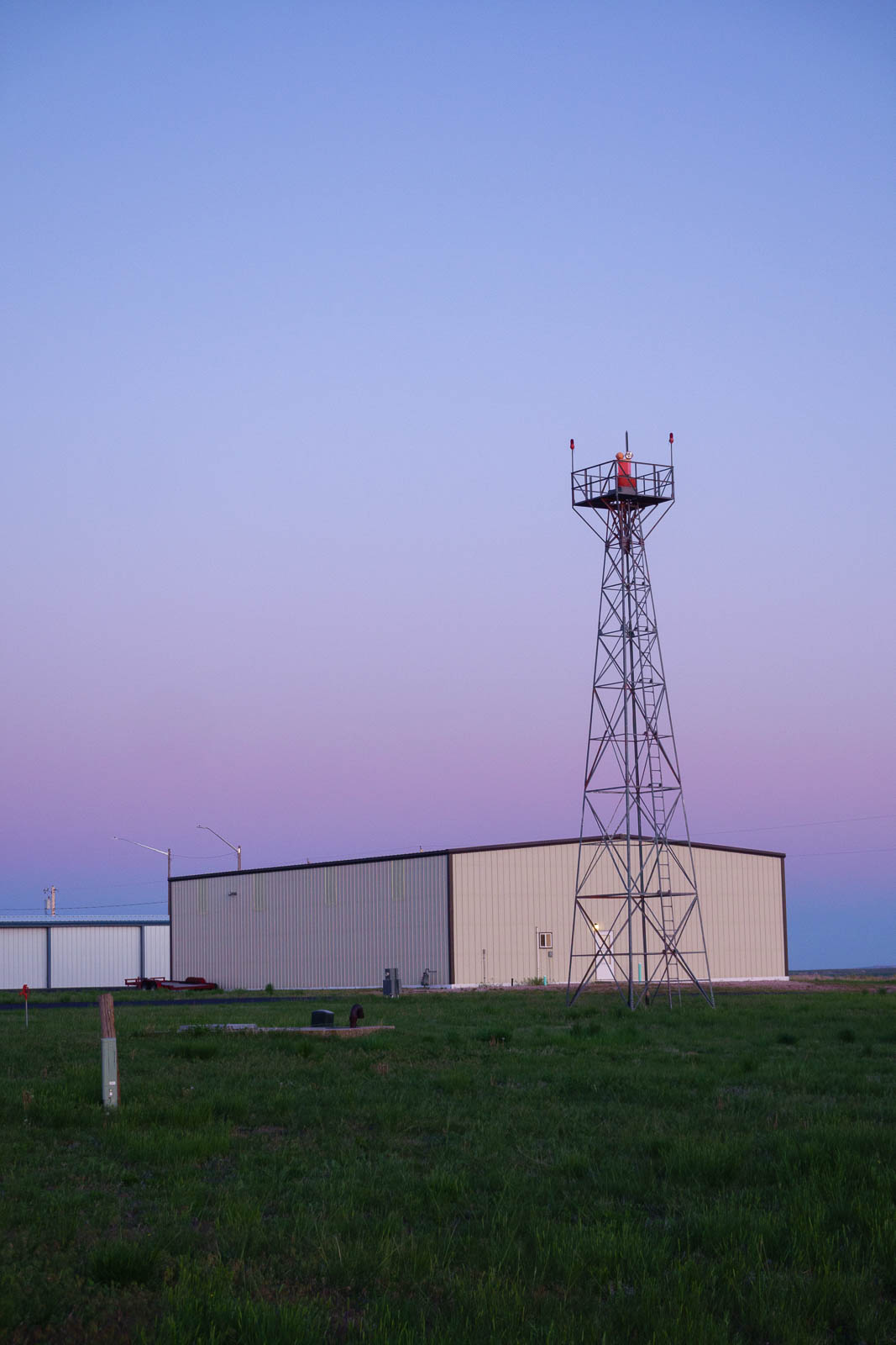
We touched down in Torrington, Wyoming, a sleepy field with a couple beautiful Grumman turbine Ag Cats and an Air Tractor 7 miles from the border of Nebraska. Jim, the FBO overseer, came outside to unlock the 100LL dispenser and we fueled up, tied the plane down and took the old airplane car out for a drive around town. I suggested we take it for a joy cruise out into some Wyoming wilderness, and about 10 miles out the engine overheated and we pulled over, laughing. Of course! The classic airport jalopy was resistant to my forced road trip. It really didn’t want to start so we added some water to the coolant after a spell on the side of the road (complete with people stopping to ask if we needed help almost immediately), and carefully drove it to the nearest automotive store where we added an entire jug of coolant to the thirsty engine and bought a replacement lightbulb for the plane.
Back on the airport, we took the plane up for an hour at sunset to shoot, then landed and had a typical flamping camp chair picnic under the wing complete with avocados, brie, and seltzer.Two guys landed around this time in a great little yellow tailwheel aircraft, a 220 hp fat tire Scout. We got to talking and it just so happened that they were flying cross country as well, to Connecticut! Tiny beautiful aviation world, it is.Night fell and the day was done. Good to be in Wyoming. We slept well, and prepared for our journey East.


Flight Path
[sgpx gpx=/tracks/stratux/gslog_2020-05-25.gpx summary=1 uom=5 gheight=200]
Day 15 – Out of this World
Sunday, May 24 2020
Day 15
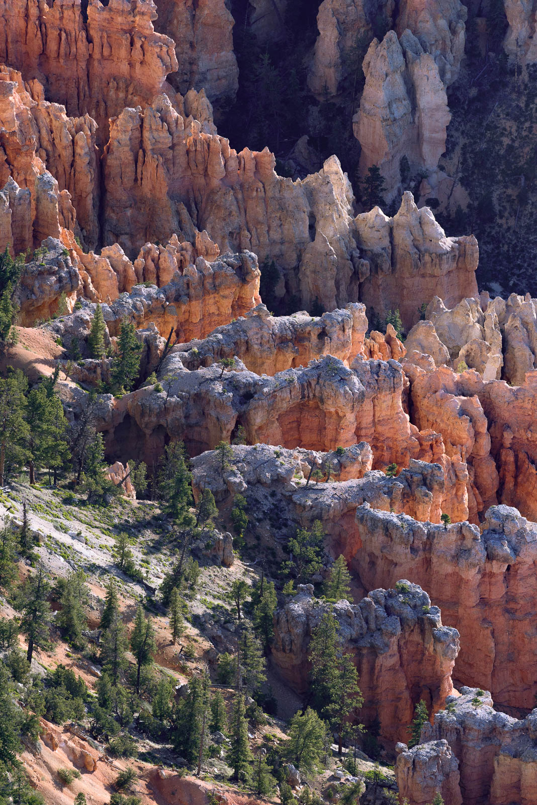
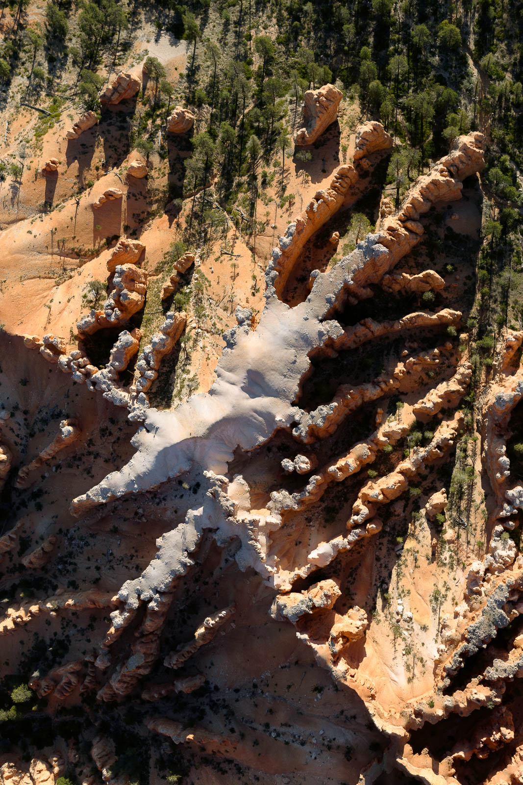
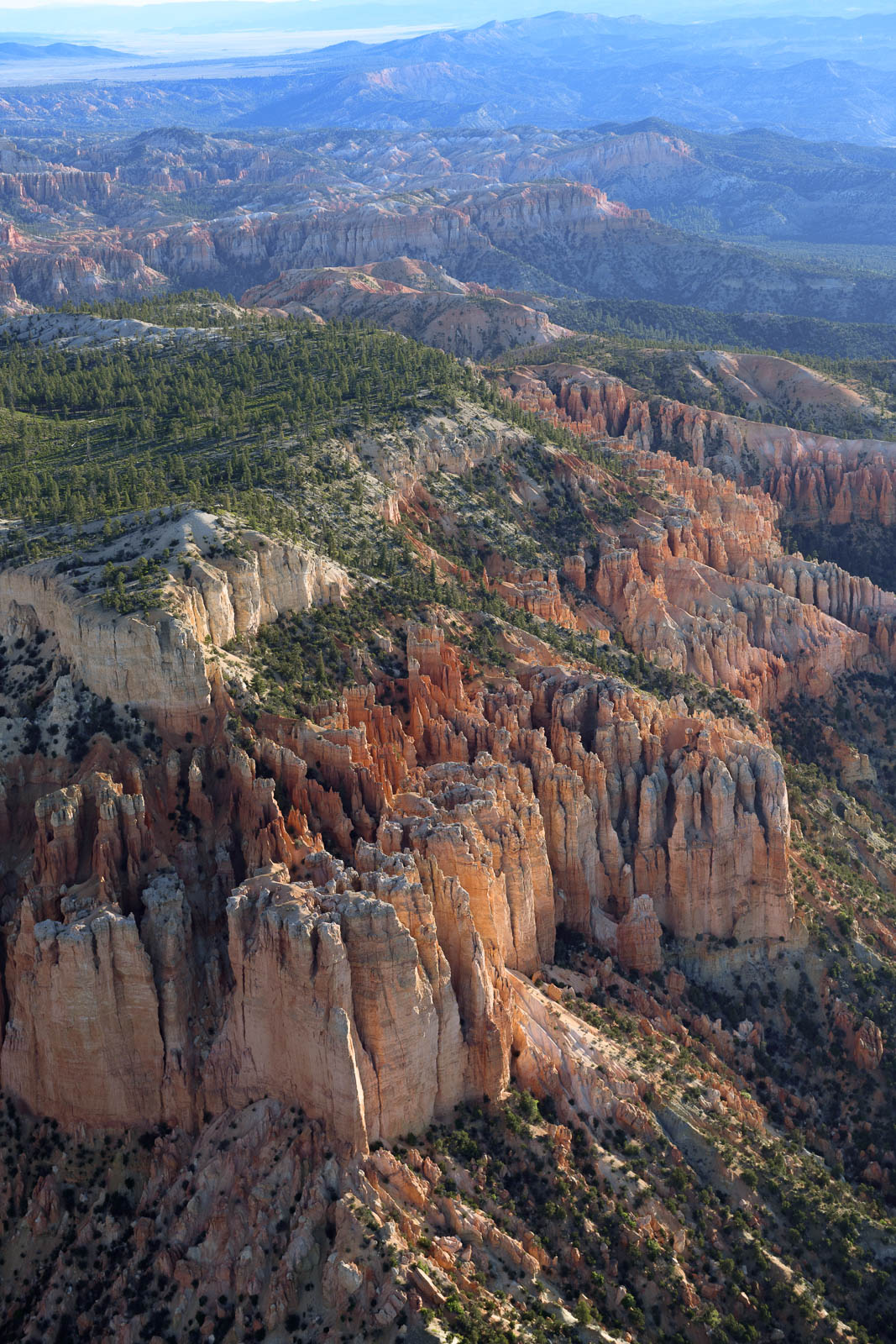
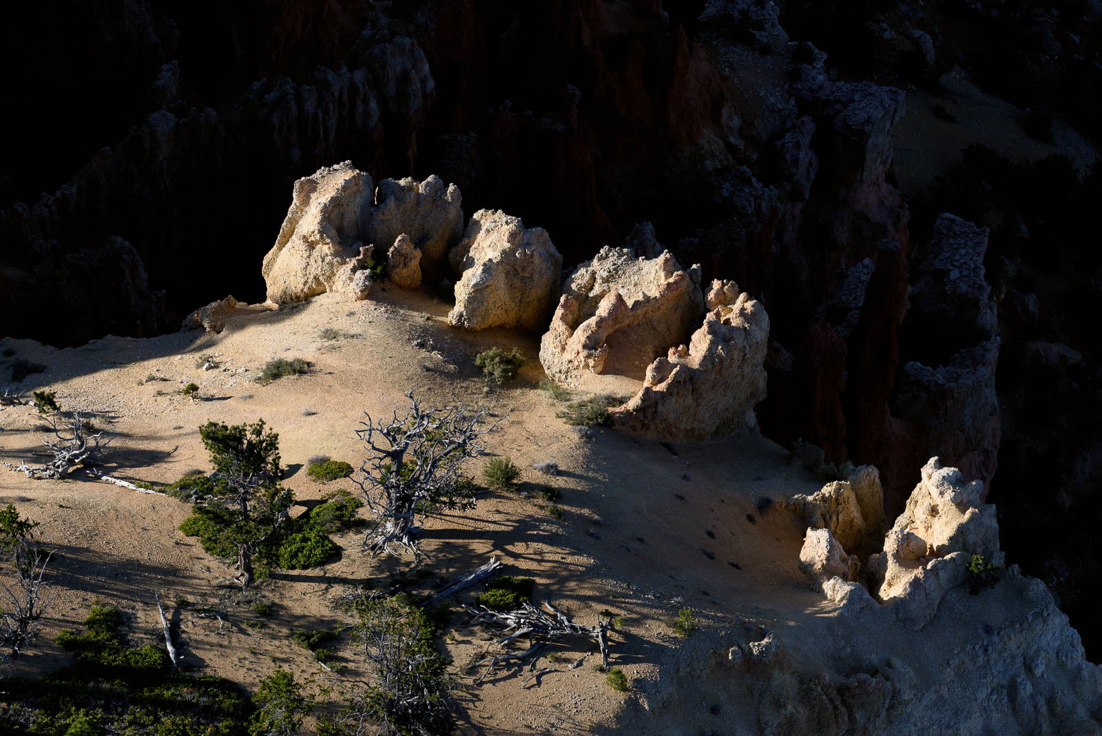
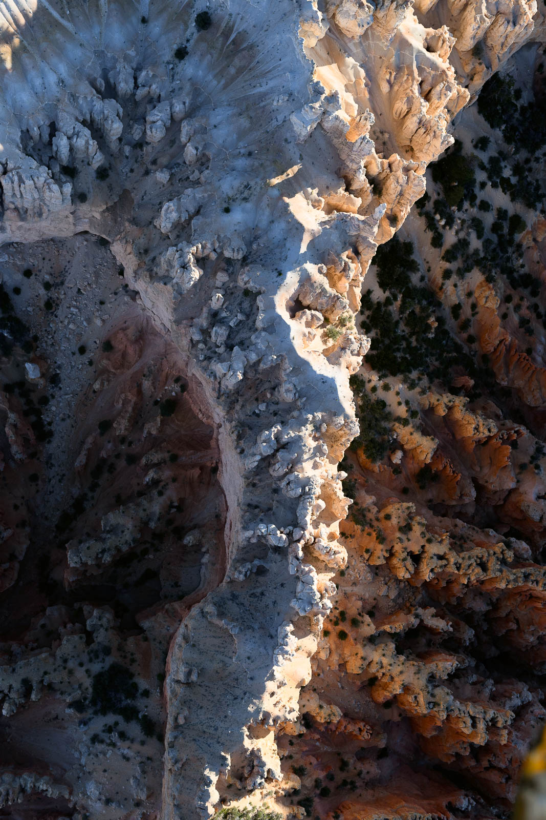
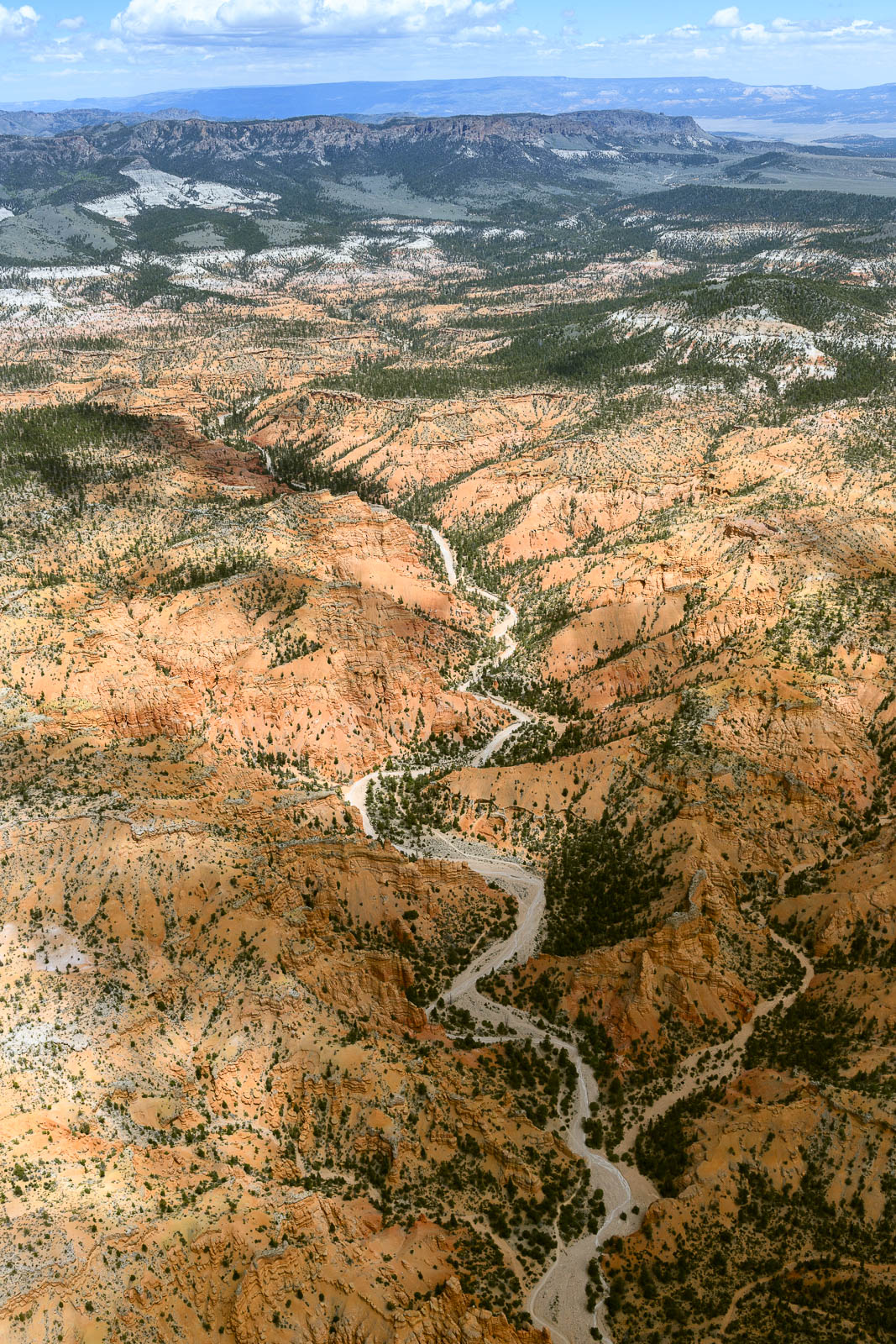
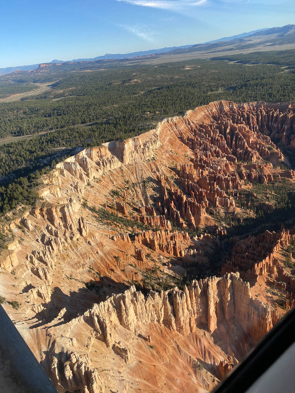
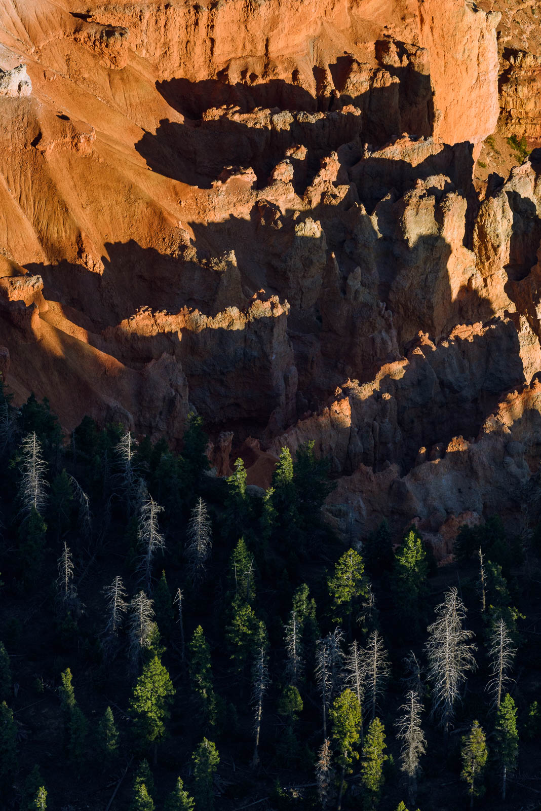
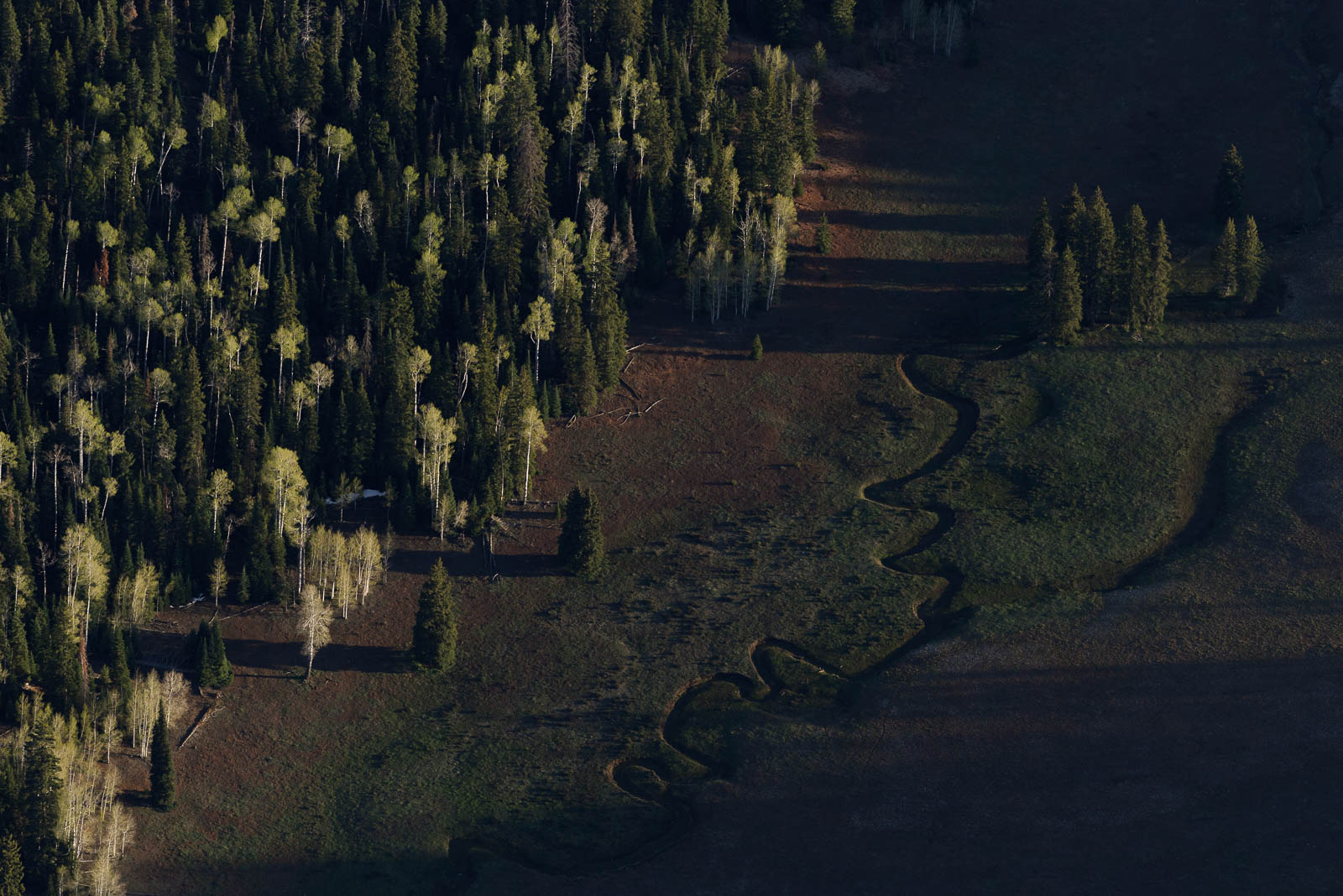
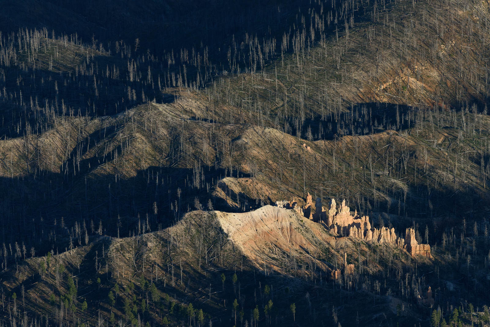
We woke up before sunrise in Richfield and headed to the plane for some early morning shooting of Bryce Canyon, the Canyonlands, Moab, and the unnamed beauty in the expansive, alien landscape between these spectacular places. Richfield at dawn was so peaceful, so still. The surrounding mountains, capped in snow, sat in silent observation of our flight preparations.
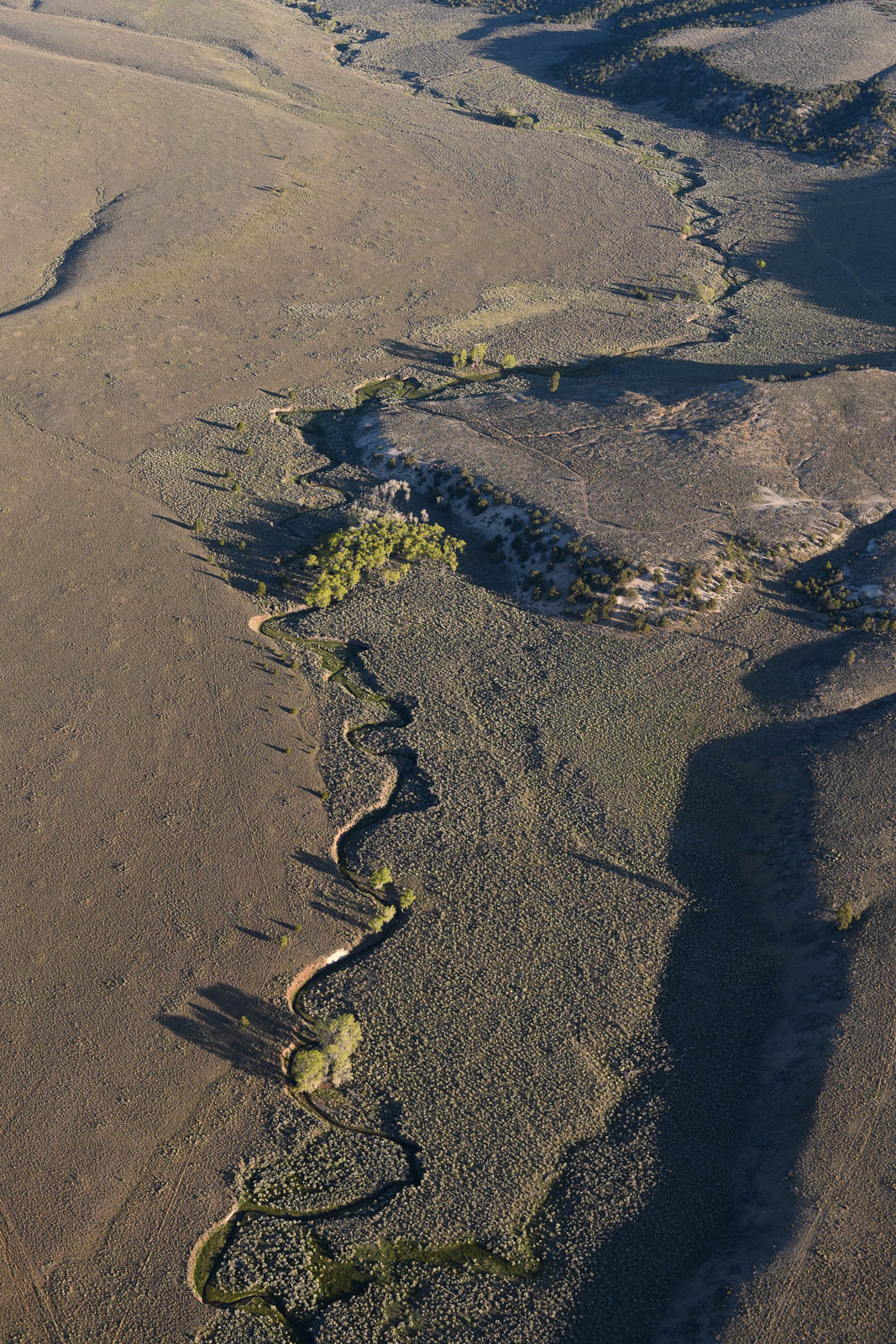
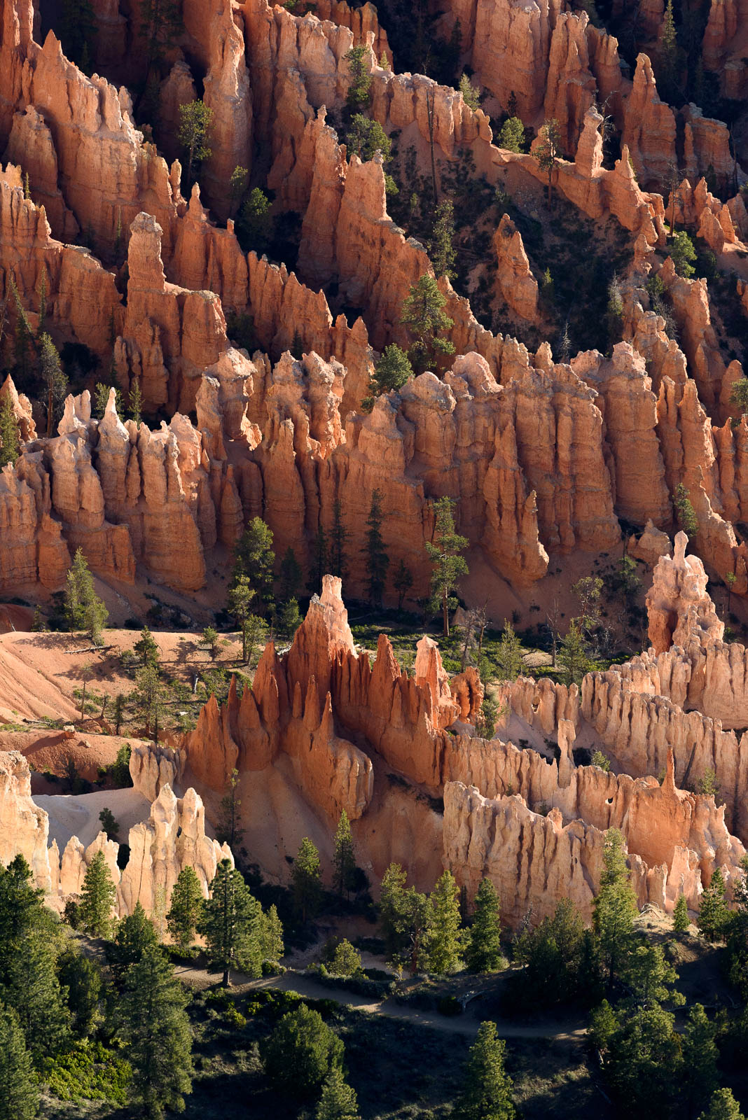
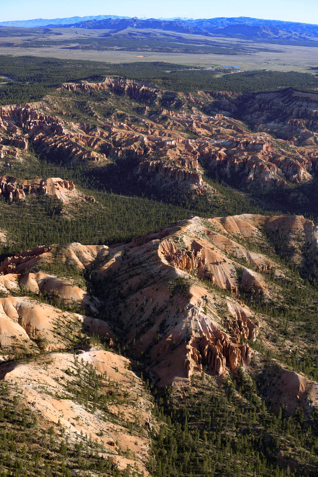
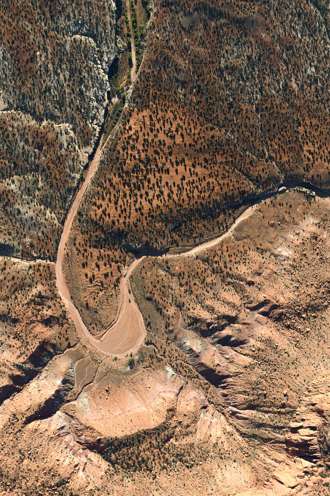
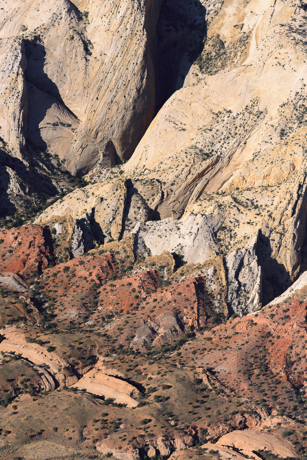
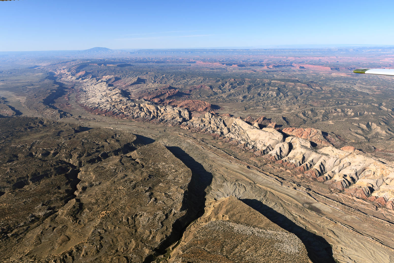
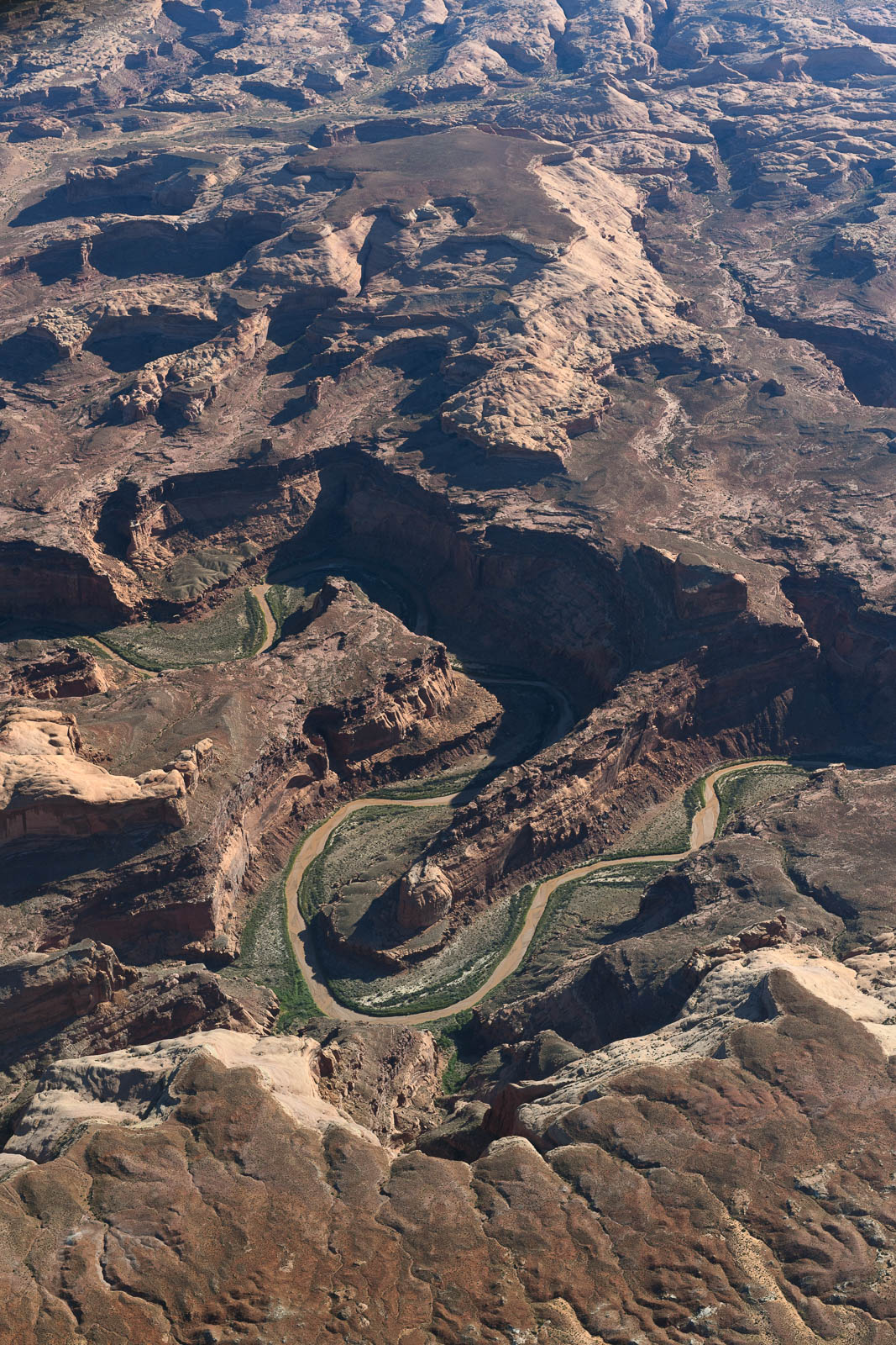
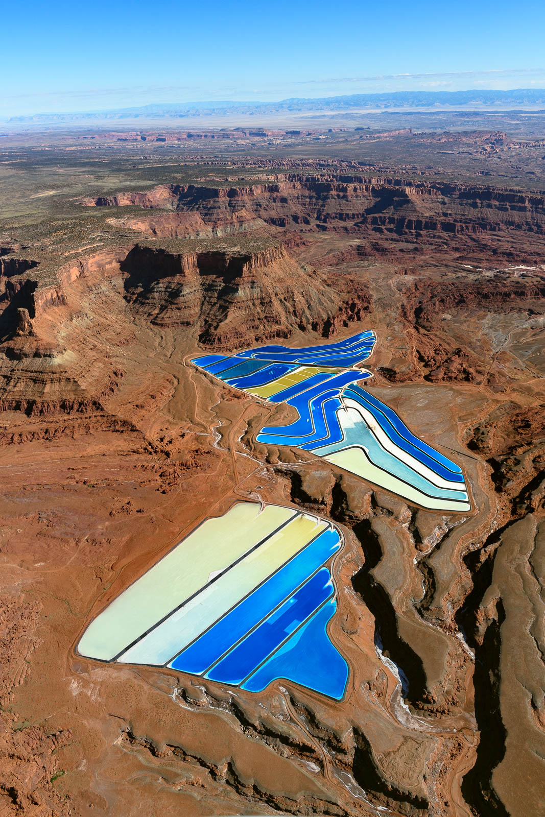
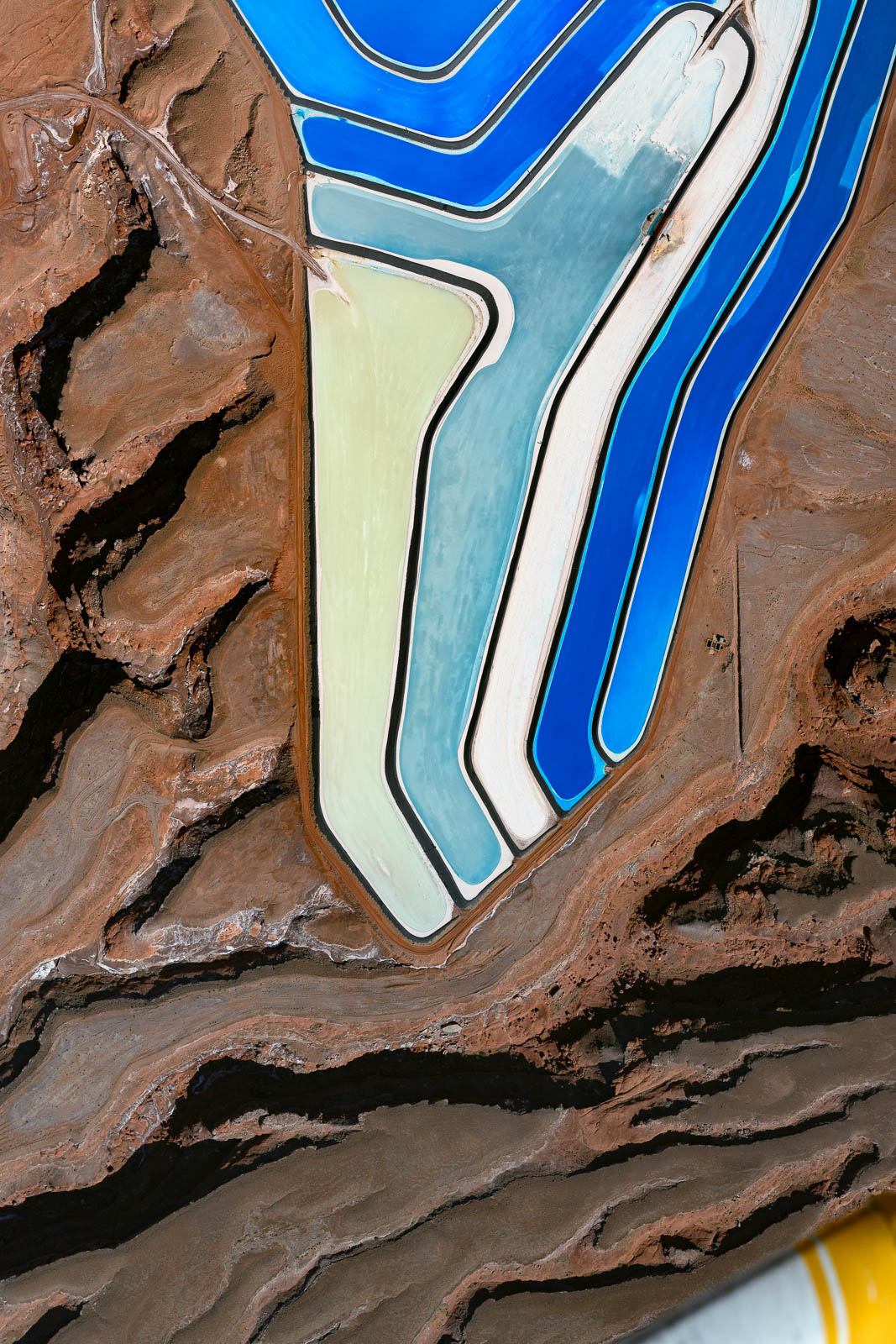
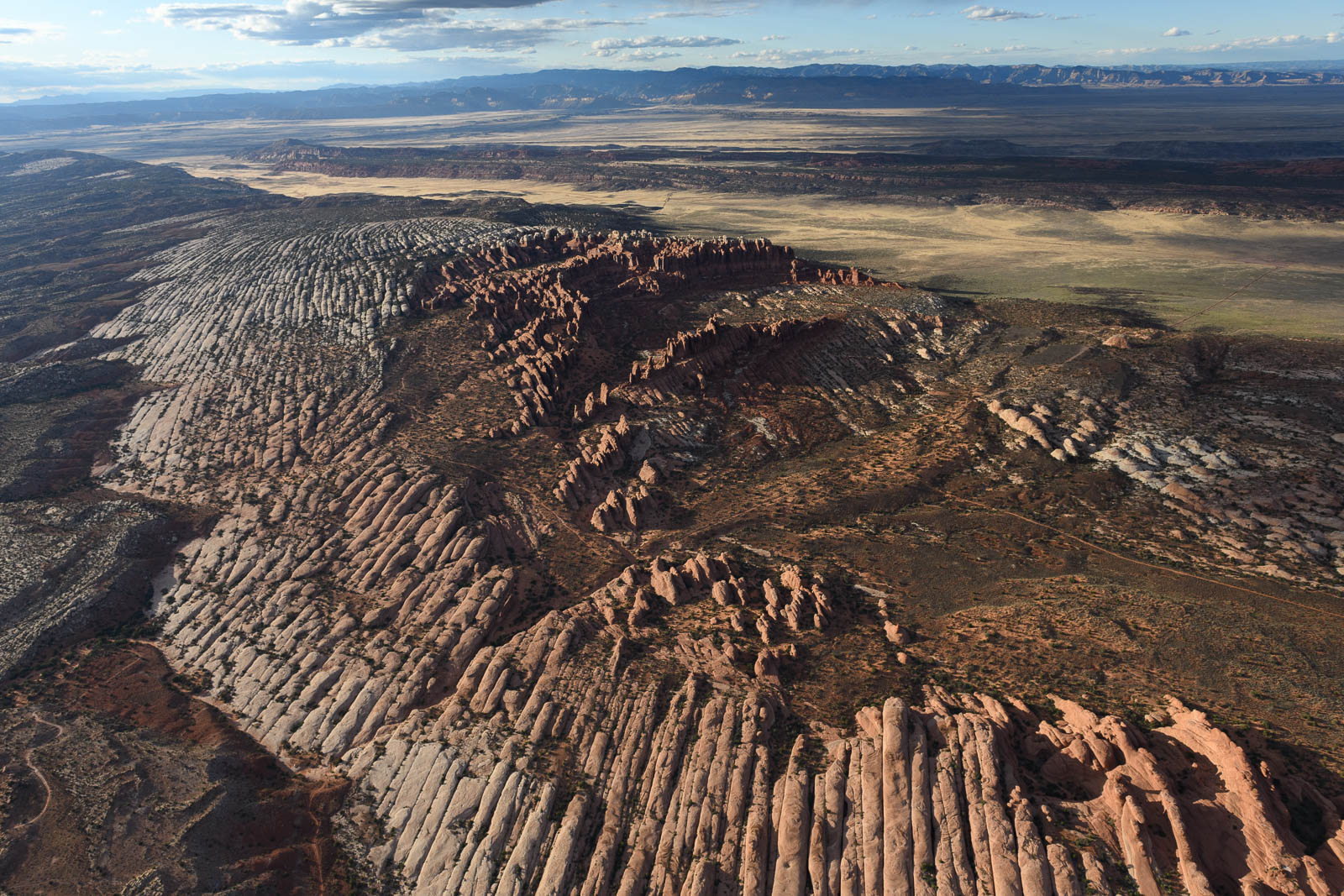
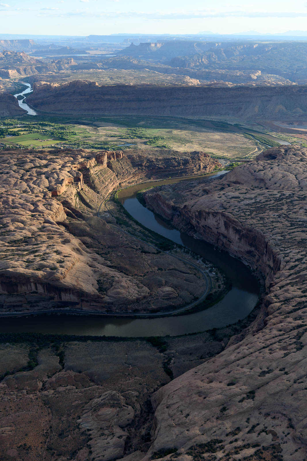
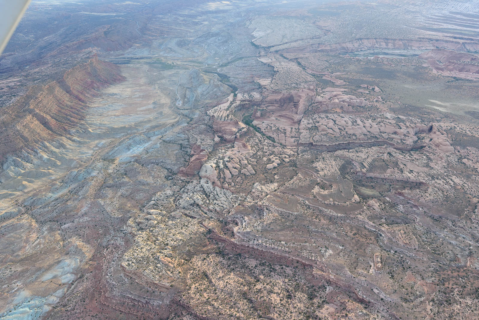
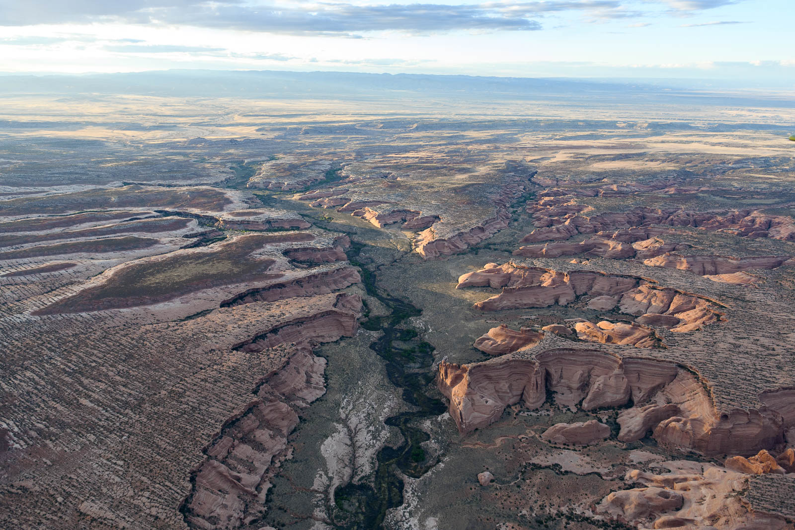
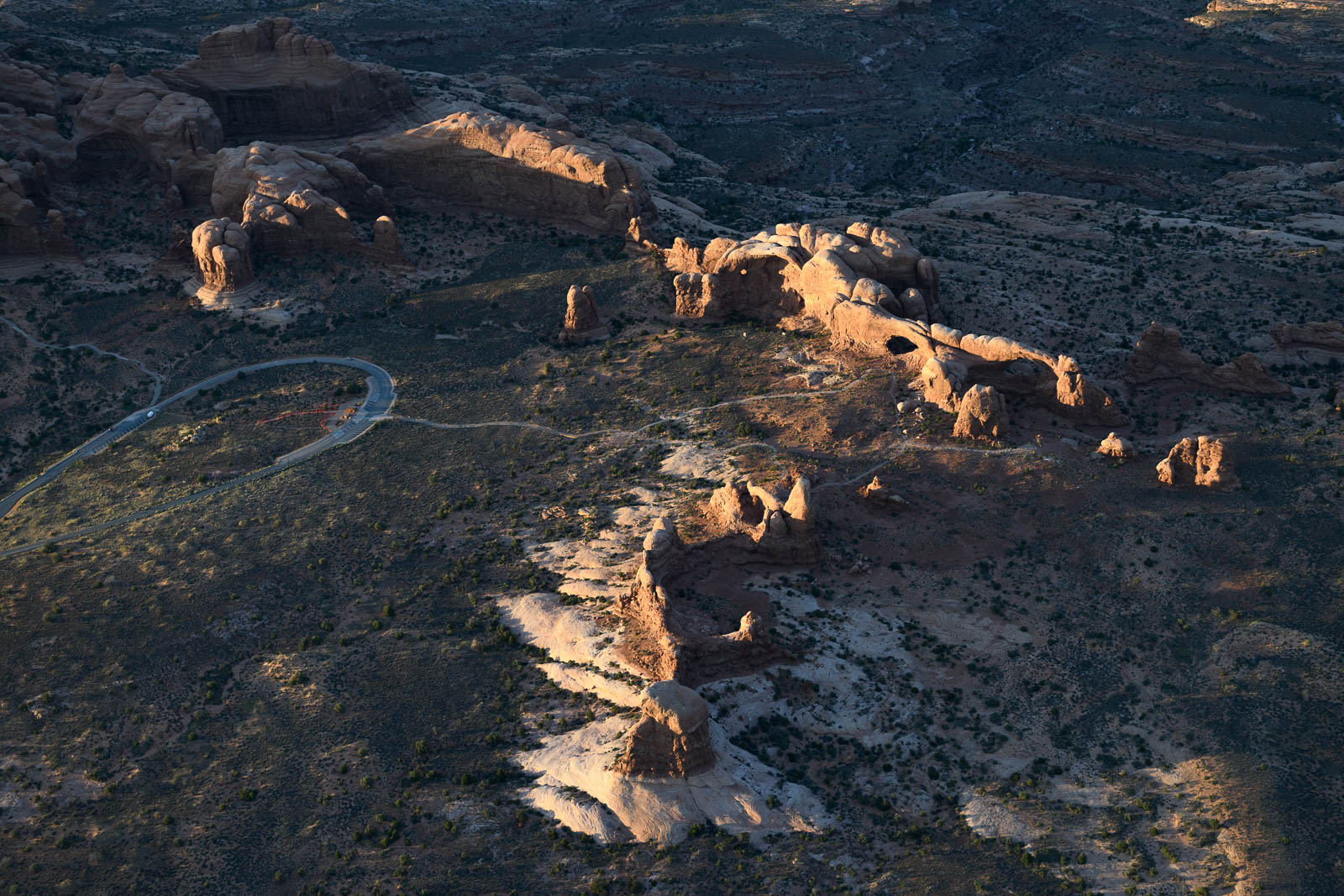
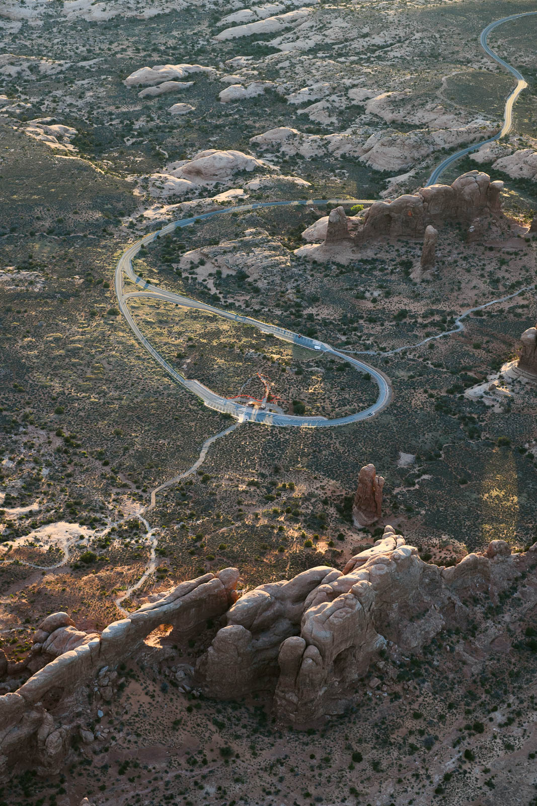
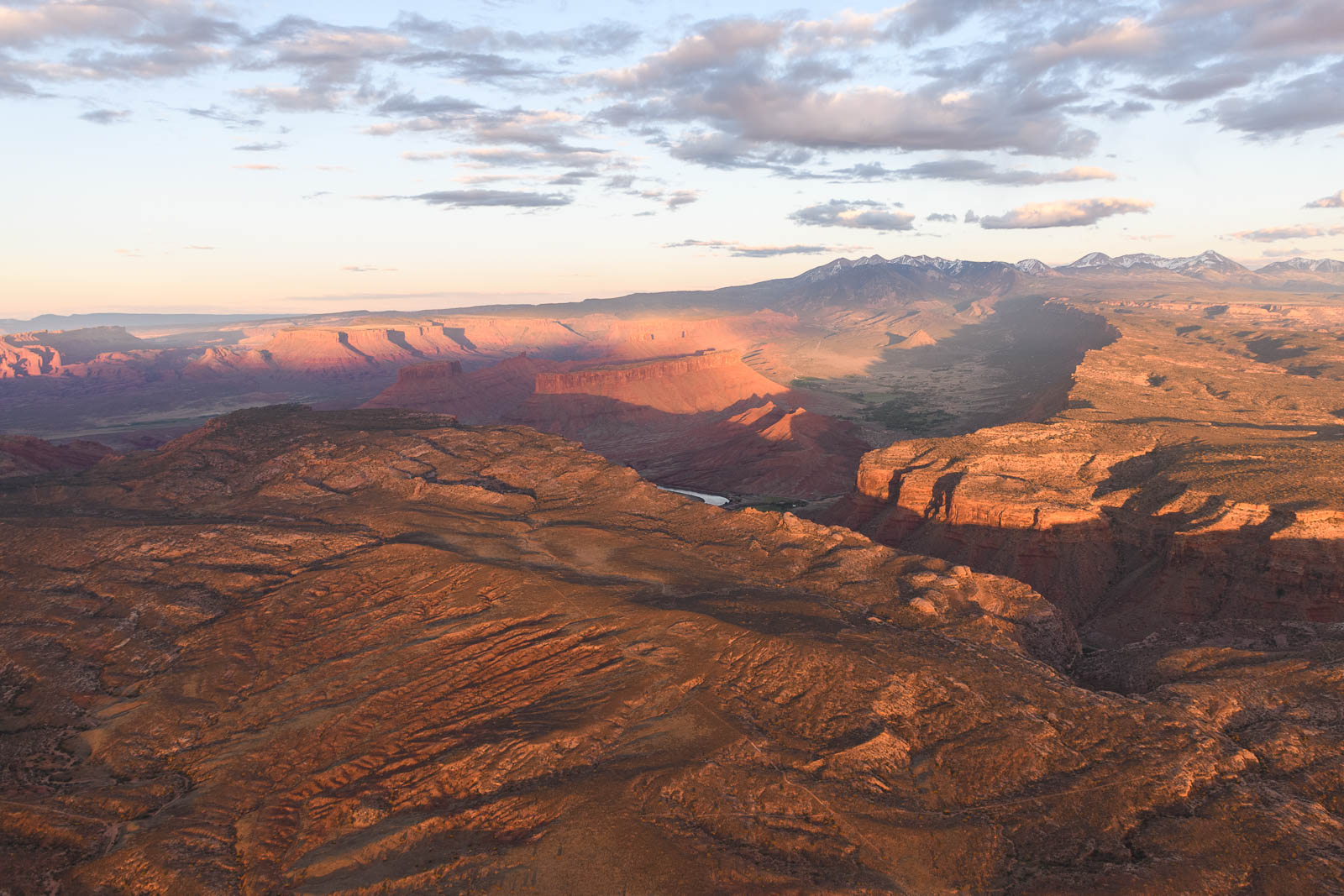
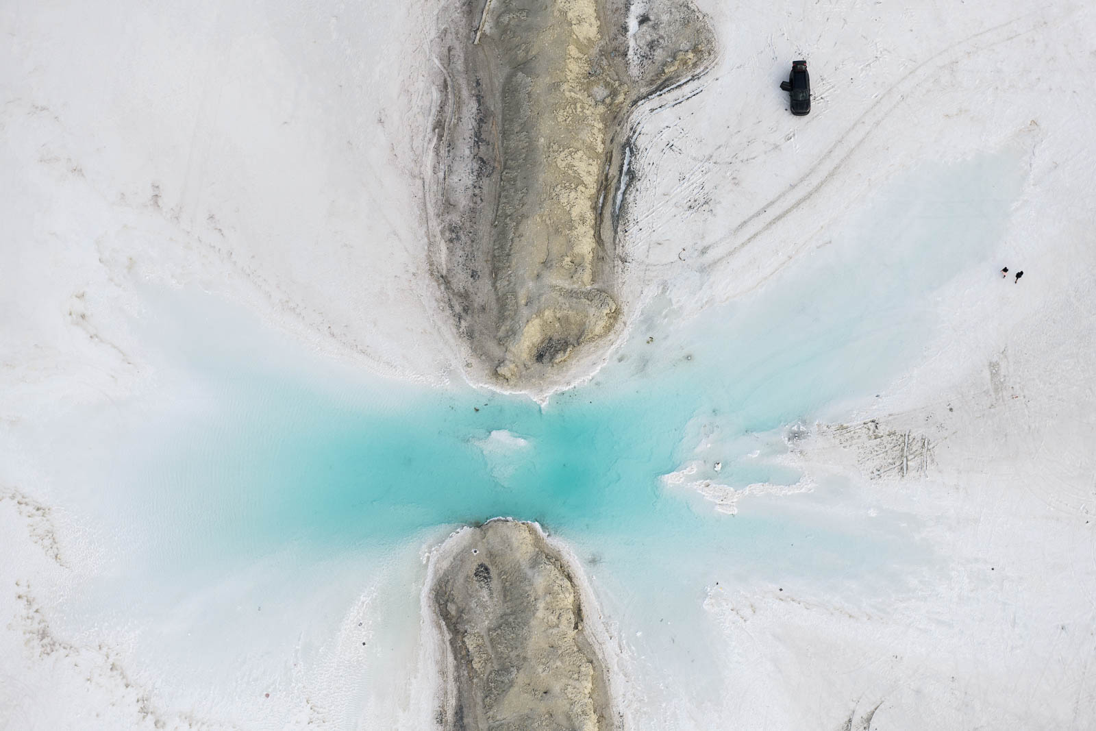
We took off just as the sun rose over the horizon and flew Southeast, following a valley down to Bryce Canyon, an expansive, gnarled pit of red rocks. Beautiful in the morning light, I circled in lazy spirals overhead as Filip shot, following the twisting canyon maze. We then pressed on to Canyonland Airport, and along the way photographed some of the craziest landscapes we’d seen so far, including the Grand Staircase and Canyonlands National Park. The most notable thing on this flight was just South of the airport, and barely noted on the chart. I mentioned my new obsession with the salt lakes—these were similar, evaporation pools meant to extract minerals from the waters. They were brilliant blue and soft, buttery turquoise pools gridded out in the red rocks of Moab. Truly looked like someone had taken a paint brush and run it across the ground. Stunning and strange, I flew in varying altitudes above it, until fuel called and I landed at Canyonland.
We explored Moab for the afternoon, grabbed lunch and coffee, and marveled at how, though many of the popular parks were closed right now, the town was absolutely bustling with outdoor fans and tourists. It was probably the most “normal” any place has felt since this trip began (indeed since this pandemic began), which of course in itself felt a bit strange. So we kept our distance and observed, and then headed back to the airport to prep for a sunset flight.
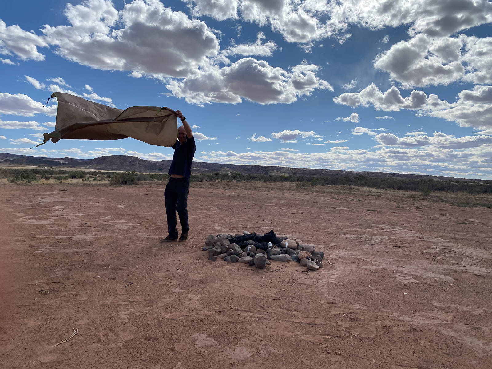
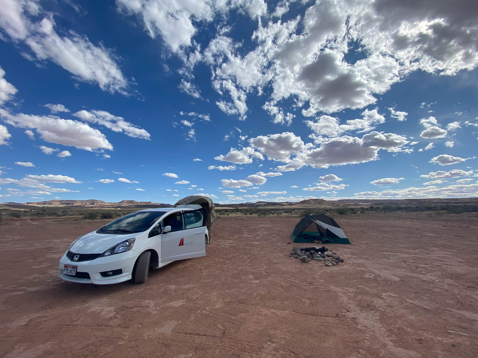
Before going up, we grabbed our camping gear and the airport car graciously lent to us, and drove out into the desert, where we set up camp and noted the location so we could find it upon return. Utah is amazing in that you can basically camp anywhere; we weren’t the only ones wild camping on the desert that night.
We headed back to the airport to preflight, and as I was untying the plane, a pilot pulled up in his car and asked if we were taking the plane across America—he’d seen a post about it online and recognized Old Rusty! We all had a pretty good laugh about it, and then both fired up and took off into the brilliant afternoon light. We plugged 123.45 into our radios and talked to each other throughout the flight—so fun!
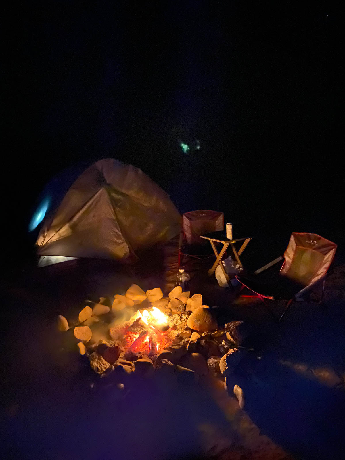
We landed and were extremely fatigued at this point, so we headed back to camp, lit a fire and were asleep under the stars by midnight.


Flight Path
[sgpx gpx=/tracks/stratux/gslog_2020-05-24.gpx summary=1 uom=5 gheight=200]
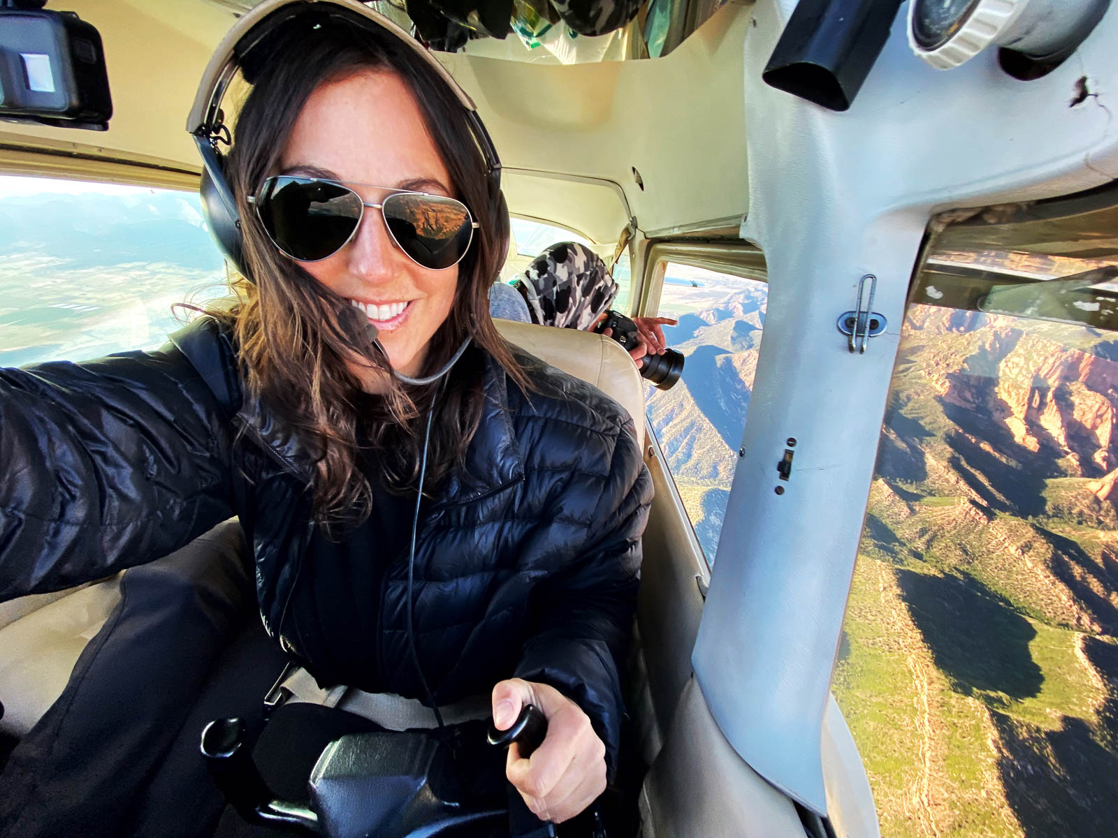
Day 14 – Road to Zion
Thursday, May 23 2020
Day 14
You may ask why we have included no day 13 post here. It isn’t for superstitious reasons, though perhaps it should be. No, day 13 was spent at the FBO in Bountiful, completely rewriting our route to include a diversion to Utah’s incredible national parks to the South, and then looking at the weather and immediately realizing there was no way we could safely traverse the valley passes to our destination that day. Winds gusting 50 knots wouldn’t make for a great mountain crossing experience. We’d really hyped each other up planning this new route and were excited to get going, so being grounded felt extra agonizing. Nonetheless, we headed back to the hotel and prepared to wait out the storm. Day 13 was a wash but we were also grateful that in almost two weeks of flying cross country, we’d only been weathered out for one day. We hoped that luck would hold the rest of way.
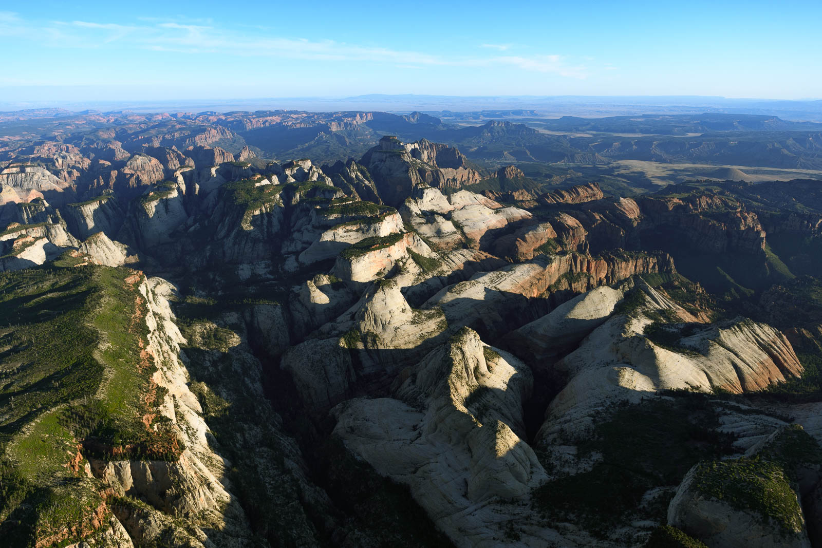
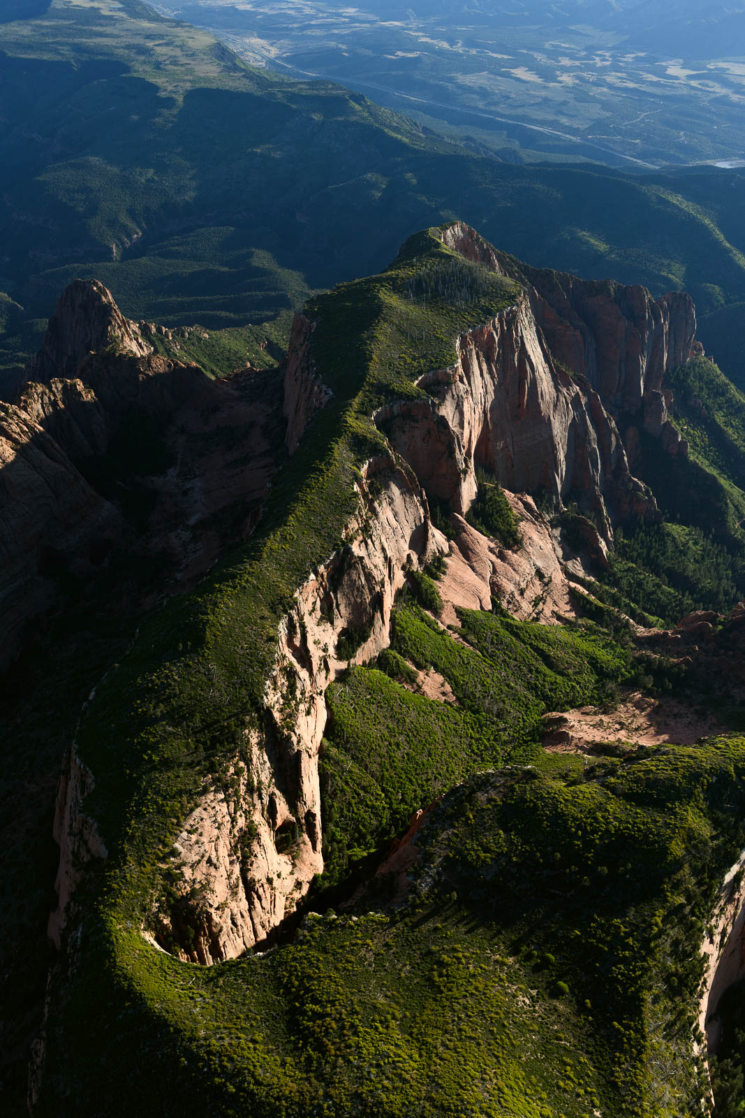
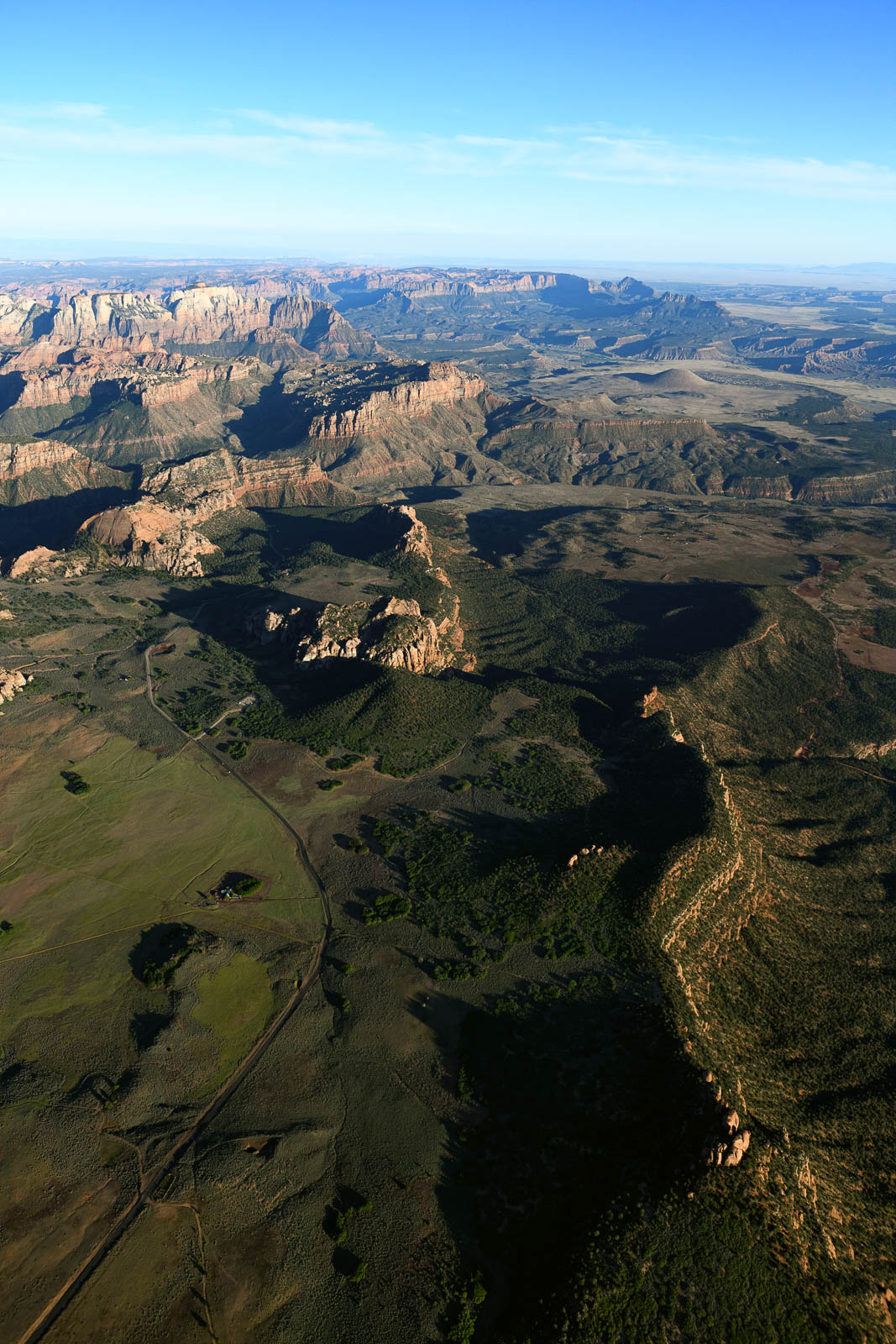
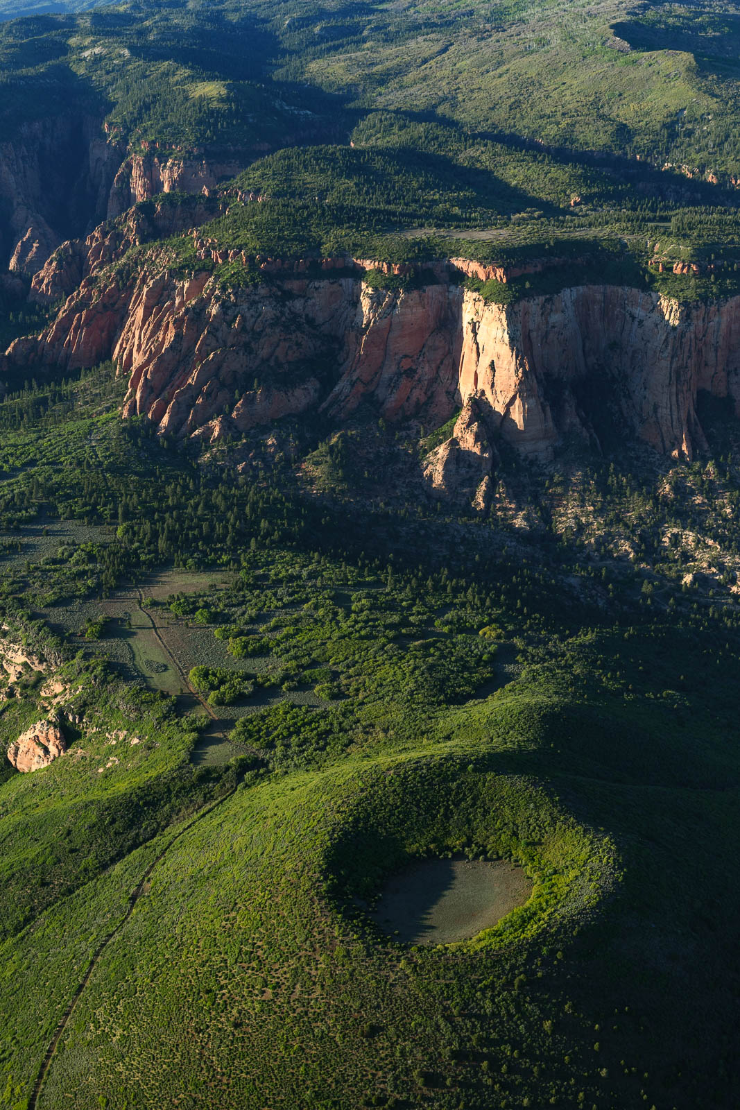
The morning of day 14 began with temps below freezing and sheets of icy rain, but as the sun climbed over the Great Salt Lake, things quickly began to look up. We packed our things and headed to the airport to fuel and depart and get started on our delayed adventure. Today was extra exciting because we were headed to shoot Zion National Park at sunset. Of all the places suggested to us across the entire country, Zion might top the charts for most recommended.
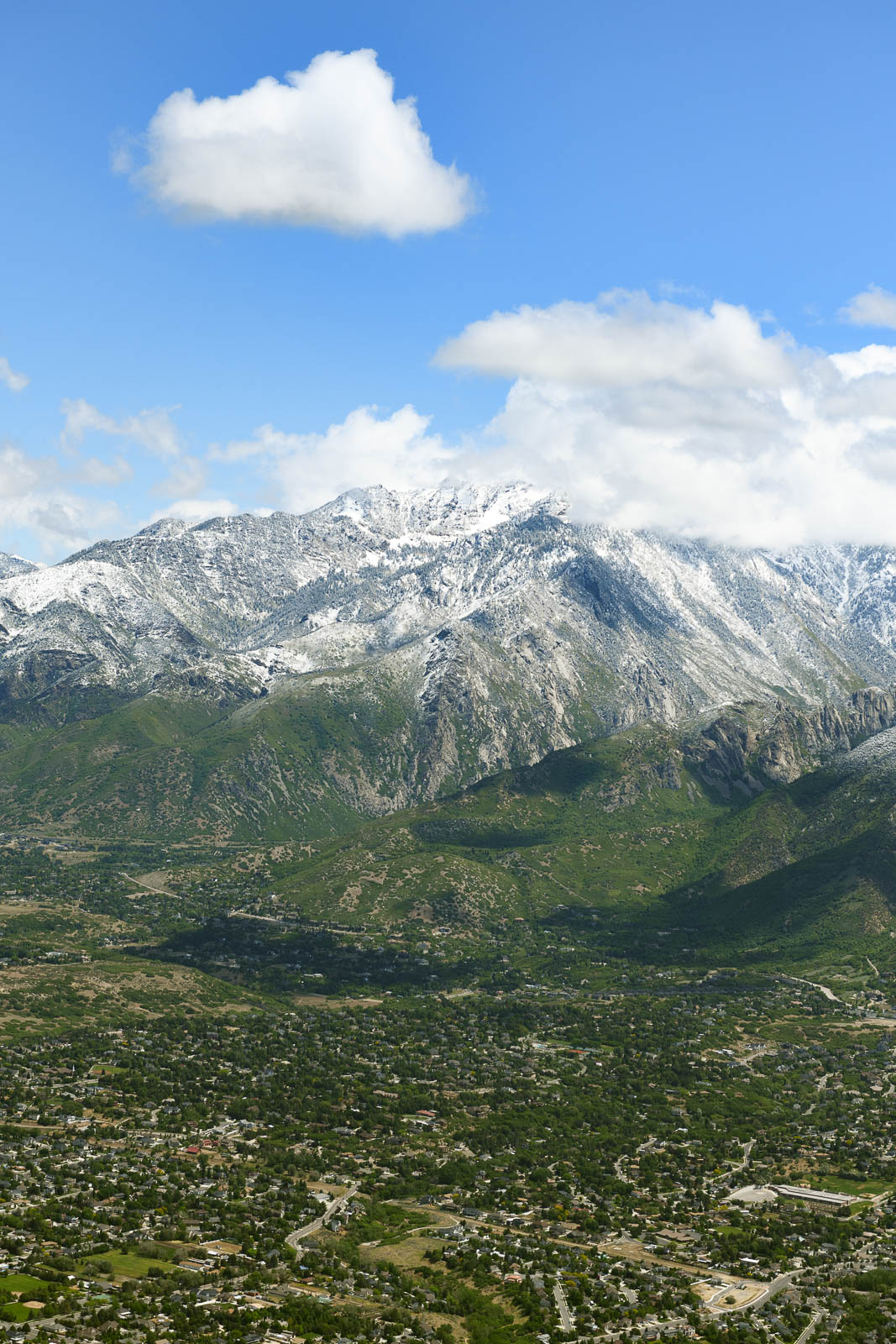
We took off from Bountiful and traversed through Salt Lake’s Bravo airspace to the South. Giant, snow capped crests towered over us to our left—the Wasatch Mountain range. After the weather the night before, more snow sat atop the peaks. There was a distinct line of green and white—you could see where the temperature atop the mountains fell below freezing.
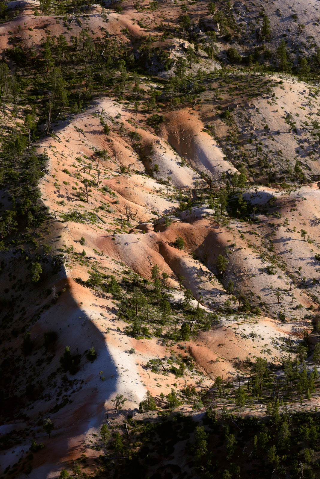
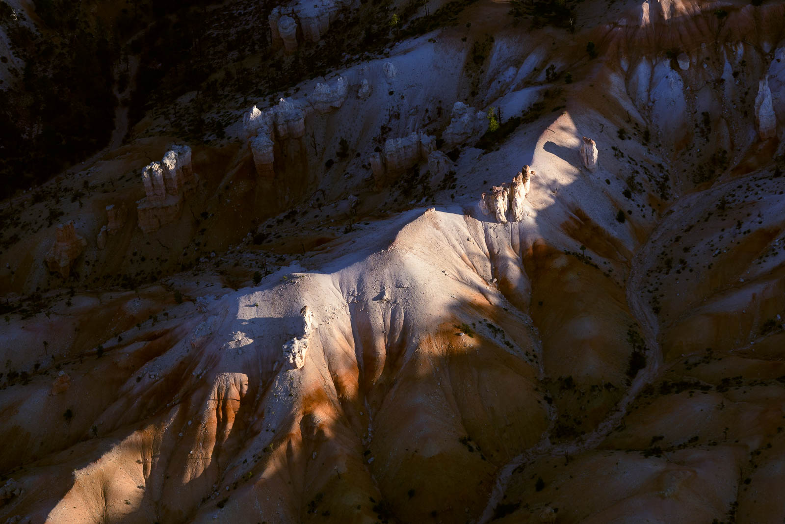
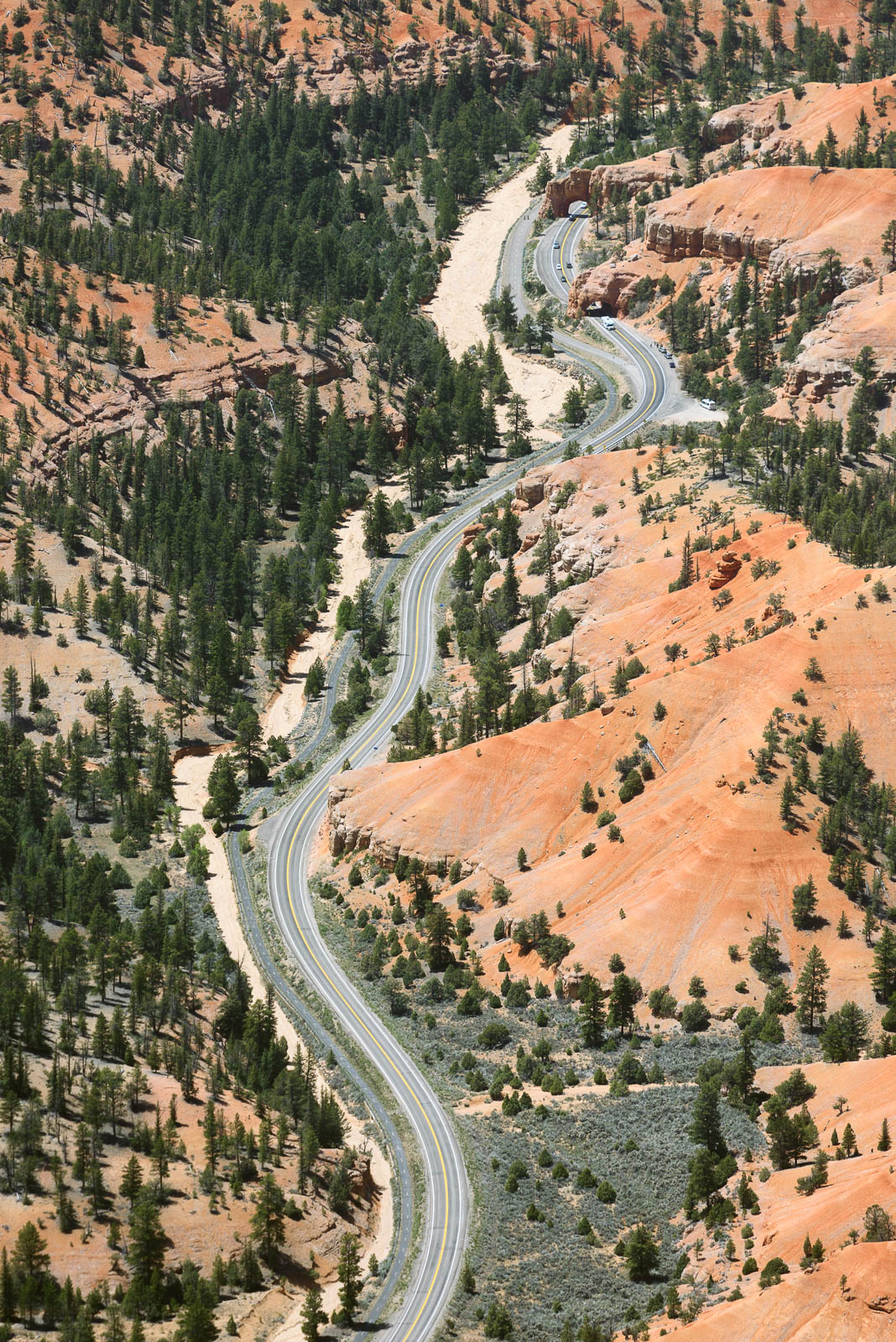
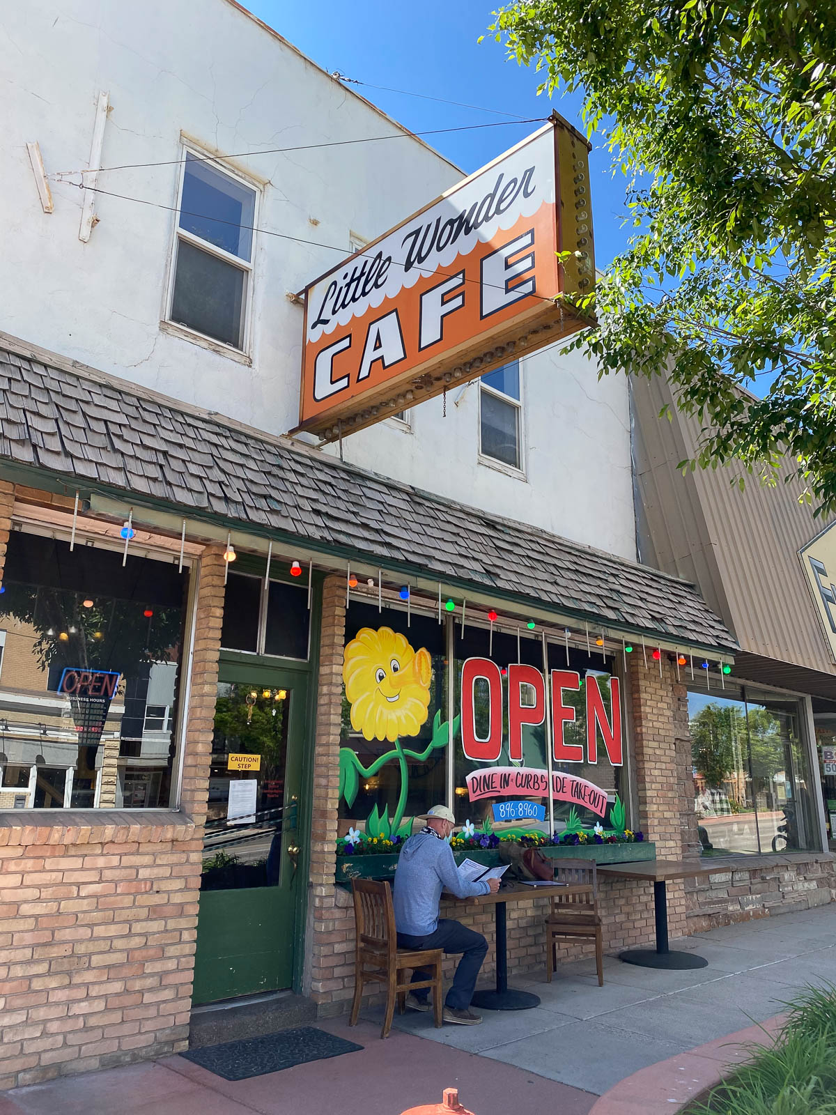
As we continued South, right around Provo, we hit some clouds that ranged from broken to overcast right at our altitude. After attempting to climb above them, and realizing they were too high, we descended below them, after checking to make sure the altitude of the terrain along our route and the cloud ceilings wouldn’t pose a problem for us. All clear, we pressed on to Bryce Canyon Airport, where we had plans to land and fuel and prepare for our sunset flying. Once we arrived there, however, we discovered the density altitude was close to 9,500 feet, and decided against such a precarious landing. After circling for some photos of red rocks, we back tracked to Richfield, a lovely little empty field with a couple crew cars, the keys casually tossed in a drawer at the FBO.
I chose the Ford, and took it for a bit of a joyride, then headed into town to grab lunch from a little local Richfield cafe, “Little Wonder.” After enjoying some of Utah’s finest, we headed back to the airport to wait for the light, then hopped in the plane to head to Zion.
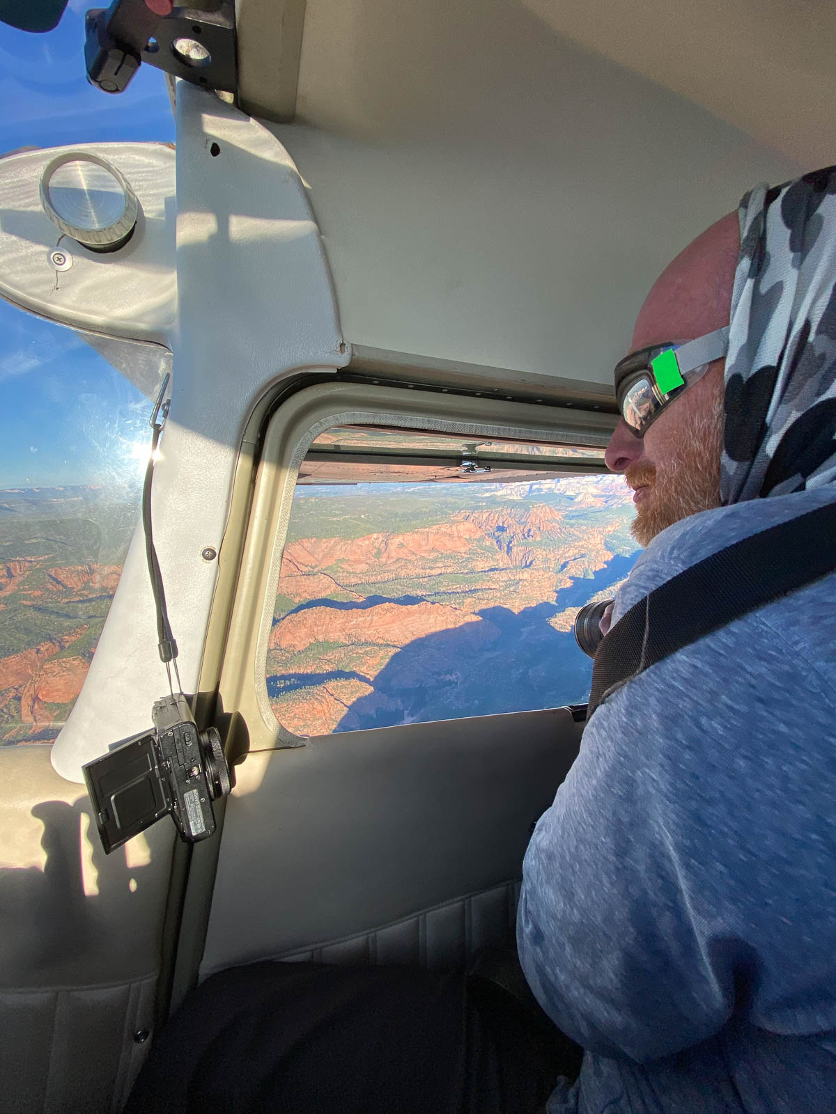
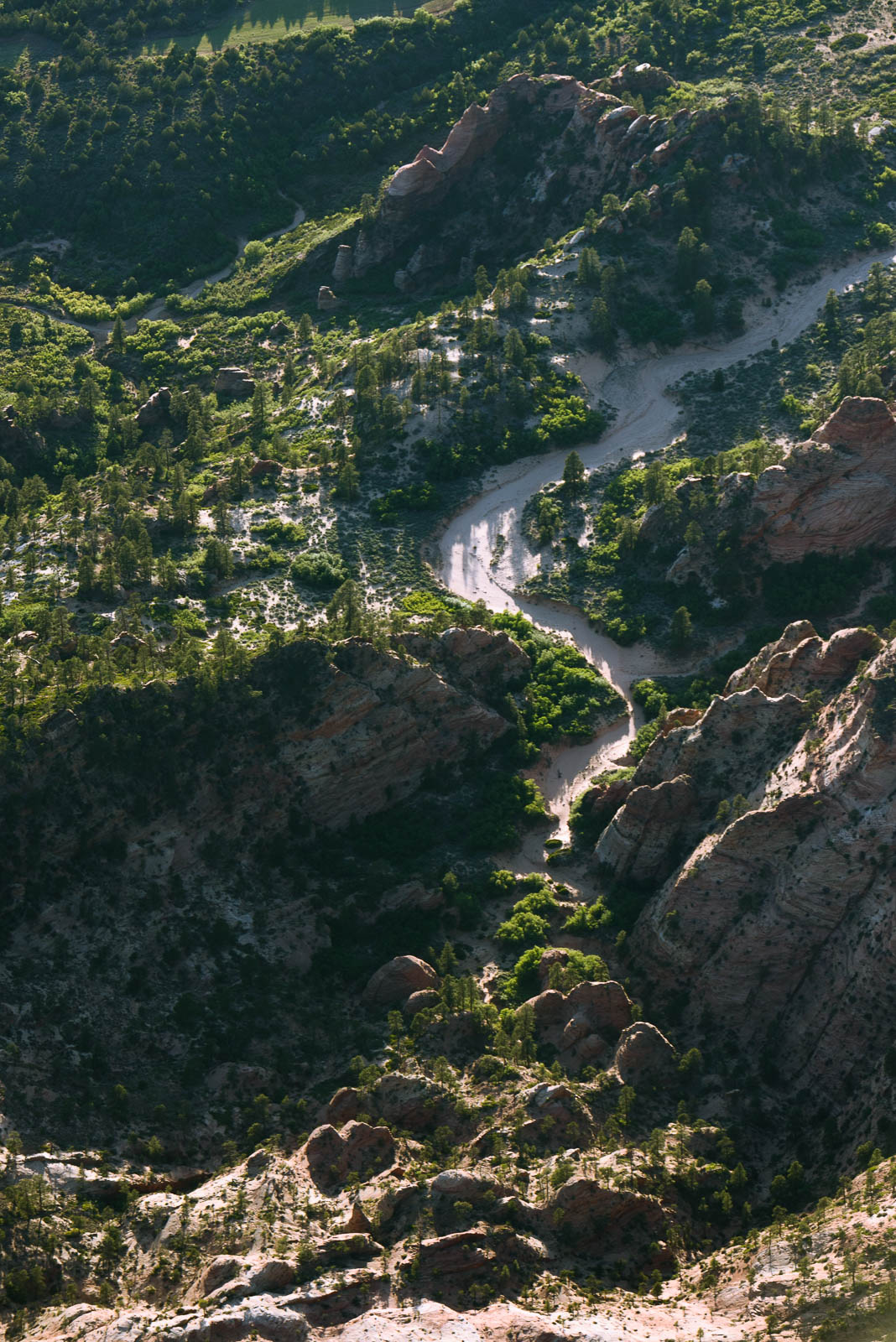
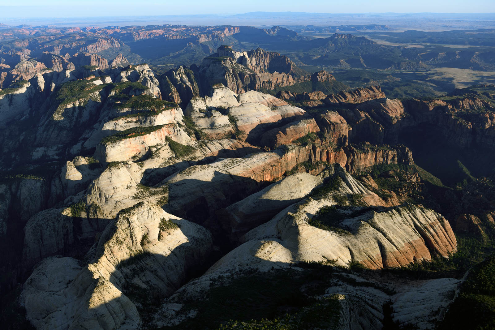
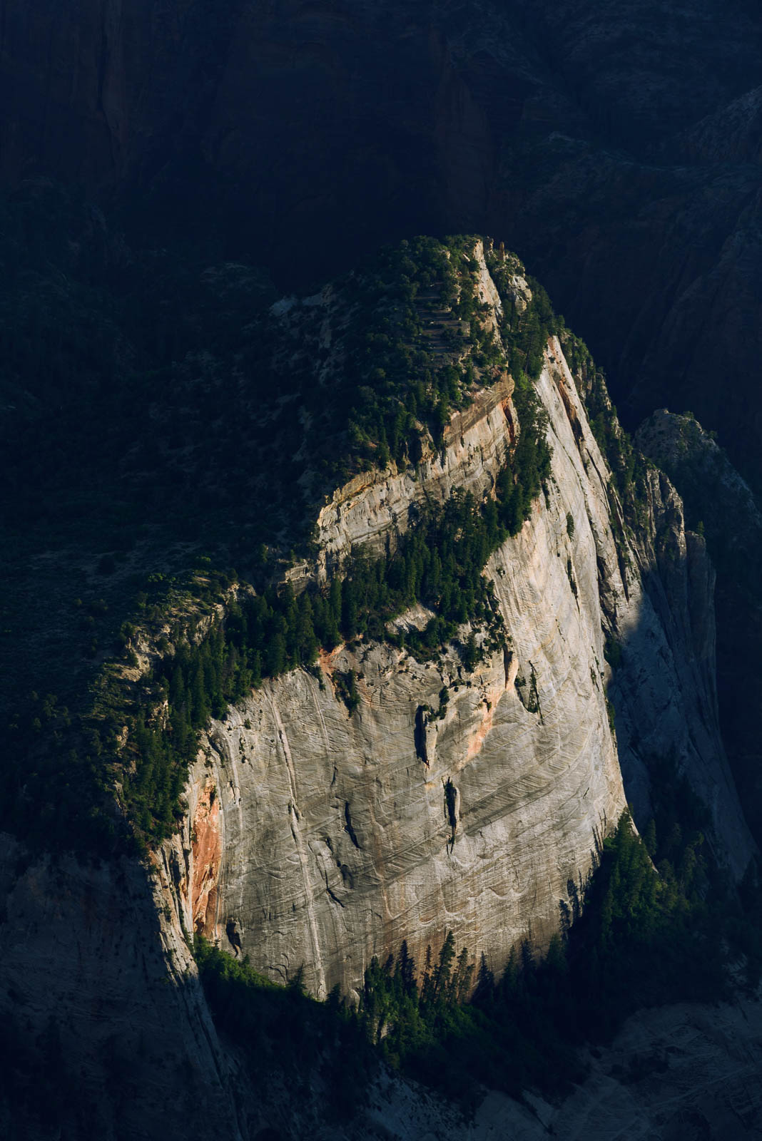
It was absolutely incredible descending into Zion, the red rock cavernous formations bursting out of the Earth with a stoic ferocity. The sun was sinking lower into the sky, casting a golden hue over the land and making flying above such a place feel magical and sacred.
After about 45 min circling above, we wrapped up shooting, and with freezing hands climbed to altitude to head home. We landed just as the sun sank below the horizon. Another solid, beautiful day.


Flight Path
[sgpx gpx=/tracks/stratux/gslog_2020-05-23.gpx summary=1 uom=5 gheight=200]

Day 12 - Salt of the Earth
Thursday, May 21, 2020
Day 12
The night in the tent with a half inflated air mattress, soaked clothes from a karmically inspired, semi evil sprinkler system, and a train that passed by every hour on the hour wasn’t exactly restful, so when our alarms went off pre 5 am, there was a moment of pure dread. But we remembered where we were and what we were doing and got up, packed up, and took off into the rising sun.
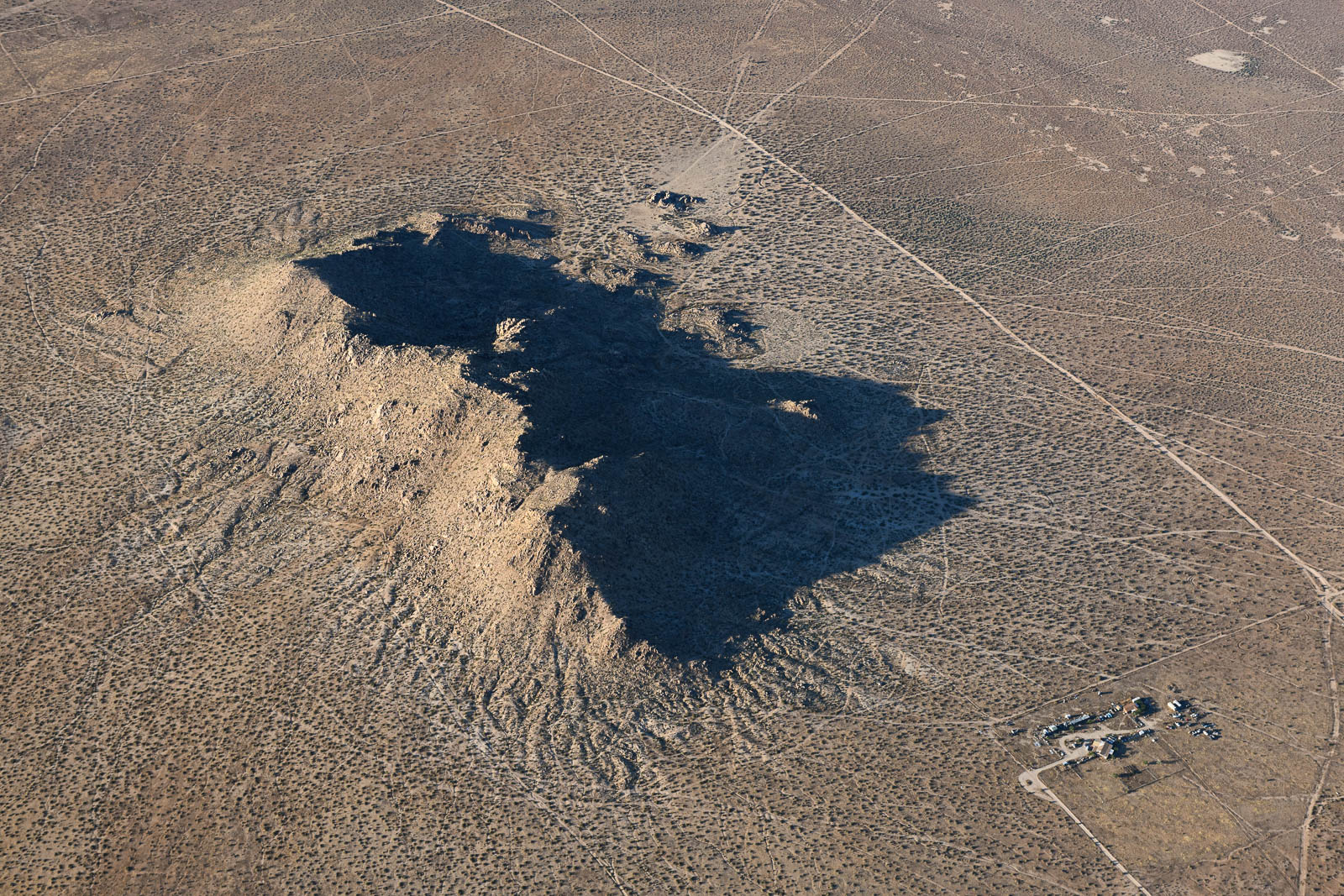
We had plotted a route through high peaks that took us through winding mountain passes and restricted flying areas and led us directly to the venerable Death Valley, in the northern Mojave Desert. The expansive desolate stretch of land was vast and intimidating and I descended into it with a sense of respect bordering on awe. The ground below us was actually below sea level. It is one of the least inhabitable places on Earth (I had insisted we pack more water for this stretch of the trip, just in case). I had some indescribable fun doing slow descending steep turns into the desert as Filip shot out the open window. Besides flying through Glen Canyon above Lake Powell, this flying took the cake for the most extreme and visually exciting to date. We even saw a crazy drone flying across the valley. We flew the valley northbound and then cut across the Spring Mountains, talking to Nellis approach, bypassing some military training flights, and landed at Northern Las Vegas for some fuel—both for us and the airplane.
We had lunch at the airport restaurant Tailwinds and Sunshine, which was filled with old flyers catching up with friends. Servers wore masks, but beyond that, very normal; the atmosphere was friendly and had a small town airport feeling, someone was celebrating a birthday, and they gave us all a slice of their cake to celebrate.
We finished lunch and some photo work, and went out, fueled up, and headed up for our next leg, a long, desolate, high altitude one with no possible fuel stops and lots of peaks and valleys to weave our way through. This kind of flying is still new to us in the Skyhawk, and it’s been an interesting challenge learning limitations, running performance numbers, and gauging energy based on wind, terrain, altitude, temperature, and weight. For example, getting out of Vegas required us to do a climbing 360 degree turn to gain altitude before pressing on to our routing, we simply weren’t climbing fast enough to get to our cruising altitude before steep terrain rose to meet us.
It was a beautiful leg winding our way North to Wendover, an old air force base with a lot of interesting old airplanes and a little museum. After we fueled there, we were stoked to see four military trainers barreling in—they taxied over and parked right in front of us in a line. Such formidable looking machines, they seemed extremely fun to fly.
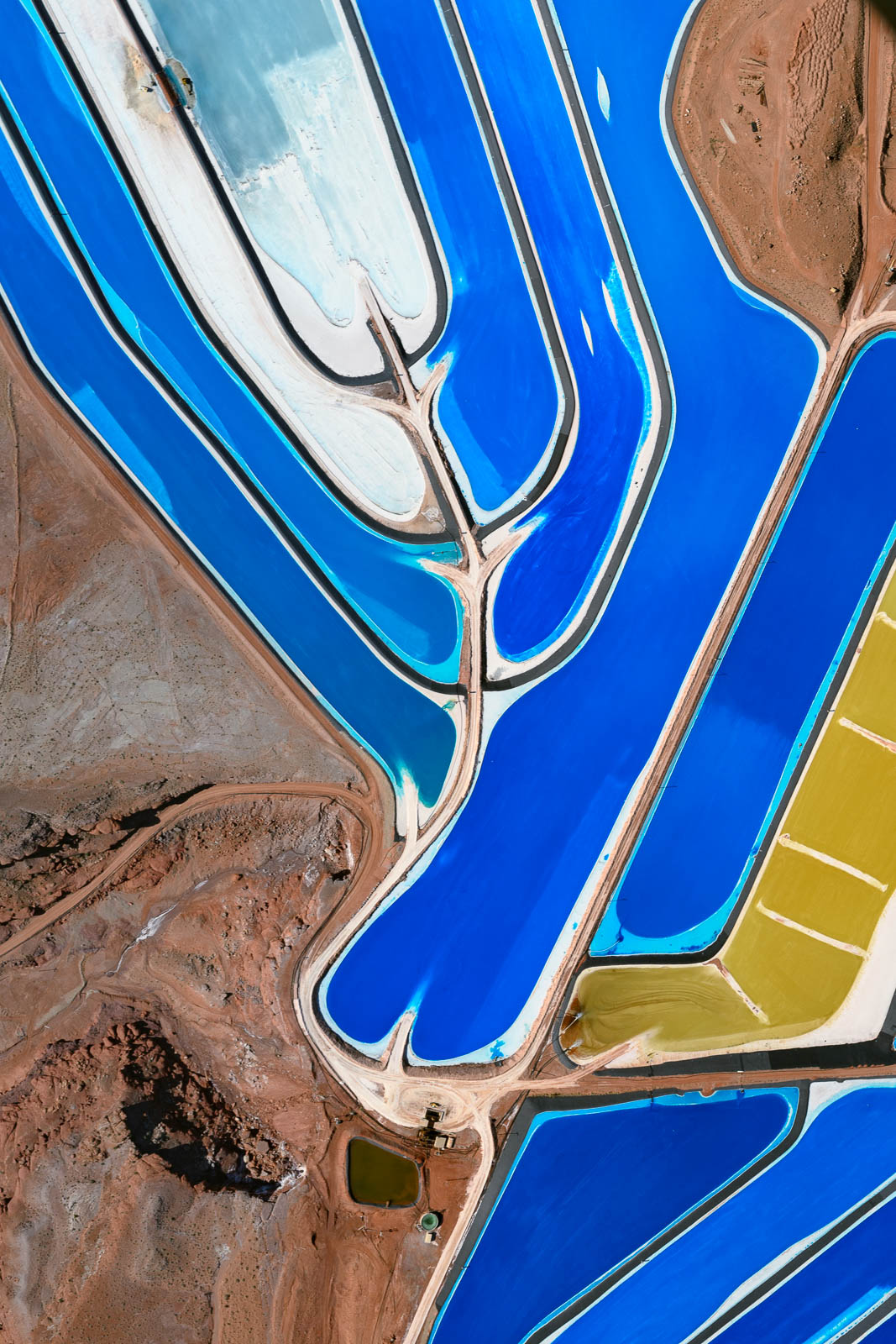
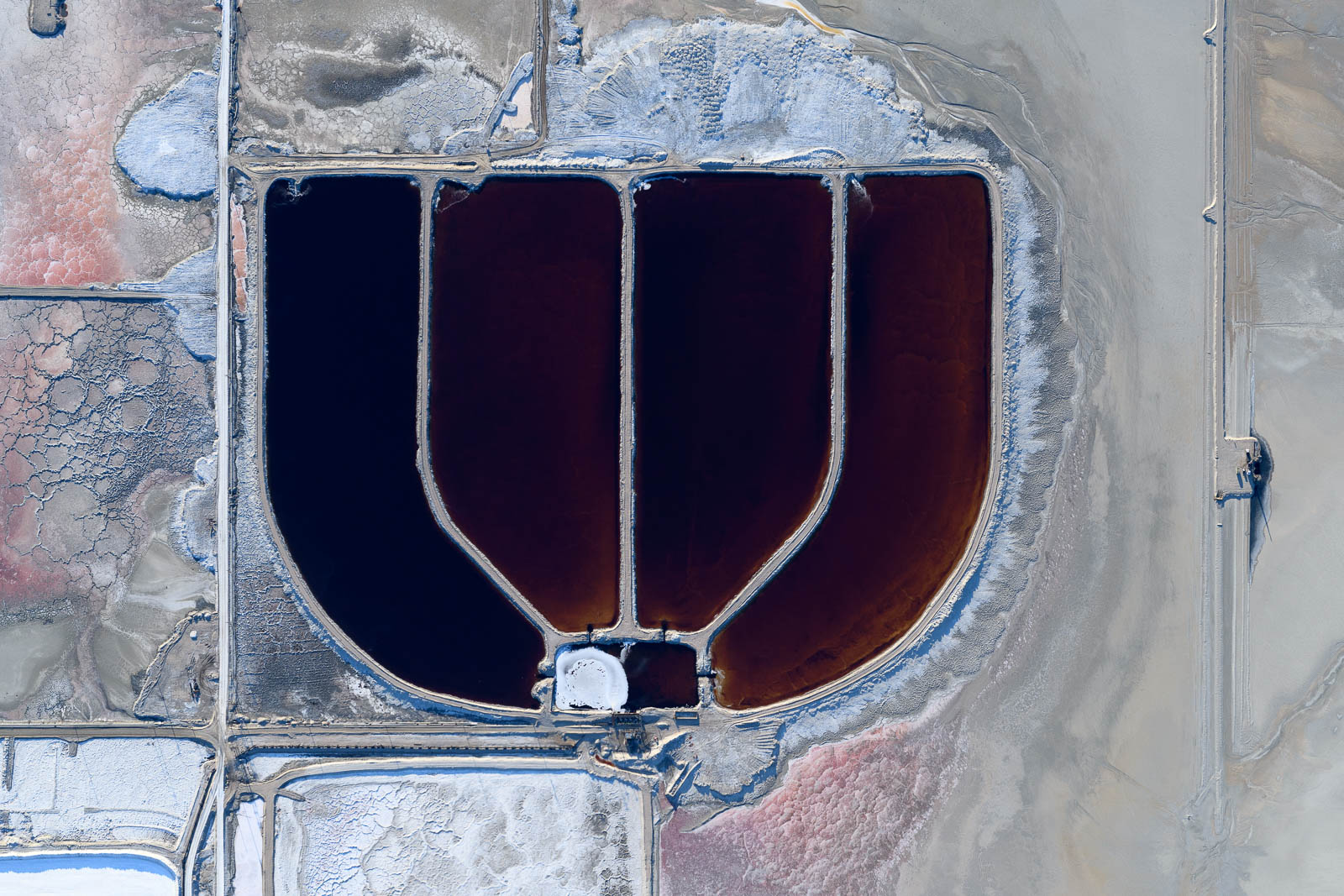
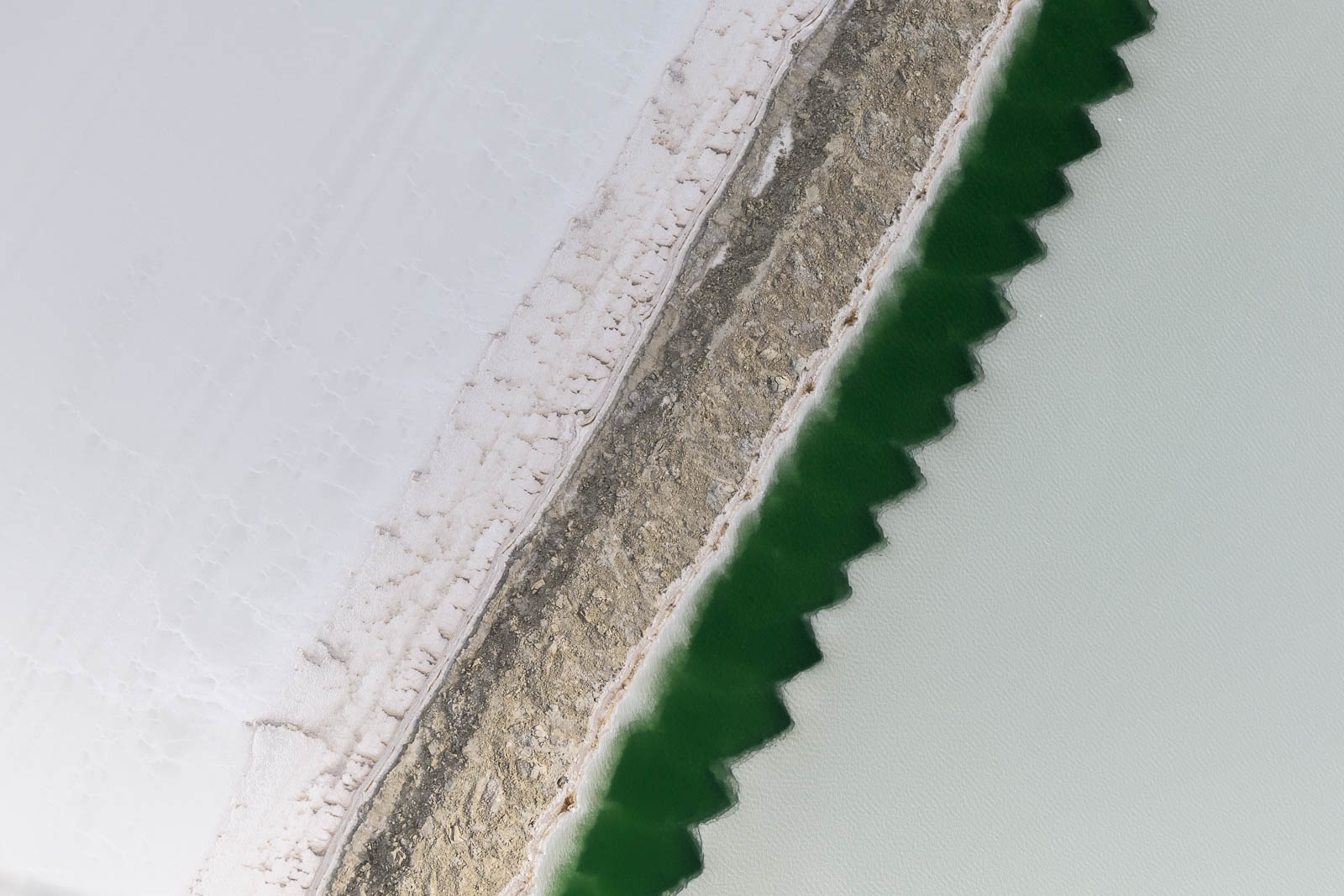
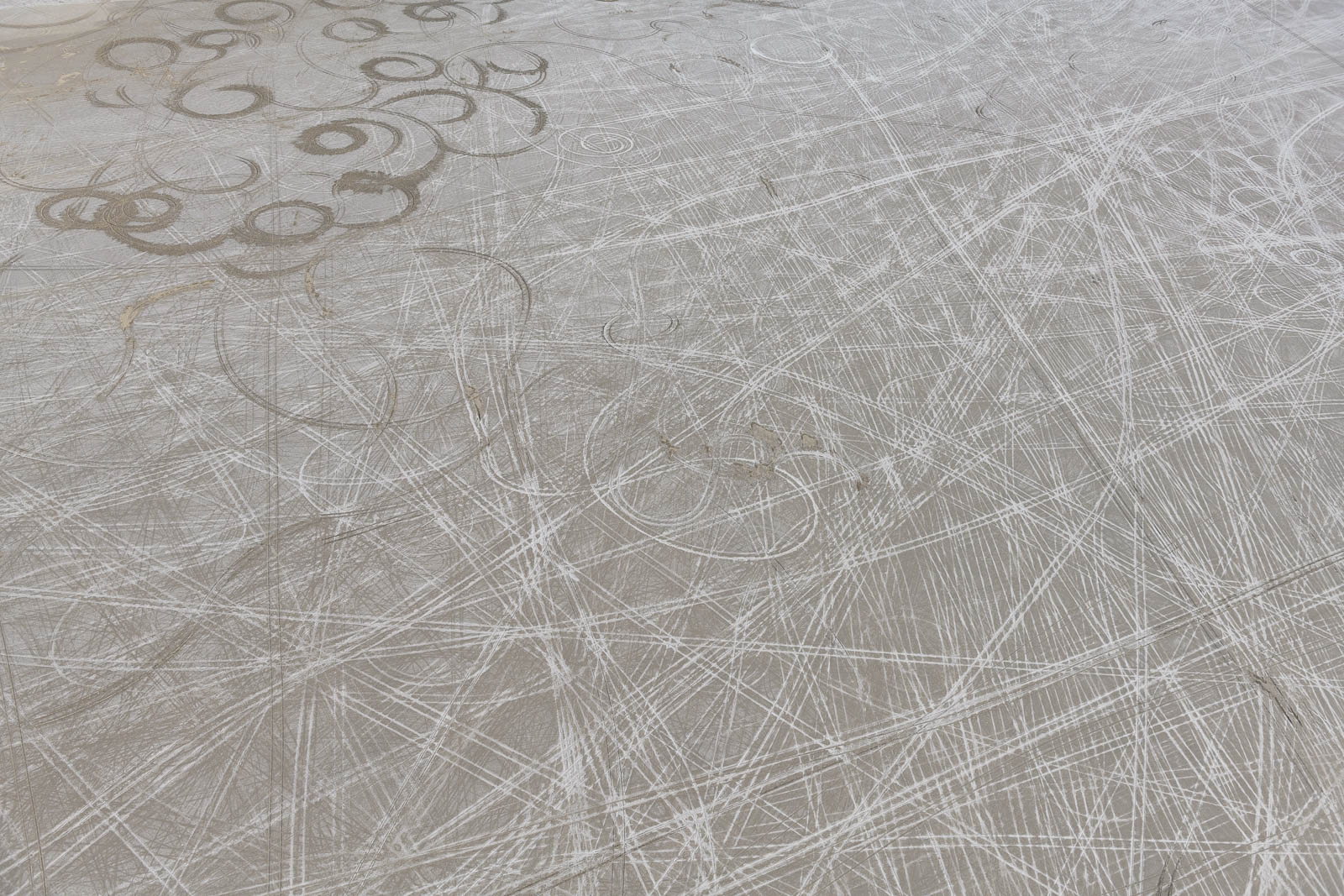
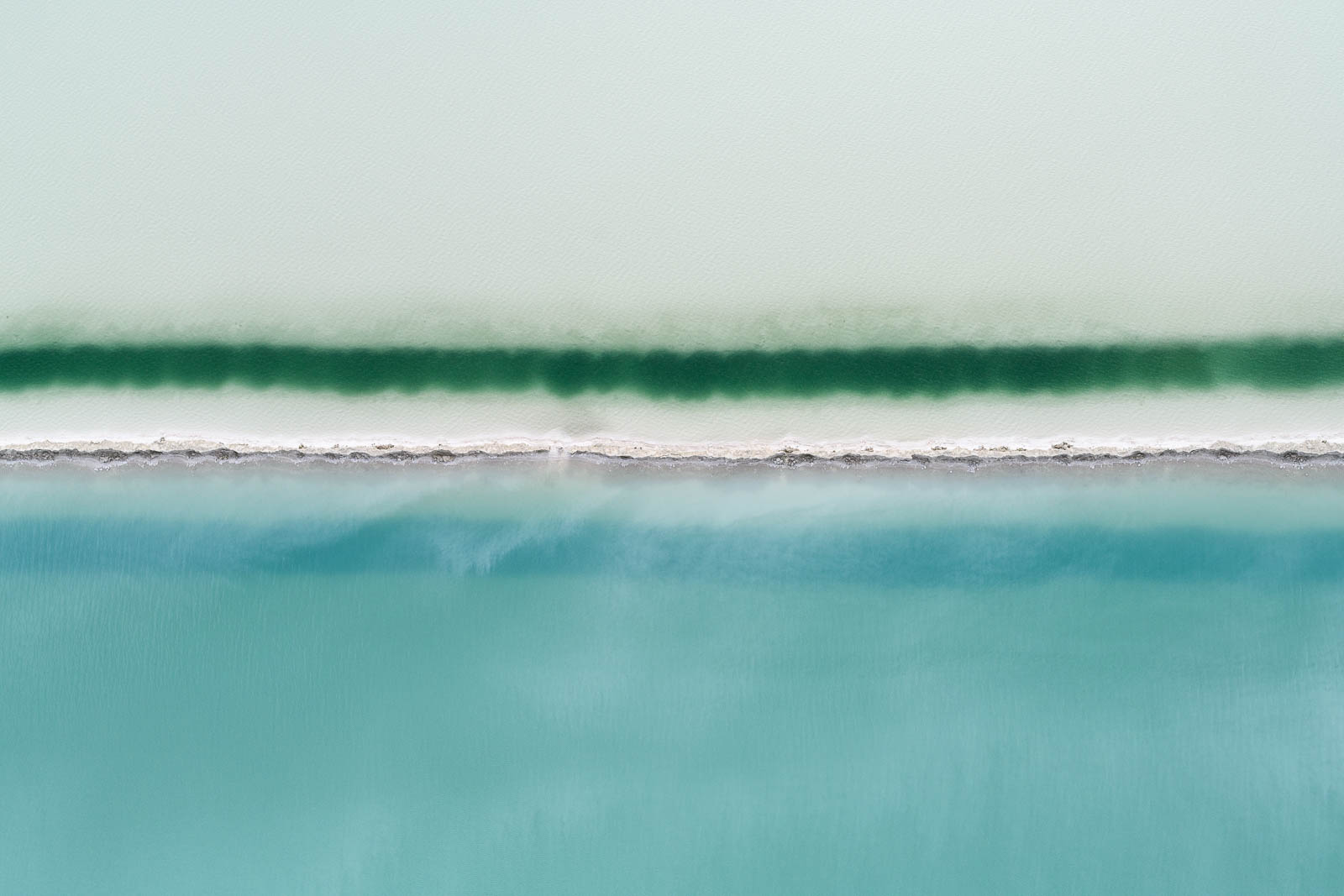
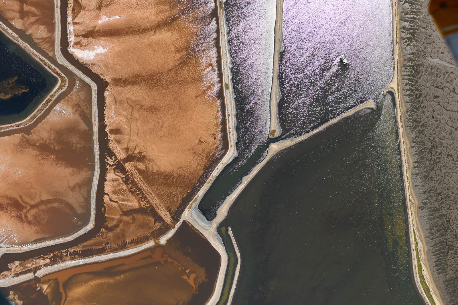
We taxied our mighty Skyhawk away from their impressive lineup to runway 26 and I took off to do some of my favorite flying of the trip—low and slow over the Boneville Salt Flats. This place has always fascinated me in photos I’ve seen, the color that the waters take on in the salt lakes are a turquoise blue like that of the Bahamas, and this paired with the white, salty earth—is there anything better? I had some fun staying super low over the pools and flats; circling as Filip took photos from the window. It was a Utopian alien tundra of a place, and getting to fly over it as we pleased was spectacular. We saw people out enjoying the day on the expansive white salt pan, they looked so small and isolated when placed in such an environment, we circled over them, observing them observing us.
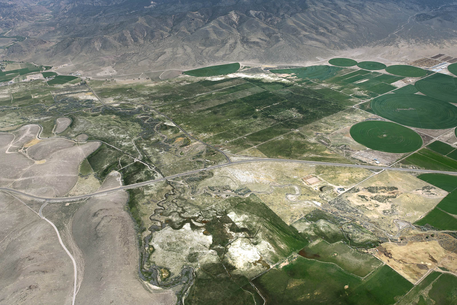
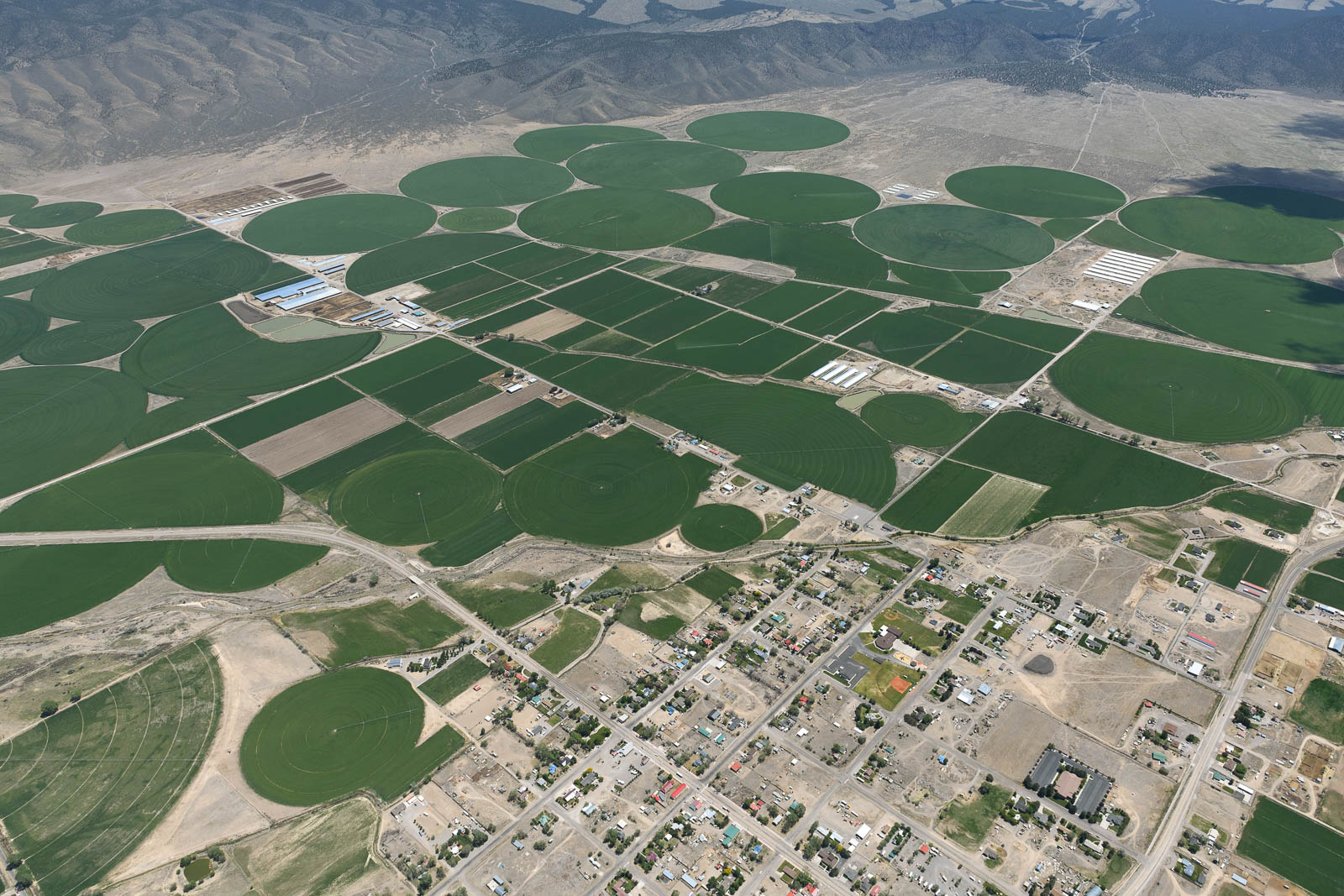
After some wonderful flying there, I pressed on to Salt Lake City where we would be spending the night in Bountiful, Utah. To my utter delight, though perhaps I could have guessed from the name, more salt lakes awaited for us there! I can feel an obsession growing. These shining colorful pools of water, gleaming and reflecting the sky, were incredible to fly over and photograph, every turn I made revealed more interesting beauty to see and shoot.
That rush of pure wonder really gave me the lift I needed to get me through the fatigue that had begun after a long day of nearly 9 hours of straight flying and a night with less than adequate sleep—the controllers at Salt Lake were super helpful in directing me through their I80 VFR transition to the field at Bountiful, and I landed softly on runway 35 as the sun set on another day.


Flight Path
[sgpx gpx=/tracks/stratux/gslog_2020-05-21.gpx summary=1 uom=5 gheight=200]
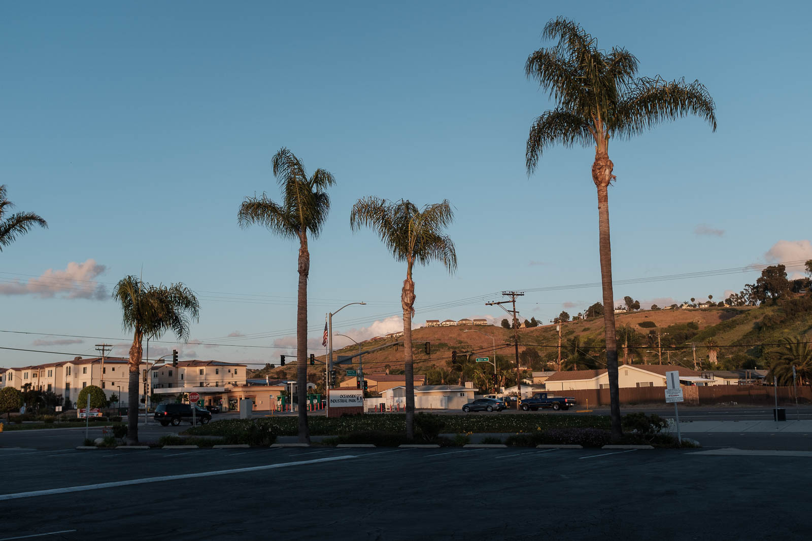
Day 11 – Welcome to Mexico (well, almost)
Wednesday, May 20, 2020
Day 11
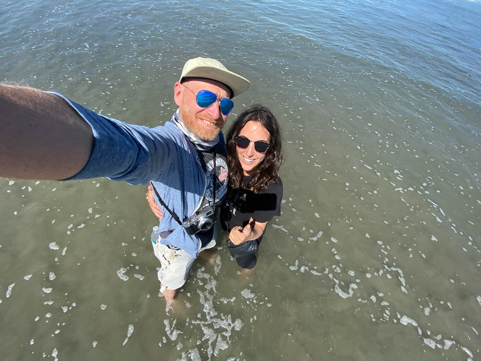
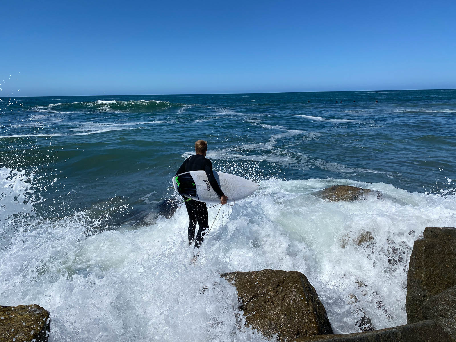
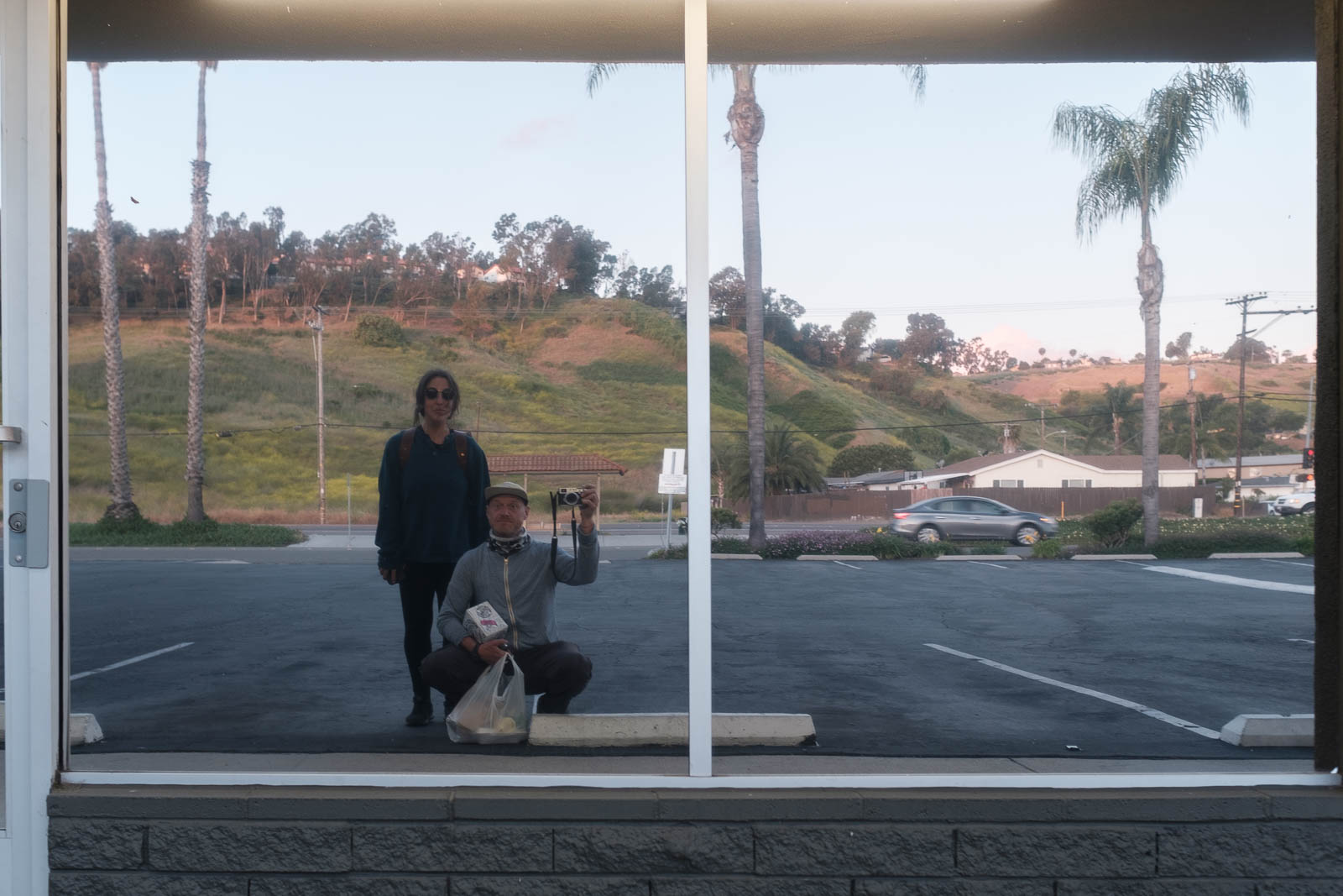
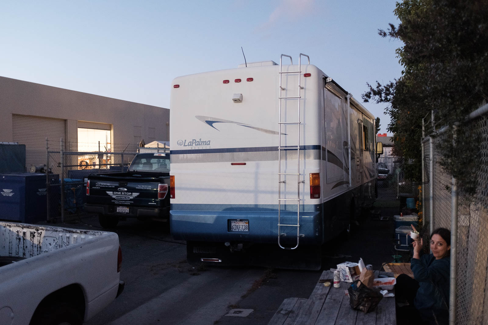
Waking up in Rick’s camper was utterly fantastic, we slept so well, and woke up in Oceanside refreshed and happy to be on the water. We decided to spend the morning on the beach—despite the strange beach rules we’d overheard such as people were only allowed to walk on the wet sand, not the dry sand—and Kelly from One Stop graciously drove us over there. It was pretty empty, and so good hanging on the Pacific, meeting surfers, climbing on jetties, getting drenched in the waves, and seriously celebrating officially making it coast to coast. So damn good for the soul.
On our way out here, the return leg we’d planned was always through the south over El Paso, to photograph the desert and the border. However, some new inspiration came in the form of recommendations from pilots Greg Brown and Laurel Lippert, who inspired us to look to the central route home. This would take us further North and through the mountains again, passing over places like Death Valley, Vegas, Red Rocks, the Boneville Salt Flats, and more incredible geography we’d only dreamed of seeing.
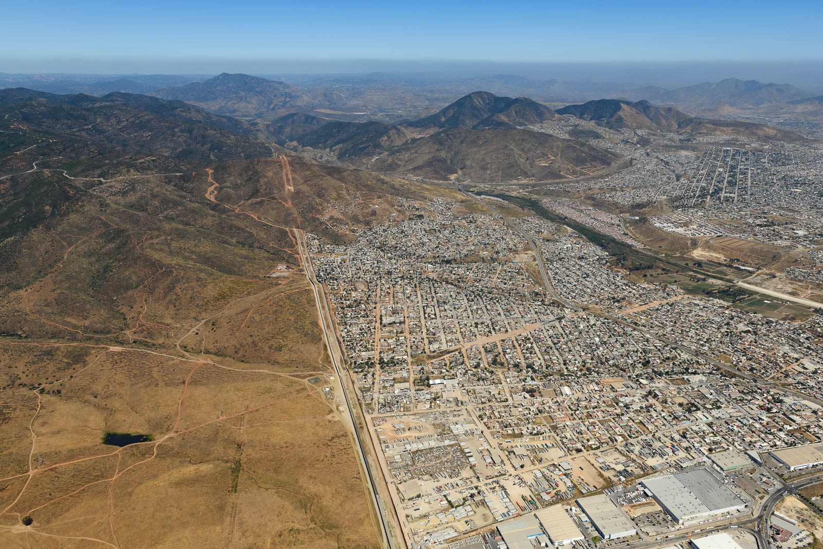
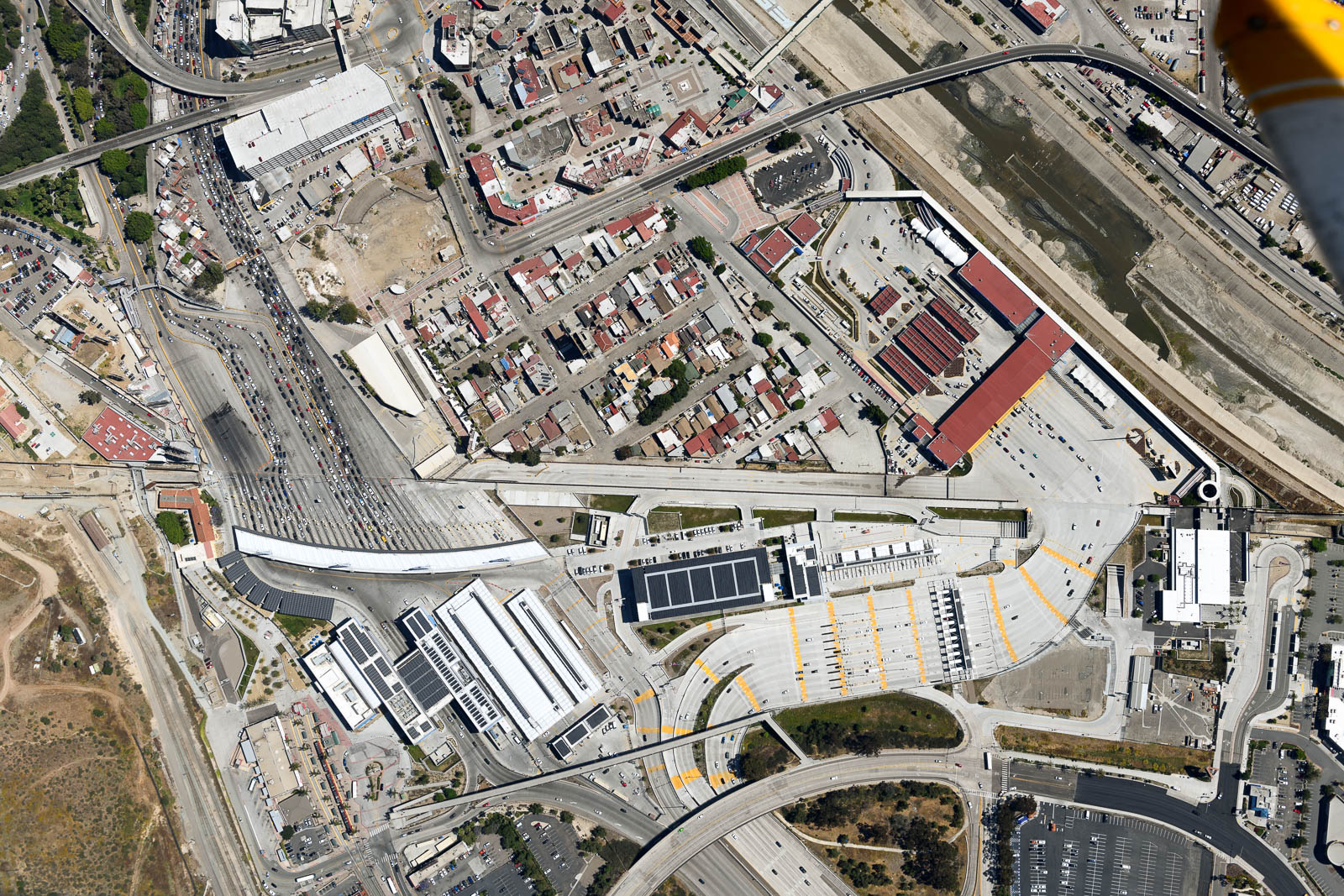
After some thought, we decided this route was the way to go, and we headed back to the shop to do some new preliminary route planning. After deciding to camp on the field at Kern Valley that night, and determining a basic route for the next few days, we bid farewell to Keith, David, Kelly, Rick and the guys at the shop and headed to the airport. We had some exciting plans that afternoon. Before departing for the North, we were heading South, through San Diego’s Bravo airspace, to the border of the USA and Mexico. We’d called customs and the tower at Tijuana, and determined we couldn’t actually cross into Mexican airspace to photograph the border, but we could come damn near close. So we headed on down the coast through a surprisingly busy Bravo (the ATC controller was amazing, hope she sees this, she was a machine) and down below Brown airfield, where we alerted them to what we were doing. They gave us permission to circle south of their runways, and a couple stern warning to stay on the American side as I circled closer and closer to Mexico, my wingtips brushing up against the invisible line in the air. The border was pretty spectacular, there was a striking visual change immediately upon crossing into Tijuana, and a wall that stretched into the sea. Kind of crazy to see something that gets so much air time in person.
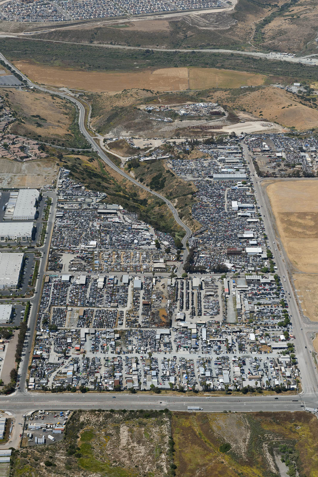
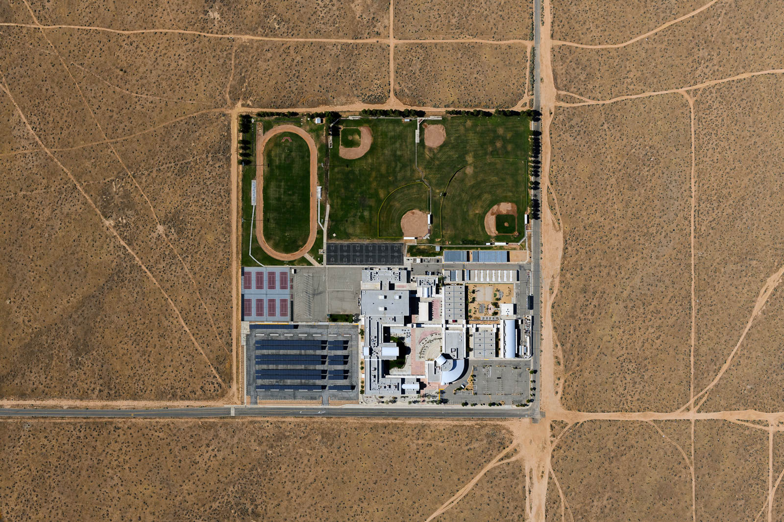
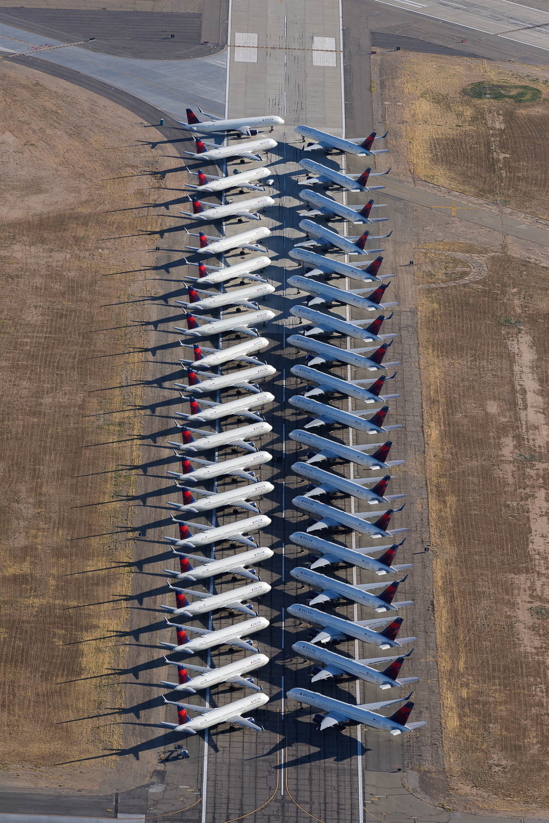
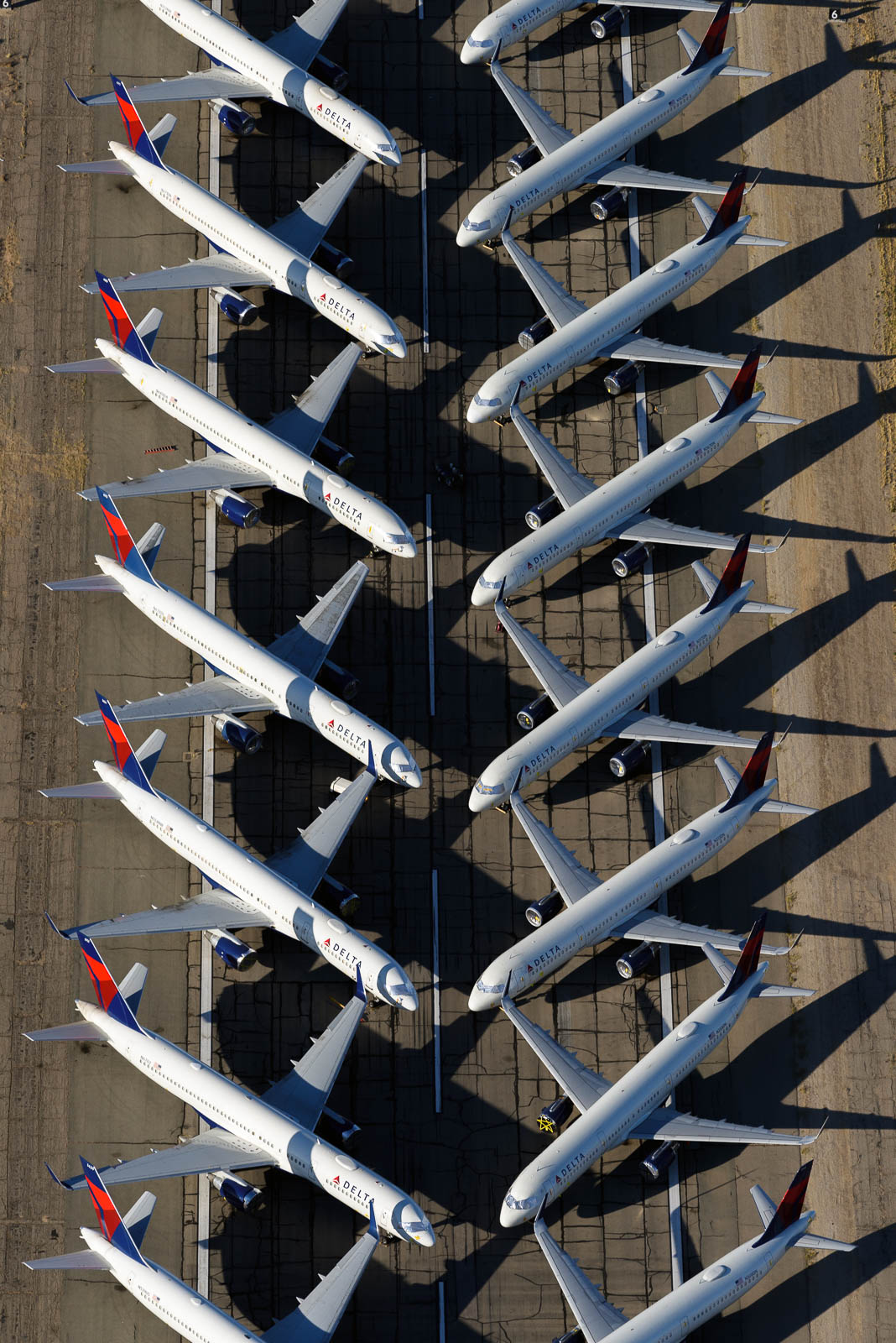
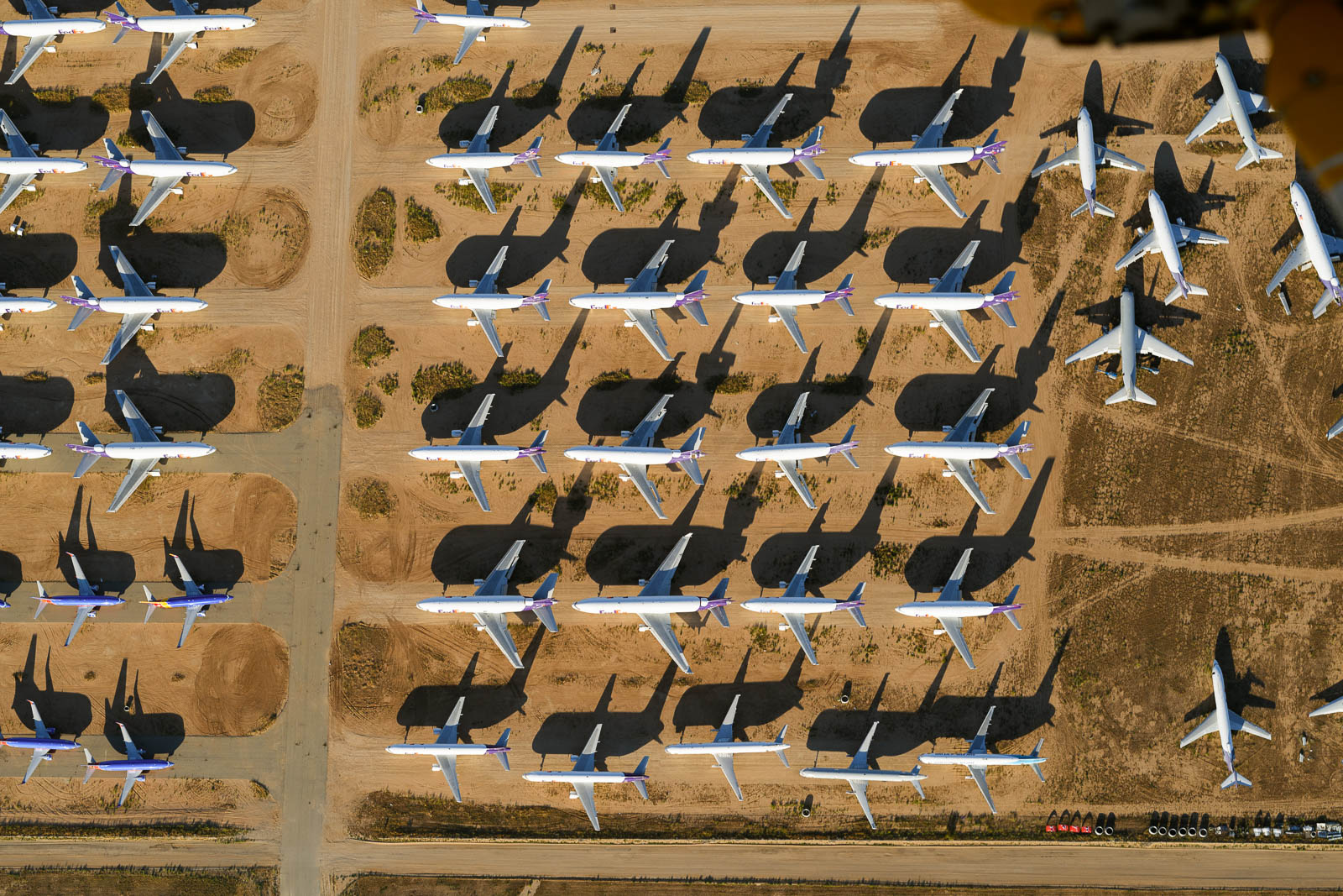
After we finished with this, we headed North to KVCV, an airport with another airplane storage and boneyard. It was lovely until another plane approached to do the same thing at the same altitude. I told the tower I was descending by 500 feet, but still felt slightly sketched out by this Cherokee who was clearly not holding their altitude, so we departed after we’d snagged the shots and pressed on to home at the base of the Sierra Nevadas.
The winds picked up pretty heftily, and after we landed at our last fuel stop for the night, Tehachapi, we realized that Kern Valley’s short runway without weather reporting in a valley with large mountains around it, was not the best plan. Happily, there was randomly airport camping on the field at Tehachapi. Sadly, it was shuttered due to Covid. The sun was sinking below the horizon and winds were building so we decided to chance it, and quietly and minimally set up our tent in the furthest campsite from the ramp to be inconspicuous. Immediate karma! The sprinklers came on an hour later. Drenched and screaming, we tried to cover up the worst of the sprays and save any non waterproof items around.
Only marginally successful at that, we passed out early, for a 4 am wake up to hit the sky for sunrise.


Flight Path
[sgpx gpx=/tracks/stratux/gslog_2020-05-20.gpx summary=1 uom=5 gheight=200]
Day 10 – Rusty over LA
Tuesday, May 19, 2020
Day 10
We slept in a bit in Ramona, and one of the guys from the airport was kind enough to swing by in his truck and give us a ride back to the plane. The day prior, we’d noticed a burning smell as we were navigating the low clouds on the coast and had discovered the landing light wire bracket had snapped and the wire was melting in the heat of the number 2 cylinder—so the days plans included fixing that.
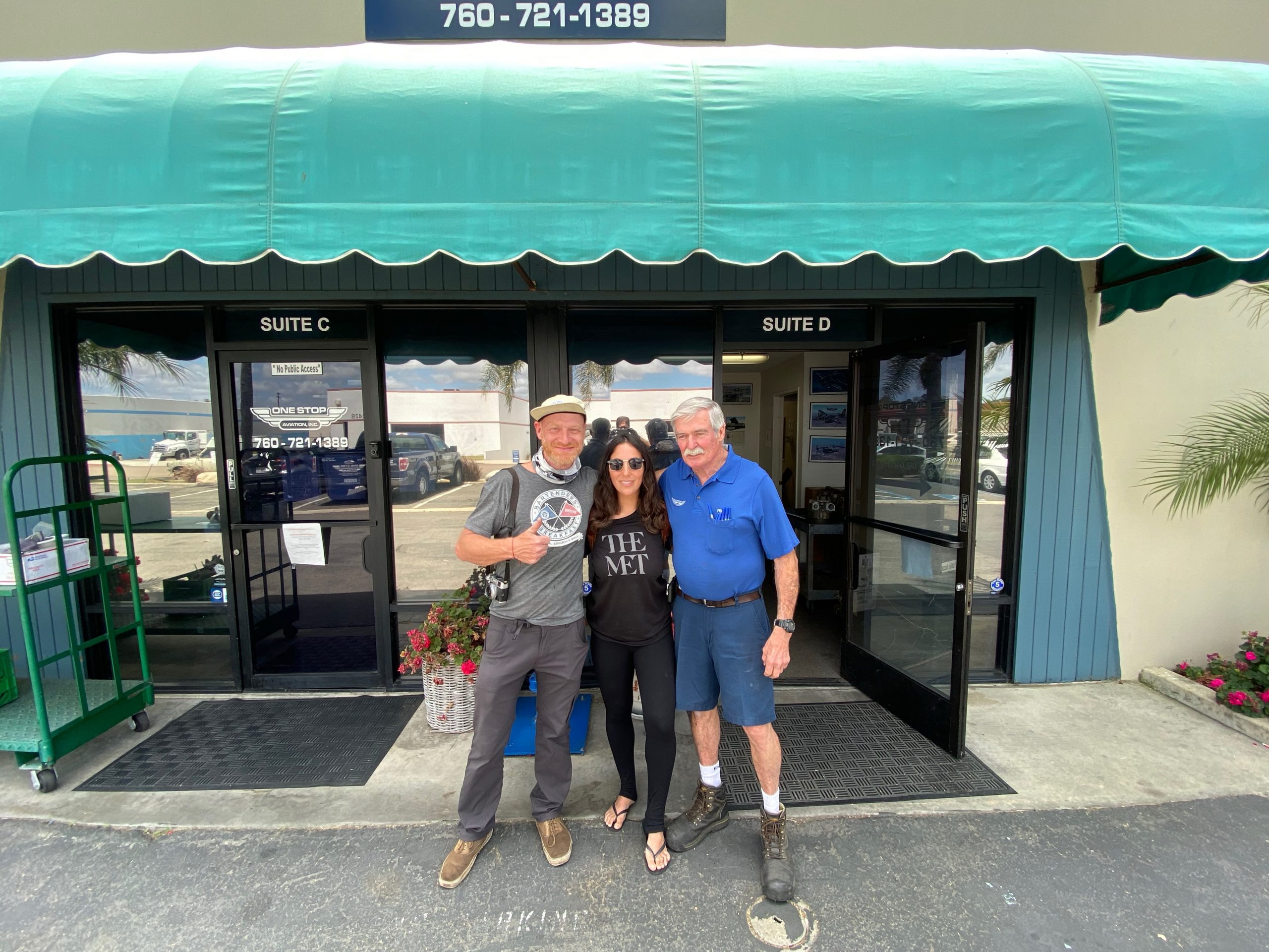
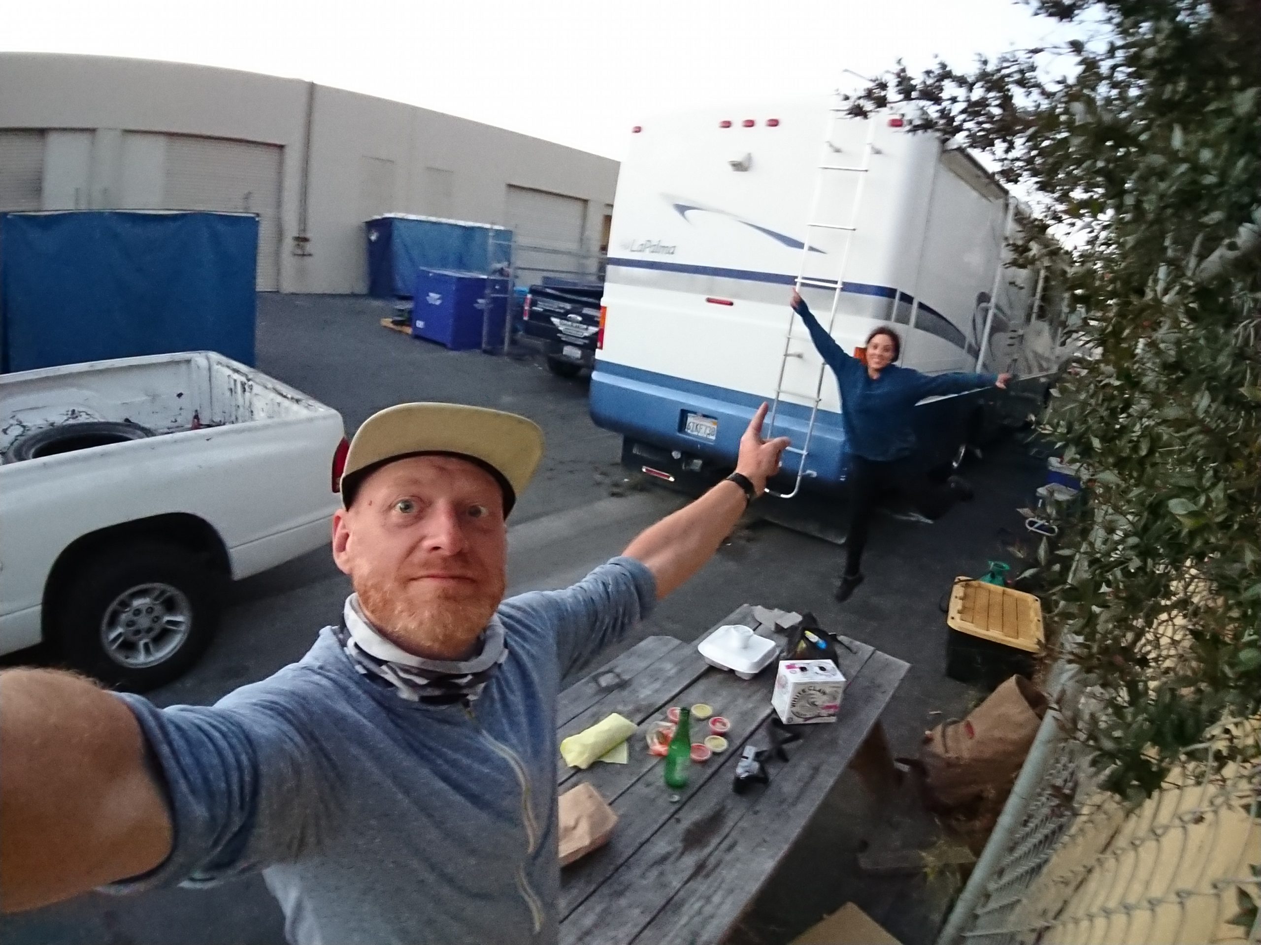
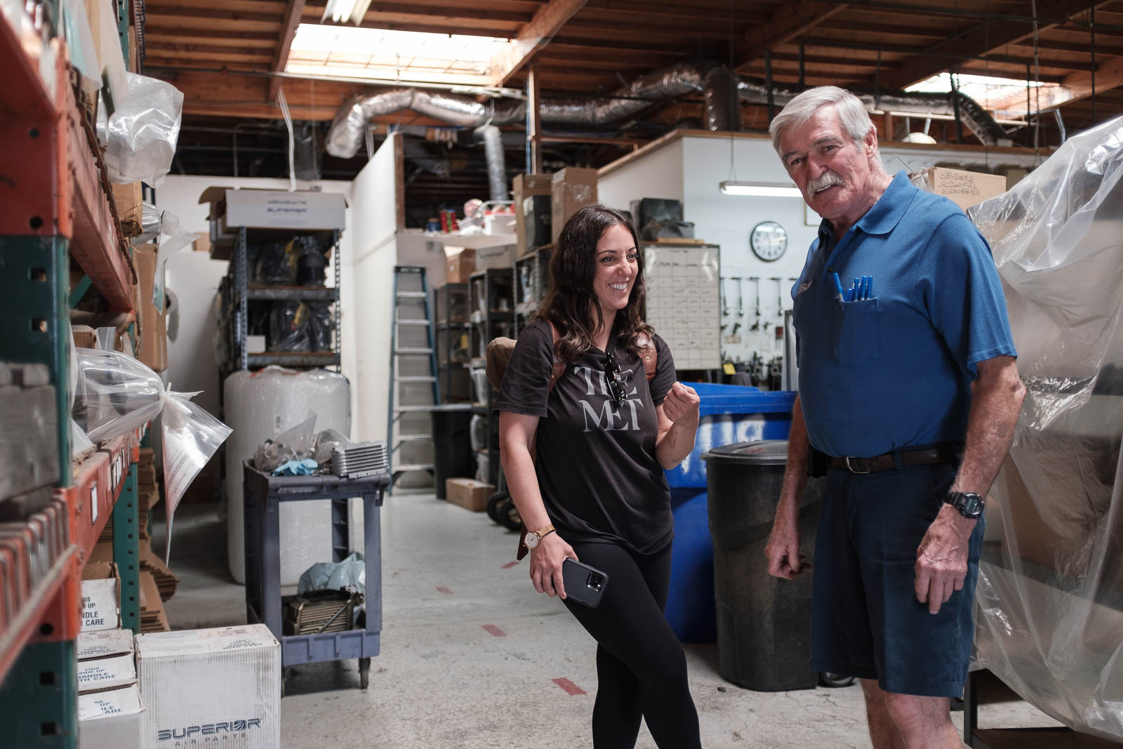
We fueled minimally in Ramona and then made the short hop to Oceanside on the coast, a far less eventful flight the day before. There we met with some great guys from One Stop Aviation, who brought us over to their main workshop, where we got to meet Rick, the owner, who had overhauled Rusty’s engine a month prior! It was really fascinating to tour the shop with him and see all the work and gear it takes to work on these engines, he had Lycomings and Continentals from all across the world in various stages of repair. We told him a little about our trip and he offered to let us stay in his camper behind the shop—so kind. We accepted, and headed back to the airport to do some repairs and get flying.
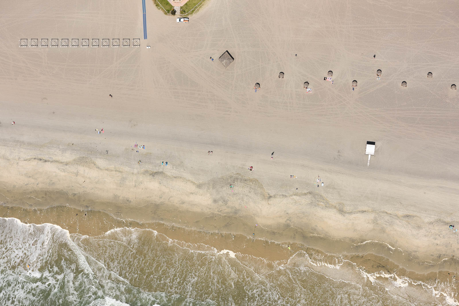
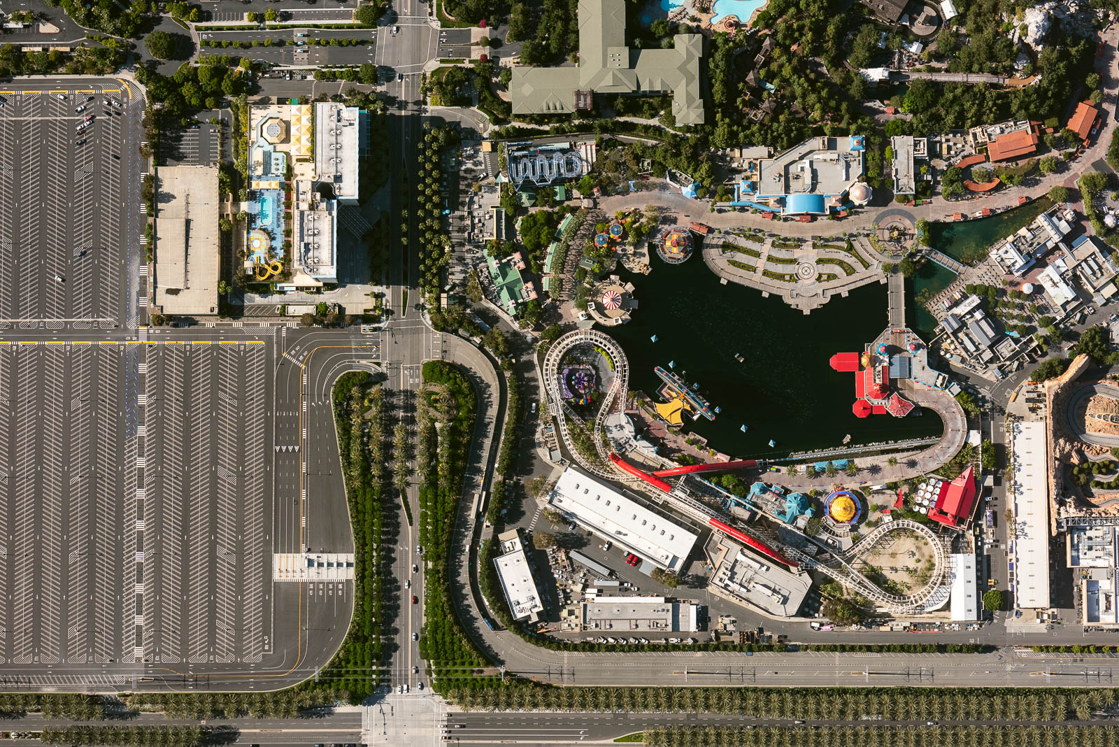
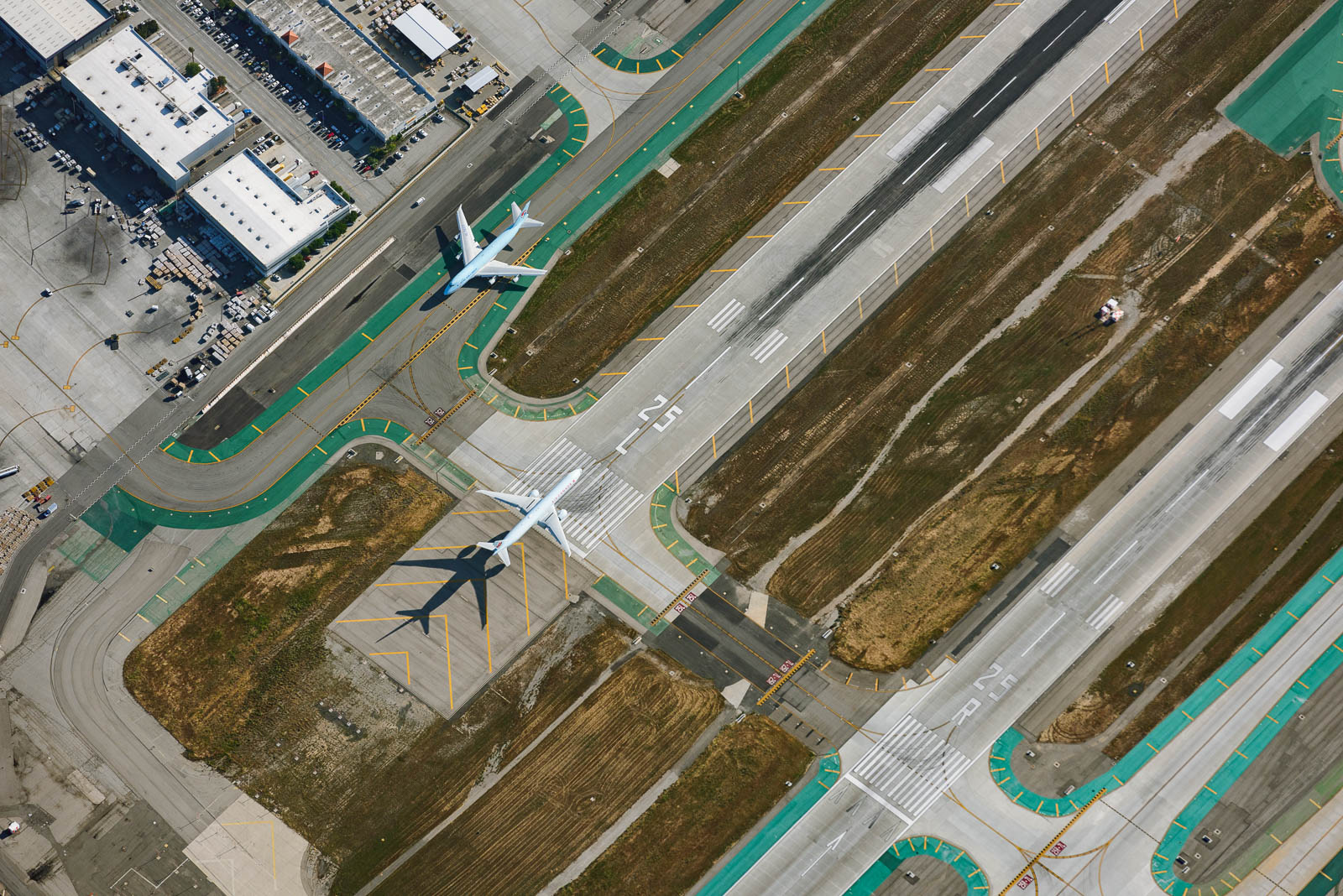
After some work, the plane was good as new and we took to the sky. Today our plans included photographing LAX at 10,000 feet above the Bravo airspace, where we wouldn’t have to talk to ATC and could circle and shoot to our heart’s content. We also circled low over empty beaches and Disneyland, with bare empty parking lots as far as the eye could see. It was wild flying above places that were usually so populated, and it was surreal to be above LAX—besides seeing the ocean, that really hit home that we had officially made it coast to coast. The shooting was fantastic, circling high above that iconic field, and so, so cold—about 25 degrees Fahrenheit. There’s nothing like tossing open the windows at altitude to shoot in those temperatures like that to make you feel completely awake and alive.
After we circled for a bit shooting and freezing, we headed back south to land at Oceanside, descending out of the Bravo airspace. I was ecstatic to be flying low along the coast, over the ocean and palms. It’s my favorite thing in the world.
We were happy and tired when we landed and taxied behind our mechanics hangar to tie down before heading over with new friend Keith to the shop camper, grabbed some Mexican dinner, and passed out early. California suits us real well.


Flight Path
[sgpx gpx=/tracks/stratux/gslog_2020-05-19.gpx summary=1 uom=5 gheight=200]

Day 9 - California Dreams
Monday, May 18, 2020
Day 9
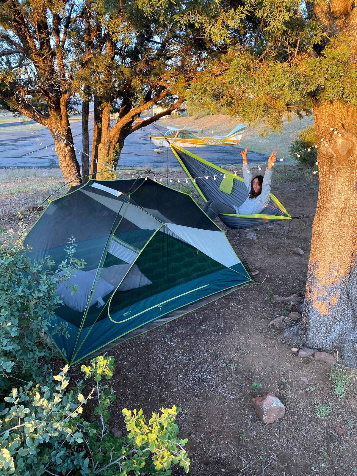
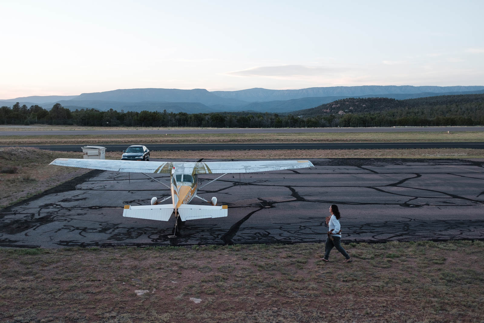
Waking up on the airfield campground in Payson was magical. We awoke with the sun, light spilling over the plane and our campsite. It was immensely satisfying, knowing that California was on the horizon.
We got ready and returned the little airport car we had been given for the night. We took a little too much fuel and were heavy for the higher elevation, so we made sure to increase our takeoff roll in order to gain speed to climb out effectively. We got off the ground and climbed high over the mountains, navigating by the Blythe VOR—our friend Tracy in Stamford TX had suggested this—which would take us through the Banning Pass to the coast.
We had desired to fly direct to Oceanside Airport, where the mechanic shop One Stop Aviation was located, as they had overhauled the Skyhawk’s engine a month before and we wanted to “meet the parents.” However, strong headwinds at altitude foiled this plan, and we stopped to take a little extra fuel at Borrego, a dusty desert field just before the final mountain stretch that would get us to the ocean.
We fueled and departed quickly, and climbed to cross the mountains ahead. The ceiling was steadily getting lower and the weather was becoming more and more marginal at our destination airport. We crossed the mountains and coastal California greeted us with fog and low visibility. Hooray! We decided to try for Oceanside anyways, as the weather was just on the edge, and headed there direct. The cloud ceiling was steadily dropping and hills and unfamiliar terrain was rising around us in every direction. We kept Ramona Airport in our minds as a deviation, and pressed on to try for Oceanside. My pirate heart leapt with joy at the first sight of the Pacific Ocean in the distance, but the weather became too unfriendly to make it into Oceanside, so I turned for Ramona and landed there.
A happy accident, for one of my best friends Dominique just so happens to live in Ramona! So we all shared a glorious socially distanced dinner and evening with her catching up and sharing stories. Great for the soul. California! We made it coast to coast!


Flight Path
[sgpx gpx=/tracks/stratux/gslog_2020-05-18.gpx summary=1 uom=5 gheight=200]

Day 8 – As Far as the Eye Can See
Sunday, May 17, 2020
Day 8
After a basically sleepless night in rather uncomfortable accommodations in Page, Arizona we awoke just before dawn and forced our sore, lifeless bodies to the plane. The world was awakening and the light was growing—it was time to take to the sky.
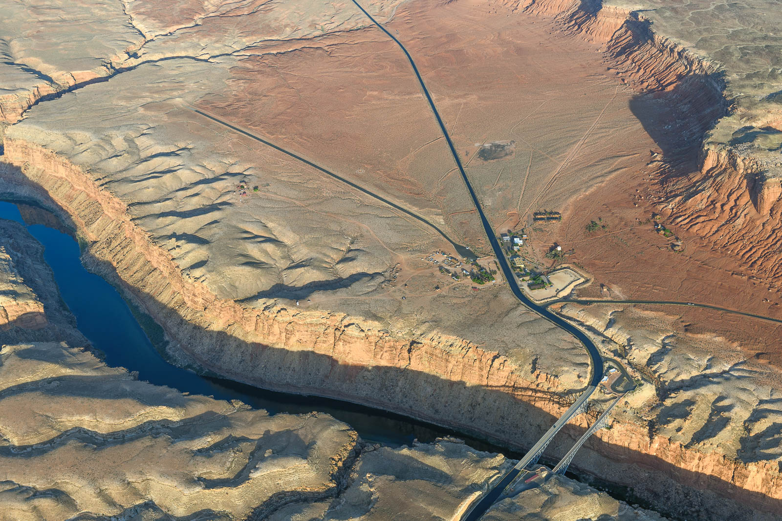
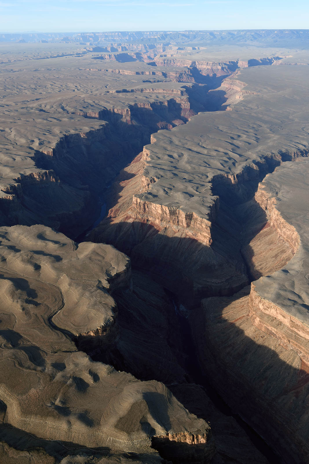
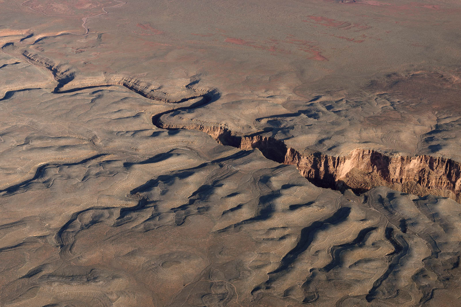
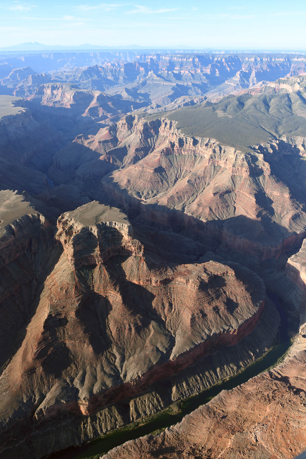
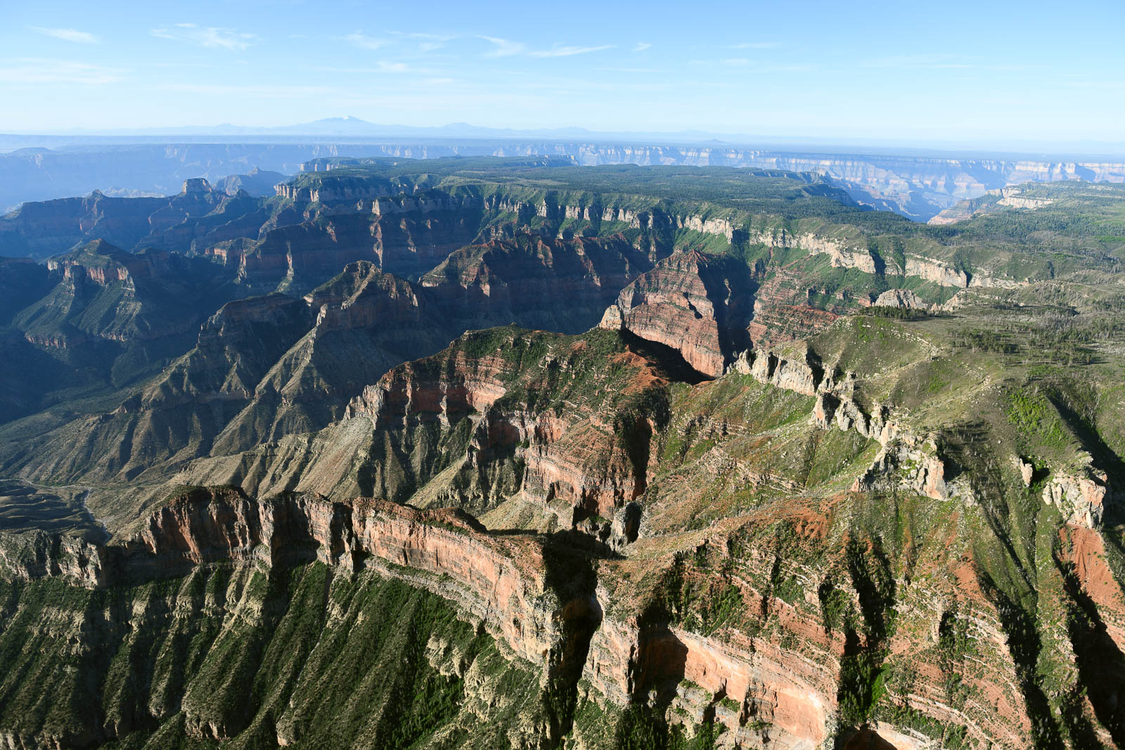
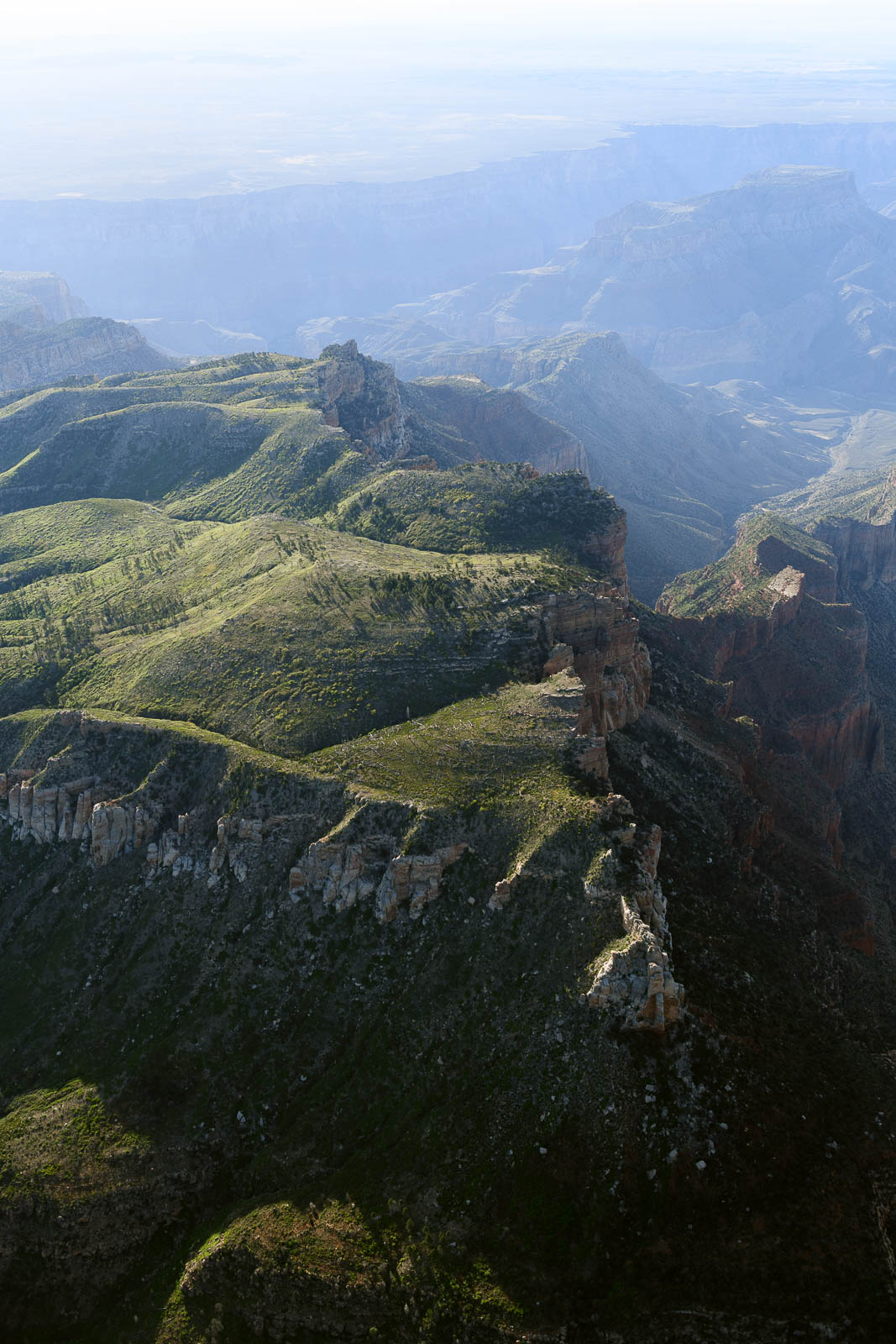
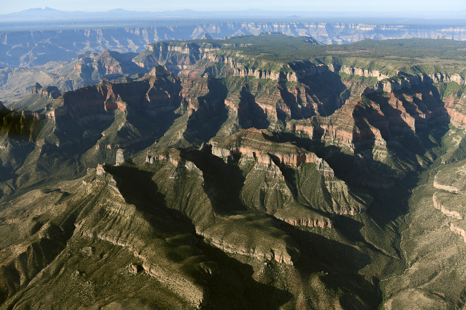
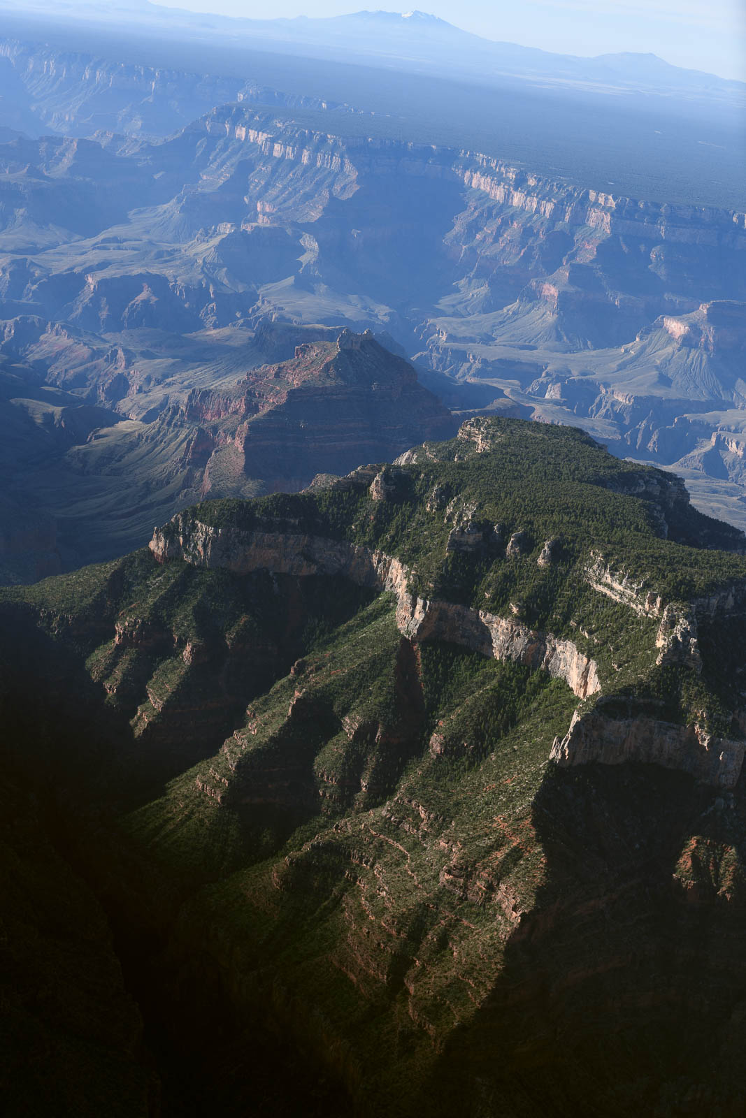
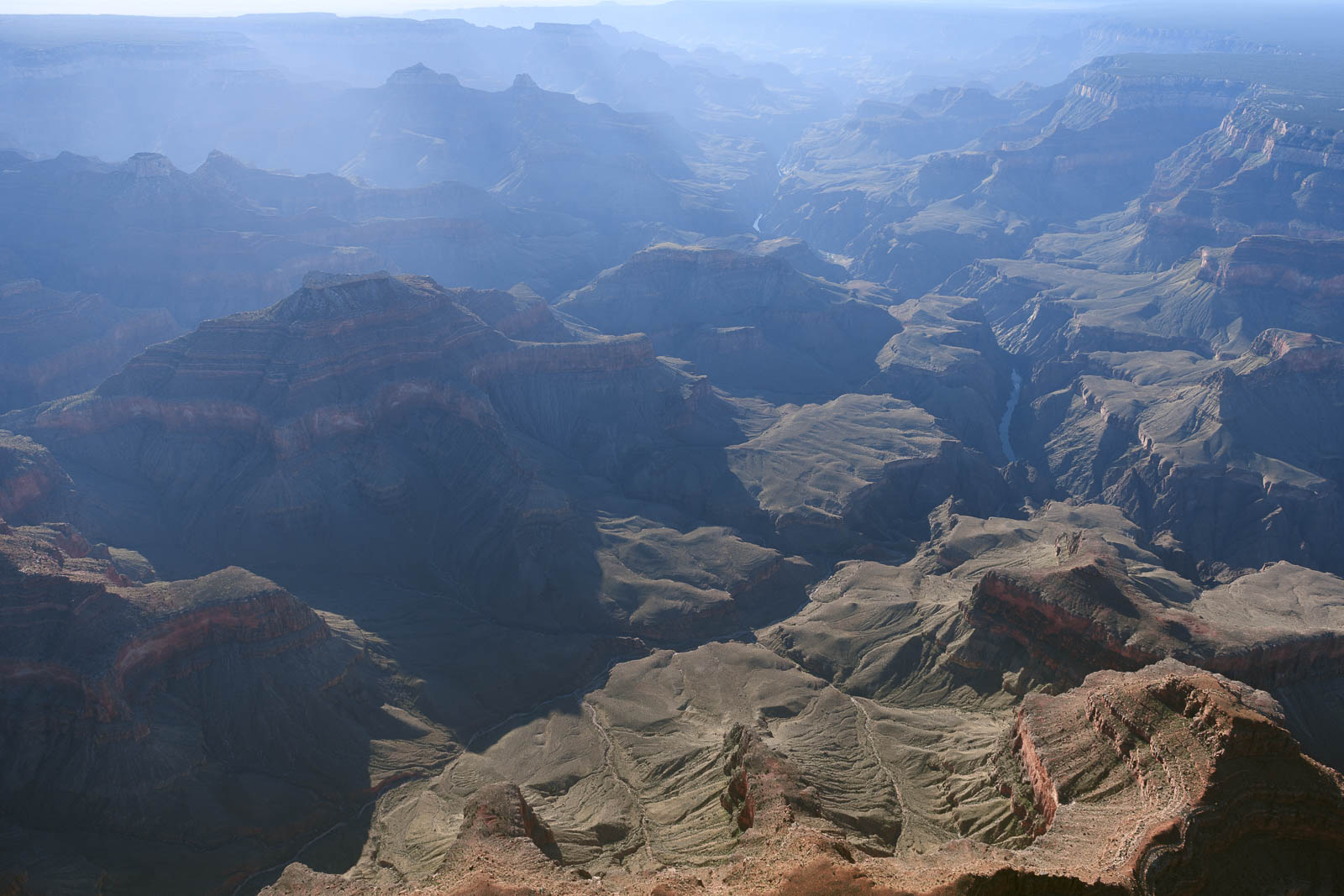
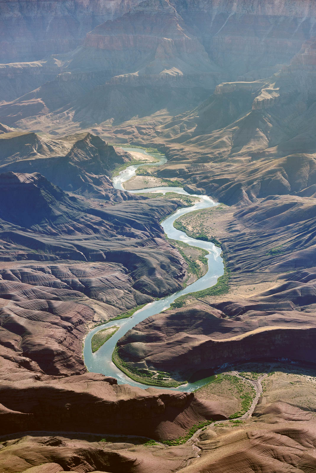
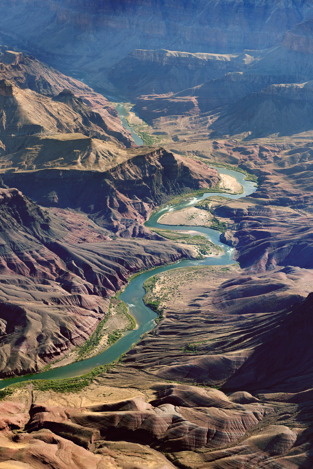
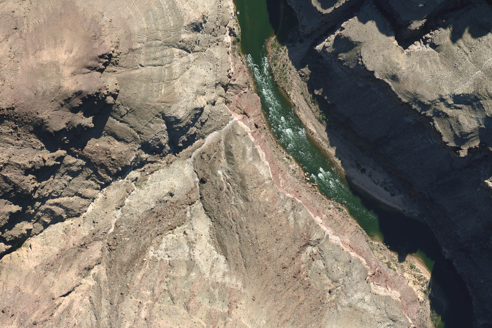
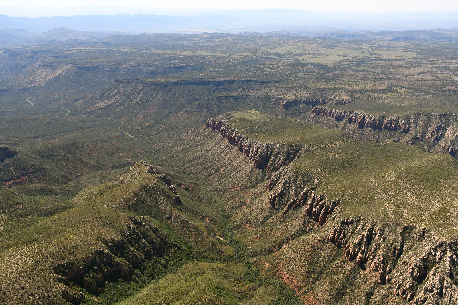
We fired up and taxied out to runway 33, which faces Glen Canyon and Lake Powell, and I took off and stayed low and level with the runway, picking up speed and not climbing, until we flew out and over the valley, the expansive vastness exploding around us, and I used the excess airspeed to rocket into the sky and follow the winding Colorado River down passed Horseshoe Bend to Marble Canyon, where we would eventually join up with the Grand Canyon. While Filip had been to this site before, it was my first time seeing it, and entering it from the sky was almost too profound to comprehend. The vastness was overwhelming and deeply moving. I flew down into the Dragon Corridor, the VFR corridor that took us down southbound through the canyon, at an altitude of 10,500’ (density altitude 13,500’) and reveled in the glorious beauty of it. Words somewhat fail me in accurately describing the feeling of flying over this landscape, of having the ability to maneuver through and over this land.
We monitored the radio frequency of the canyon–we did not hear or see anyone else flying. The tower at Grand Canyon airport was also closed. The virus has shutdown many places, and that includes this natural wonder of the world.
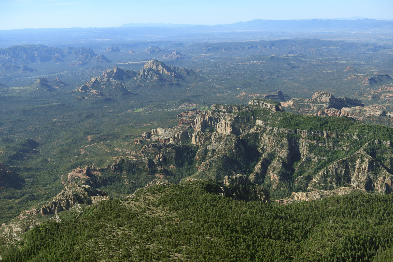
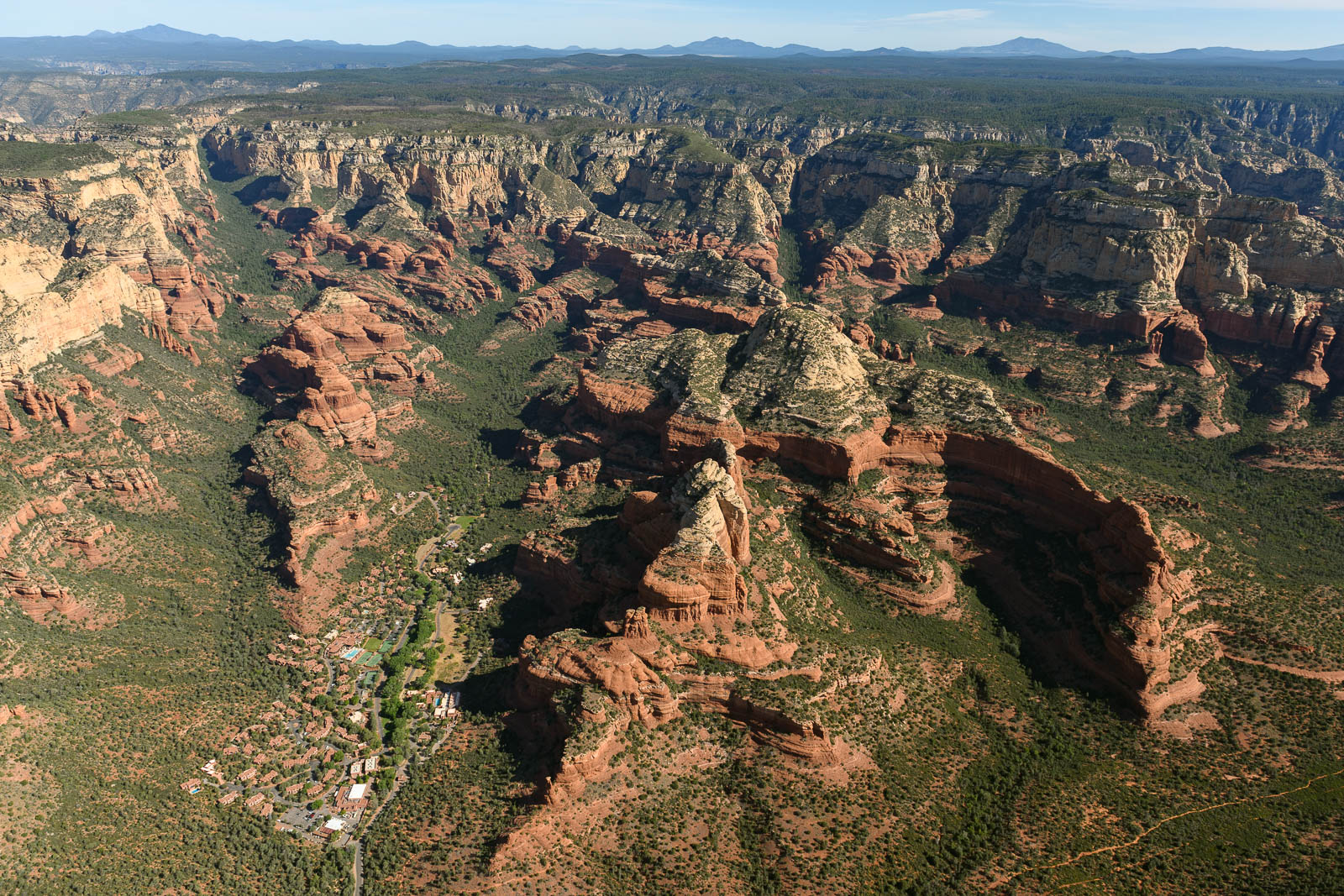
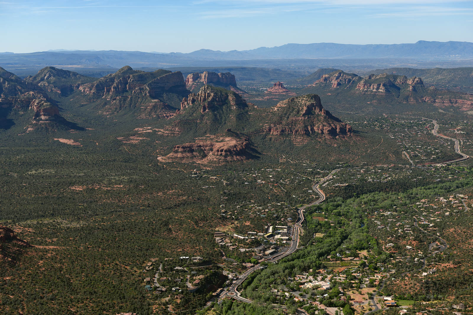
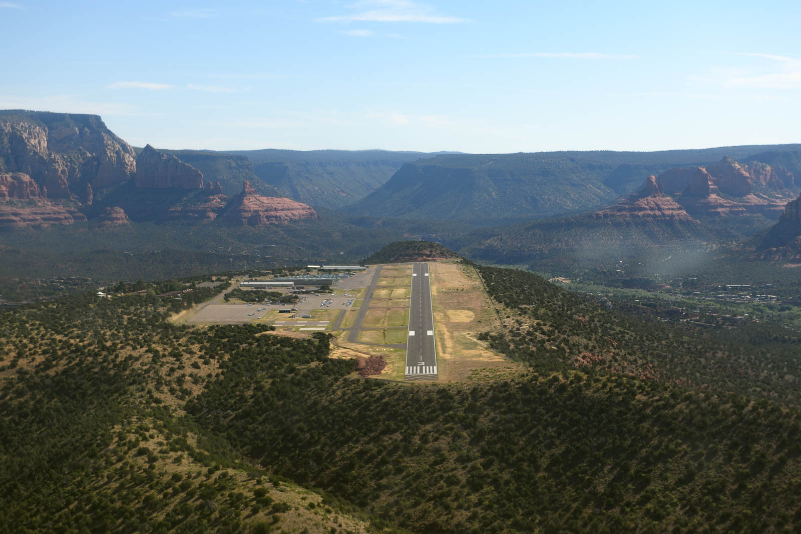
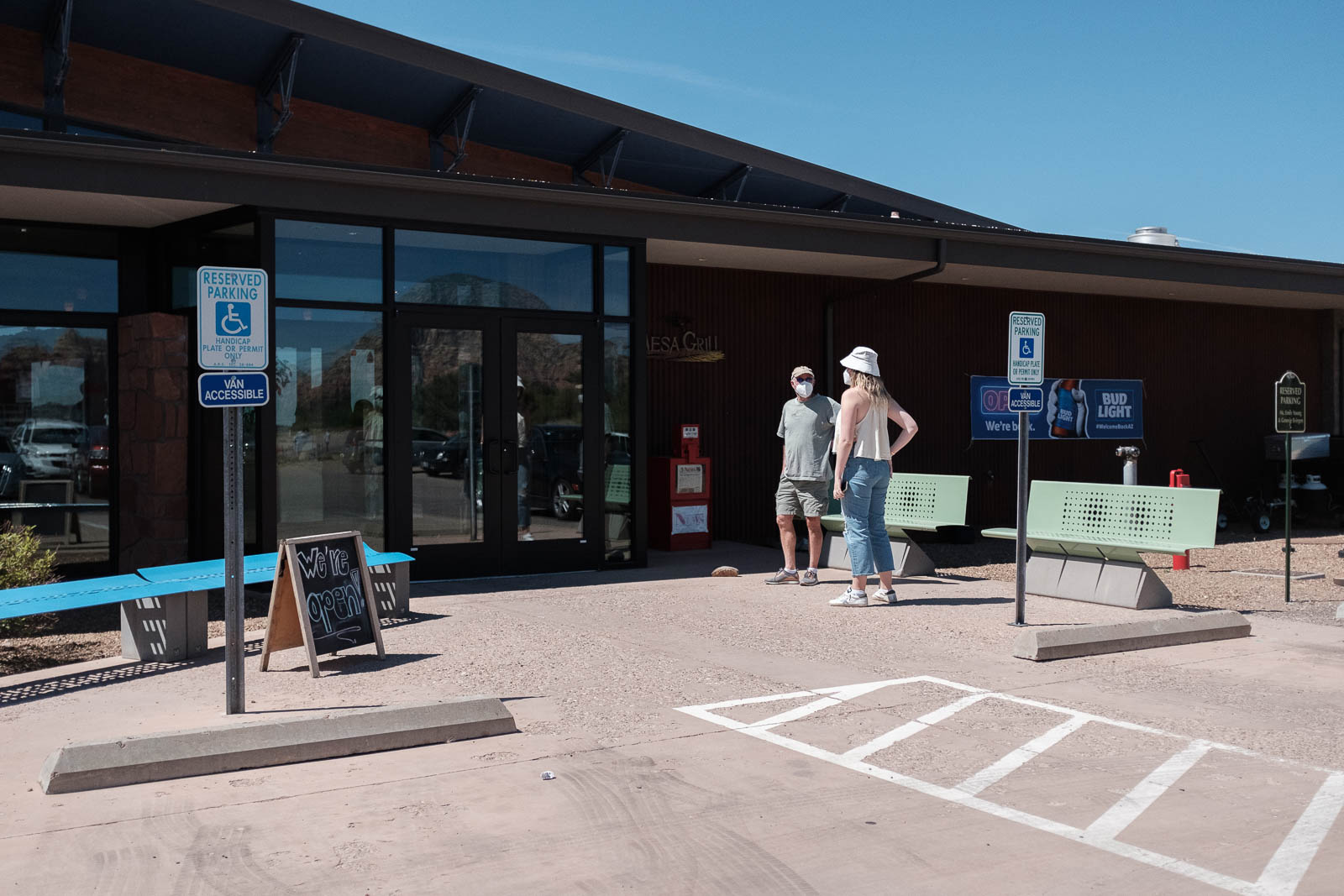
We finished shooting over the Grand Canyon and checked our fuel and ultimately decided we had more than enough to make it straight to Sedona, where we have tentative plans to fuel and grab breakfast. We’d been told by a lot of wonderful pilot friends that Sedona Airport was not to be missed and the sentiment was not wrong—the airport sits on top of a mesa with incredible red rock formations exploding around it. I audibly gasped as I approached the airfield to land, it was prehistoric, it grasped me firmly by the heart and soul and shook me to the core, even as I set up for landing in gusty mountain winds.
We had breakfast on the field and marveled in the beauty of the world around us. It has been quite the experience to witness the majesty of all these natural wonders, and almost psychedelic to witness it changing so rapidly.
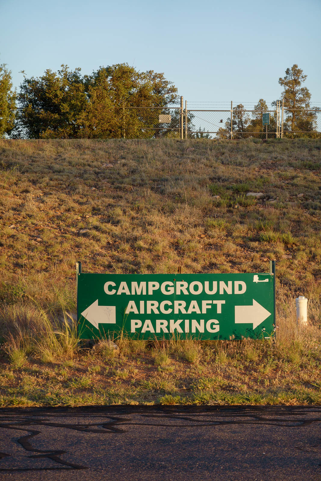
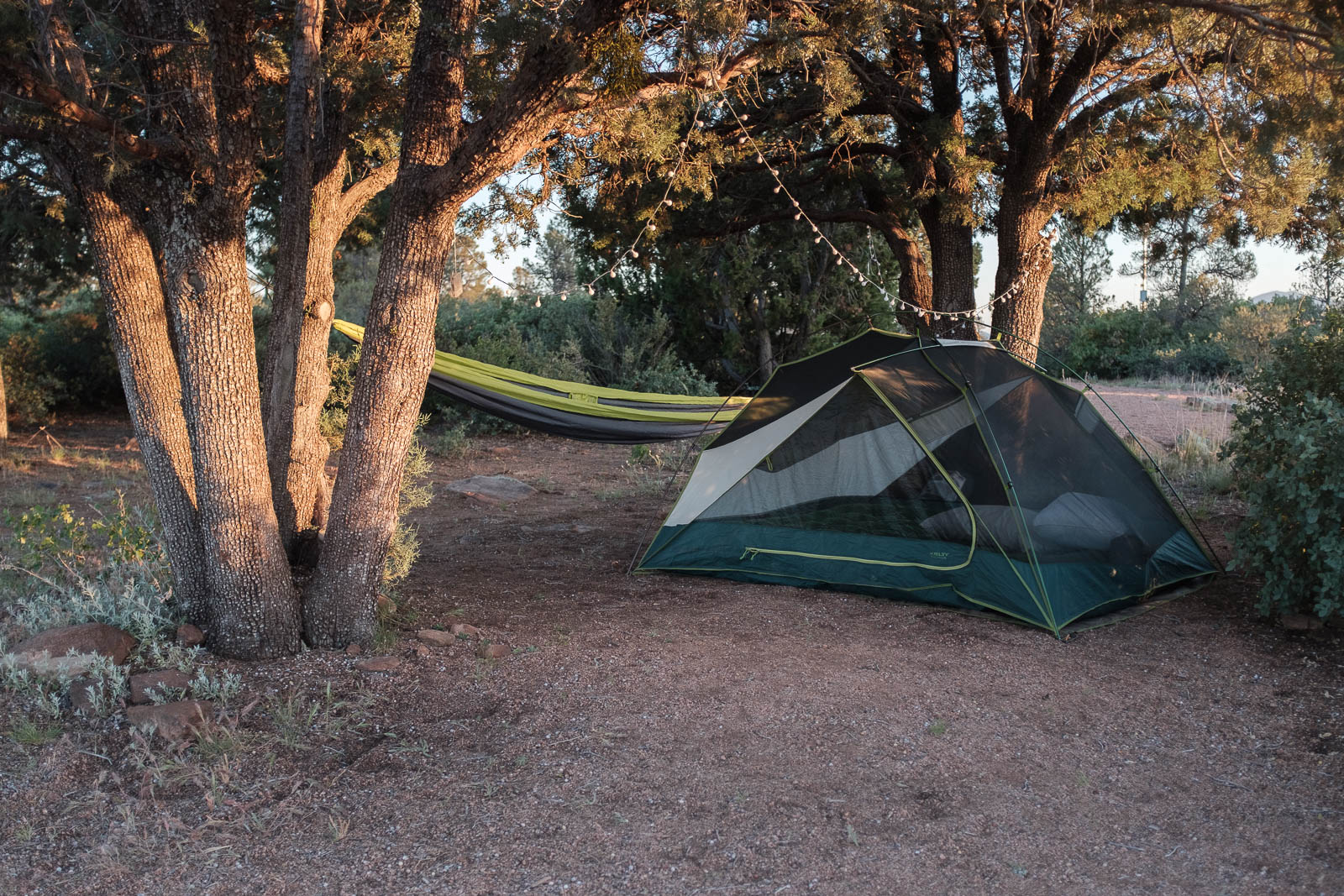
We spent some time in Sedona, and then pressed onwards to our home for the night, Payson Arizona, an airfield with camping that promised firewood, a car, and views for days. It was rather intimidating getting out of Sedona, there was a direct crosswind and it was real gusty, topped off with high density altitude. We didn’t fuel fully to keep our weight as low as possible, and upon take off, stayed in ground effect as long as able, to gain airspeed and climb effectively into the mountain air.
Payson paid off, and we write currently beside a beautiful campfire next to our pitched tent and resting airplane. Filled with gratitude, we plan tomorrow’s route. A good hard day, in the books.
Sweet dreams, Arizona.


Flight Path
[sgpx gpx=/tracks/stratux/gslog_2020-05-17.gpx summary=1 uom=5 gheight=200]